
Geography Optional · UPSC Notes
Geomorphic Processes and Landscape Development — UPSC Geography Optional Notes
Free, exam-focused notes for UPSC Prelims and Mains, with Prelims tips and Mains points for every topic. 6 topics.
Open in the interactive reader: bookmarks, progress tracking and read-aloud.
Geomorphic Cycles and Landscape Development (Davis, Penck, King)
Landscape development theories ask how relief changes through time. W.M. Davis (1899) proposed a cycle of erosion through youth, maturity and old age ending in a peneplain, controlled by structure, process and stage. Walther Penck (1924) linked landforms to the rate of uplift relative to erosion, while L.C. King (1953, 1962) explained landscapes by parallel scarp retreat forming pediplains. Later geomorphologists replaced cycles with dynamic equilibrium and open systems.
In simple words
These theories try to tell the life story of a landscape, from newly raised land to a worn-down plain.
Davis compared it to a human life: a young landscape has steep V-shaped valleys, a mature one has rounded hills, and an old one is a gentle peneplain.
Penck and King said the story depends on how fast land rises and on how slopes retreat, not only on age.
UPSC often asks you to compare Davis and Penck or to critically examine the cycle concept.
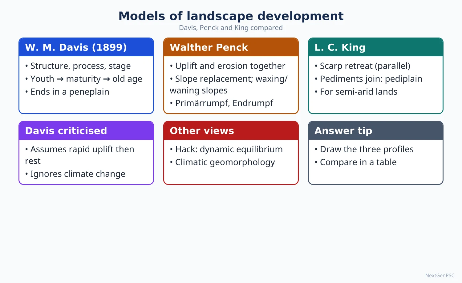
1. Factors controlling landform development
Structure (geology): rock type, hardness, jointing, folding and faulting decide how easily rocks erode; hard quartzite stands as ridges while soft shale forms valleys.
Process: the agents at work (rivers, glaciers, wind, waves, groundwater, mass movement) and the climate that controls them.
Time or stage: how long the processes have operated since the last uplift.
Tectonics: uplift, subsidence and tilting renew relief and reset erosion.
Climate: controls weathering type and dominant agent; climatic geomorphology (Julius Büdel, Jean Tricart) holds that each climate zone produces distinct landforms.
Base level: the lowest level to which a river can erode, usually sea level (J.W. Powell, 1875); a fall in base level rejuvenates erosion.
2. Davis's geographical cycle
Source: William Morris Davis, 'The Geographical Cycle' (1899), the first general model of landscape evolution.
Trilogy: landscape is a function of structure, process and stage; Davis emphasised stage.
Assumptions: rapid uplift of a land mass, then a long period of tectonic stillness during which erosion lowers the land; humid temperate climate with rivers as the main agent.
Youth: rivers are few, valleys narrow, deep and V-shaped, waterfalls and rapids common, wide flat interfluves remain; relief increases as valleys deepen.
Maturity: a dense drainage network has consumed the uplands; maximum relief is reached early in maturity; divides become sharp then rounded; valleys widen with floodplains and meanders.
Old age: relief is very low; broad floodplains, wide meanders, oxbow lakes; the land becomes a peneplain ('almost a plain'), with isolated resistant hills called monadnocks (after Mount Monadnock in New Hampshire).
Interruptions: renewed uplift (rejuvenation) or climatic change interrupts the cycle; accidents such as volcanic eruption or glaciation also intervene.
Signs of rejuvenation: knickpoints (breaks in river profile), incised meanders, paired river terraces and uplifted peneplains.
3. Criticism of Davis
Uplift assumption: Penck and later geologists argued that uplift is not short and sudden; erosion acts during uplift too.
Too much time: long stillstands are rare in a tectonically active earth, so complete peneplains are seldom formed.
Climate: the 'normal' humid temperate cycle ignores arid, glacial and tropical landscapes (Davis later added an arid cycle).
Deductive and descriptive: the model is qualitative, built on stages rather than measured processes.
Defence: it gave a simple, teachable framework and introduced terms (peneplain, monadnock, rejuvenation) still in use.
4. Penck's model
Source: Walther Penck, Die morphologische Analyse, published after his death in 1924; he focused on the relation between the rate of uplift and the rate of erosion.
Waxing development (aufsteigende Entwicklung): uplift accelerates faster than erosion, rivers incise rapidly, and slopes become convex.
Uniform development (gleichförmige Entwicklung): uplift and erosion are in balance, so slopes are straight and relief stays constant.
Waning development (absteigende Entwicklung): uplift slows and stops; slopes become concave and relief declines towards an end-peneplain (endrumpf).
Primärrumpf: a primary low surface formed when slow uplift is matched by erosion from the start.
Parallel slope retreat: Penck held that slopes retreat parallel to themselves, being replaced from below by gentler slopes, rather than declining in angle as Davis suggested.
Piedmont benchlands (piedmonttreppen): step-like surfaces around a dome of expanding uplift.
Criticism: his writing was difficult and was often misread through Davis's critiques; the convex-concave link to uplift rates is not borne out everywhere, because rock type and climate also shape slopes.
5. King's pediplanation cycle
Source: L.C. King, 'Canons of Landscape Evolution' (1953) and The Morphology of the Earth (1962), based on South Africa and other Gondwana lands.
Process: after uplift, scarps retreat parallel to themselves by weathering and sheet wash, leaving a gently sloping pediment at their foot.
Pediplain: coalescing pediments form a wide plain; residual steep-sided hills are inselbergs (bornhardts) and smaller kopjes.
Global cycles: King argued that the same planation surfaces (such as the Gondwana and African surfaces) can be correlated across continents.
Assessment: fits semi-arid and savanna landscapes well, but critics argue that intercontinental correlation is doubtful and that scarp retreat varies with rock.
6. Later views
Dynamic equilibrium: John Hack (1960) argued that landforms adjust to the balance between rock resistance and erosive energy, so form can stay steady while the land is lowered; time is less important.
Systems approach: Arthur Strahler (1950s) and Richard Chorley (1962) treated landscapes as open systems with flows of energy and matter, measured by morphometry.
Etchplanation: E.J. Wayland (1933) and Julius Büdel (1957) explained tropical plains by deep chemical weathering and later stripping of the weathered layer (double planation surfaces).
Thresholds and complex response: Stanley Schumm (1970s) showed that landscapes may change abruptly once a threshold is crossed.
7. Indian examples
Polycyclic Chota Nagpur plateau: step-like surfaces of the Pat lands and the Ranchi plateau are interpreted as successive erosion surfaces; waterfalls such as Hundru on the Subarnarekha mark rejuvenation at the plateau edge.
Monadnocks and inselbergs: residual hills rise above the plains of Bundelkhand, the Mysore plateau and the Chota Nagpur plateau (for example Parasnath hill).
Rejuvenation in the Western Ghats: Jog Falls on the Sharavathi, and deep gorges of west-flowing rivers, show base-level change and uplift.
Old fold belt: the Aravalli is a much-eroded relict of an ancient mountain range.
8. Diagrams to draw
Davisian cycle: three cross-sections in a row labelled youth (deep narrow V-valleys, flat divides), maturity (sharp divides, maximum relief) and old age (broad floodplain, peneplain with a monadnock); below, a graph of relief against time with upper and lower curves for divides and valley floors converging.
Penck's slopes: three slope profiles labelled convex (waxing), straight (uniform) and concave (waning), with an arrow showing the rate of uplift.
King's model: a scarp retreating parallel to itself (dotted earlier positions), a widening pediment at its foot, and an inselberg left on the pediplain.
9. Using it in the exam
10-mark answer: define peneplain, pediplain or rejuvenation with a diagram and an Indian example.
15-mark answer: compare Davis and Penck under assumptions, mechanism, slope form, end product and criticism, in a table.
20-mark answer: critically examine the cycle concept, moving from Davis to Penck and King and then to dynamic equilibrium, with diagrams and Indian examples.
Keywords: structure-process-stage, peneplain, monadnock, rejuvenation, knickpoint, waxing and waning development, parallel retreat, pediplain, inselberg, dynamic equilibrium.
Davis's trilogy in one line: Davis held that landscape is a function of structure, process and stage.
| Basis | Davis (1899) | Penck (1924) | King (1953, 1962) |
|---|---|---|---|
| Key control | Stage (time) | Rate of uplift vs erosion | Scarp retreat and pedimentation |
| Uplift | Rapid, then stillstand | Erosion acts during uplift; rate varies | Episodic uplift, then long planation |
| Slope change | Slopes decline in angle (slope decline) | Slopes retreat parallel; convex, straight, concave forms | Parallel scarp retreat |
| End product | Peneplain with monadnocks | Endrumpf | Pediplain with inselbergs |
| Climate setting | Humid temperate | General, based on Andes and south Germany work | Semi-arid and savanna |
| Main criticism | Unrealistic stillstand, ignores climate | Hard to verify uplift-slope link | Doubtful global correlation |
Mains points
- The classic question is Davis versus Penck: compare assumptions about uplift, slope evolution and end product in a table with slope diagrams.
- For 'critically examine the cycle of erosion', cover Davis's model, its interruptions, at least three criticisms and the shift to dynamic equilibrium and systems thinking.
- Include King's pediplanation as the third view and link it to Gondwana surfaces of Peninsular India.
- Give Indian evidence: polycyclic surfaces of Chota Nagpur, knickpoint waterfalls (Hundru, Jog), monadnocks and inselbergs of the plateau.
- A common mistake is saying Penck believed in slope decline; he argued for parallel retreat and slope replacement.
- Attribute dynamic equilibrium to Hack (1960) and the systems approach to Strahler and Chorley.
- End with present relevance: denudation chronology and applied geomorphology still use cycle terms such as rejuvenation and erosion surfaces.
Did you know?
- Walther Penck died in 1923 at the age of 35, and his major book was edited and published by his father Albrecht Penck the next year.
- Memory trick for Penck's slopes: 'Waxing = conveX, Waning = concave' (both W-words, X for convex).
Denudation Chronology, Erosion Surfaces and Slope Development
Denudation chronology reconstructs the sequence of erosional events in a landscape from erosion surfaces, river terraces, knickpoints and deposits; the classic study is Wooldridge and Linton on south-east England (1939). Erosion surfaces include peneplains, pediplains, etchplains and marine planation surfaces. Slope development is explained by competing models of slope decline (Davis), parallel retreat and replacement (Penck, King) and equilibrium slopes (Strahler), using slope elements such as Wood's waxing slope, free face, debris slope and waning slope.
In simple words
Denudation chronology is like reading the rings of a tree, but for land: flat surfaces at different heights record past periods of erosion and uplift.
Each flat level was once a low plain that was later raised and cut into by rivers.
Slopes are the most common landform, and how they wear back affects landslides, farming and road building.
UPSC asks for methods of identifying erosion surfaces, Indian polycyclic plateaus, and theories of slope development.
1. Denudation chronology: concept
Definition: the study of the historical sequence of erosional and depositional phases that have shaped a landscape, dating relief features relative to one another.
Basis: a landscape is polycyclic, carrying remnants of several cycles of erosion interrupted by uplift or base-level change.
Classic work: S.W. Wooldridge and D.L. Linton, Structure, Surface and Drainage in South-East England (1939), identified a sequence of erosion surfaces and explained the drainage of the Weald.
Aim: to reconstruct tectonic, climatic and sea-level history from the landforms themselves.
2. Evidence and methods
Accordant summits: hilltops at nearly the same height suggest an old, dissected erosion surface.
Morphometric techniques: altimetric frequency curves (histograms of spot heights), superimposed and projected profiles, generalised contours and hypsometric curves bring out levels.
River terraces: paired terraces at matching heights on both banks indicate rejuvenation; unpaired terraces indicate gradual incision.
Knickpoints: breaks in the long profile of rivers, often marked by waterfalls, show the upstream migration of a new base level.
Drainage anomalies: superimposed drainage (rivers cut across structures inherited from a former cover) and antecedent drainage (rivers keep their course across a rising range, such as the Indus, Sutlej and Brahmaputra across the Himalaya).
Deposits and weathering profiles: lateritic cappings, river gravels and marine deposits on surfaces help date them.
Modern dating: cosmogenic nuclide dating and thermochronology now give absolute ages to surfaces and uplift.
3. Types of erosion surfaces
Peneplain: Davis's low, gently undulating surface produced by long subaerial erosion in a humid climate.
Pediplain: King's surface formed by coalescing pediments through scarp retreat in semi-arid lands.
Panplain: C.H. Crickmay (1933) suggested plains formed by the lateral planation of rivers joining their floodplains.
Etchplain: E.J. Wayland (1933) and Julius Büdel described surfaces exposed by stripping deep tropical weathering profiles.
Marine planation surface: wave-cut platforms raised above sea level, a view associated with A.C. Ramsay in the nineteenth century.
Exhumed surface: an old surface buried by later rocks and exposed again by erosion.
4. Indian examples of polycyclic relief
Chota Nagpur plateau: geomorphologists have identified step-like levels, commonly the Pat lands at about 900–1,100 m, the Ranchi surface at about 600–700 m and a lower surface at about 300 m, separated by scarps with waterfalls such as Hundru, Jonha and Dassam.
Karnataka and Mysore plateau: several planation levels and lateritic cappings rise towards the Western Ghats.
Western Ghats escarpment: the steep western scarp is often interpreted as a retreating escarpment, an example of King-type scarp retreat (its origin is debated, with faulting and flexure also proposed).
Meghalaya plateau: a block of Peninsular rock with uplifted surfaces and deep gorges on its southern edge.
Himalayan terraces: river terraces in the Beas, Sutlej and Alaknanda valleys record uplift and climatic phases.
5. Slope elements
Wood's model (1942): A. Wood described a full hillslope as four elements from top to bottom: waxing slope (convex crest), free face (bare rock cliff), constant or debris slope (talus at the angle of rest) and waning slope (concave pediment).
Nine-unit landsurface model: J.B. Dalrymple, R.J. Blong and A.J. Conacher (1968) divided slopes into nine units by dominant process, from interfluve to channel bed.
Convexity of hilltops: G.K. Gilbert (1909) explained convex summits by soil creep, which increases with distance from the divide.
6. Slope processes
Weathering: prepares material; its rate depends on rock and climate.
Mass movement: soil creep, solifluction, slumping, debris flows, rockfalls and landslides move material under gravity.
Wash processes: rainsplash, sheet wash and rills remove fine particles, especially where vegetation is sparse.
Controls: rock structure and jointing, climate, vegetation, basal removal by rivers or waves, and human activity such as road cutting.
7. Theories of slope development
Slope decline (Davis): slopes become gentler with time as the crest is lowered faster than the base; this fits humid climates with thick soil.
Slope replacement (Penck): a steep slope is consumed from below by a gentler slope that grows upward.
Parallel retreat (Penck, King): the free face and debris slope retreat without changing angle, leaving a widening pediment; this fits semi-arid areas with resistant caprock.
Equilibrium slopes (Strahler, 1950): slopes adjust to a characteristic angle where erosion and resistance balance, measured statistically.
Climatic view: slope form varies with climate; convex slopes dominate in humid areas, straight-concave in arid areas.
Assessment: no single model explains all slopes; Anthony Young's Slopes (1972) stressed process studies over cyclic models.
8. Applied relevance in India
Landslides: slope failure caused deadly landslides at Malin, Pune district (July 2014) and Wayanad, Kerala (July 2024), and recurring failures along Himalayan highways.
Land subsidence: Joshimath in Uttarakhand, built on old landslide debris, saw widespread ground cracks in January 2023.
Management: landslide zonation (Geological Survey of India's national landslide susceptibility mapping), slope drainage, retaining walls, bioengineering and limits on construction on steep slopes.
9. Diagrams to draw
Erosion surfaces: a cross-section of the Chota Nagpur plateau with three steps labelled with approximate heights, scarps and waterfalls at the steps.
Projected profile: several parallel profiles drawn one behind another, showing accordant summit levels as a horizontal line.
Wood's slope: a single hillslope labelled waxing slope, free face, debris slope and waning slope.
Slope models: three sketches with dotted earlier positions: slope decline (crest lowering), parallel retreat (same angle, pediment widening) and replacement (gentle slope growing from the base).
10. Using it in the exam
10-mark answer: define denudation chronology with two methods and one Indian example.
15-mark answer: slope elements and processes with Wood's diagram.
20-mark answer: compare theories of slope development or explain erosion surfaces of a Peninsular plateau, with diagrams and assessment.
Keywords: polycyclic relief, accordant summits, altimetric frequency curve, knickpoint, paired terraces, peneplain, pediplain, etchplain, free face, parallel retreat.
One-line definition: denudation chronology is the reconstruction of the erosional history of a landscape from its surviving surfaces and deposits.
| Surface | Proposed by | Process | Typical setting |
|---|---|---|---|
| Peneplain | W.M. Davis | Long subaerial down-wearing | Humid temperate |
| Pediplain | L.C. King | Scarp retreat and coalescing pediments | Semi-arid, savanna |
| Panplain | C.H. Crickmay | Lateral planation by rivers | Wide river plains |
| Etchplain | E.J. Wayland, J. Büdel | Deep weathering then stripping | Humid tropics |
| Marine planation surface | A.C. Ramsay | Wave erosion, later uplift | Coasts, raised platforms |
Mains points
- Define denudation chronology and list methods (accordant summits, altimetric curves, profiles, terraces, knickpoints, drainage anomalies) with one diagram.
- Use Chota Nagpur's step-like surfaces as the standard Indian example, giving heights as approximate.
- For slope questions, draw Wood's four elements and compare slope decline, replacement and parallel retreat.
- Show applied value: landslide zonation and slope management in the Himalaya and Western Ghats (Malin 2014, Wayanad 2024, Joshimath 2023).
- A common mistake is treating every flat surface as a Davisian peneplain; mention pediplains, etchplains and marine surfaces.
- Mark interpretations such as the origin of the Western Ghats scarp as debated.
- Mention modern dating methods to show awareness of current research.
Did you know?
- Memory trick for Wood's slope from top to bottom: 'Wax Free Debris Wanes' = waxing slope, free face, debris slope, waning slope.
Channel Morphology and Fluvial Landforms
Channel morphology studies the shape of river channels in cross-section, plan and long profile, and how they adjust to discharge and sediment load. Leopold and Maddock (1953) linked width, depth and velocity to discharge (hydraulic geometry), and Leopold and Wolman (1957) distinguished straight, meandering and braided patterns. Rivers create erosional forms (V-valleys, gorges, potholes, waterfalls) and depositional forms (alluvial fans, floodplains, levees, point bars, oxbow lakes and deltas), all well displayed in the Indo-Gangetic plain.
In simple words
Channel morphology is the study of a river's shape: how wide, deep, curved or split it is, and why.
A river is like a conveyor belt for water and sediment; when the load or the flow changes, the belt changes its shape.
Knowing this helps predict floods, bank erosion and sudden course changes such as those of the Kosi.
UPSC asks about meanders, braided channels, hydraulic geometry and landforms of the Ganga plain.
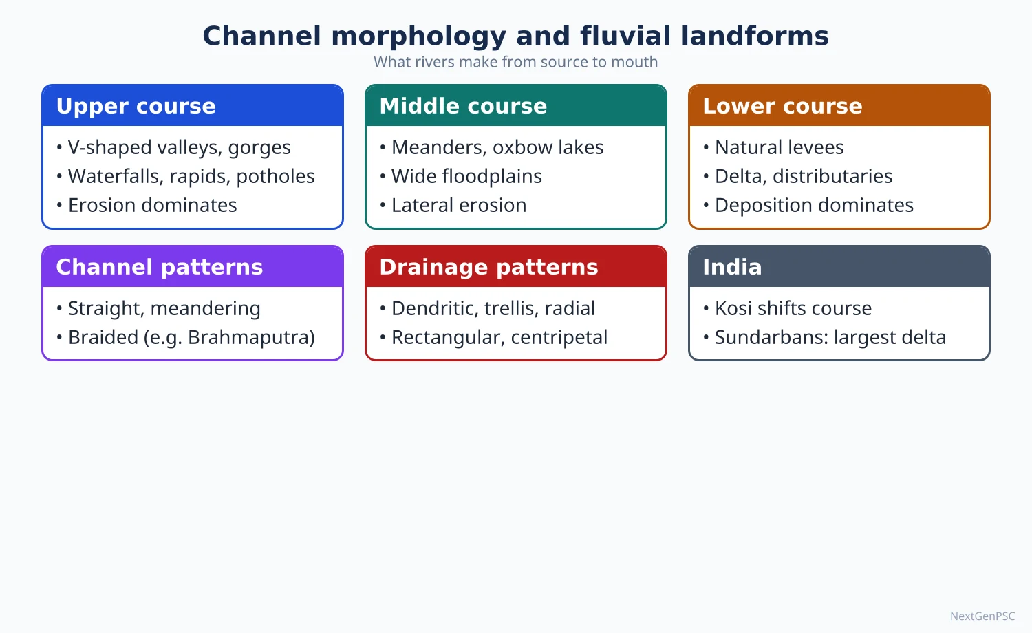
1. Channel geometry
Cross-section: width, depth, width-depth ratio, cross-sectional area, wetted perimeter and hydraulic radius (area divided by wetted perimeter); a high hydraulic radius means less friction and faster flow.
Velocity: controlled by slope, depth and roughness, expressed in Manning's equation; velocity is greatest just below the surface in the middle of a straight channel and near the outer bank in a bend.
Bankfull discharge: the flow that just fills the channel; it occurs on average about every 1–2 years and does most channel-forming work (Leopold, Wolman and Miller, Fluvial Processes in Geomorphology, 1964).
Hydraulic geometry: Luna Leopold and Thomas Maddock (1953) showed that width, depth and velocity each increase as power functions of discharge, both downstream and at a station; downstream, width usually increases fastest.
Long profile: typically concave, steep near the source and gentle near the mouth, approaching a graded profile in which slope just carries the load (G.K. Gilbert, J.H. Mackin's 'graded stream', 1948).
2. Sediment load and its transport
Types of load: dissolved load (in solution), suspended load (fine silt and clay held up by turbulence) and bed load (sand and gravel moved by rolling, sliding and saltation).
Hjulström curve (1935): Filip Hjulström plotted the velocity needed to erode, transport and deposit particles of each size; medium sand is eroded at the lowest velocity, while clay needs higher velocity because of cohesion, and once lifted stays in suspension for long.
Competence and capacity: competence is the largest particle a river can move; capacity is the total load it can carry.
Indian context: Himalayan rivers such as the Kosi and Brahmaputra carry very high sediment loads from young, erodible mountains, which drives their braiding and shifting.
3. Channel patterns
Straight channels: rare over long distances; usually controlled by faults or joints; even in them the deepest line (thalweg) wanders between pools and riffles.
Meandering channels: a sinuosity index (channel length divided by valley length) of about 1.5 or more; common on gentle slopes with fine, cohesive banks and mainly suspended load.
Braided channels: several channels separated by bars and islands; occur with high bed load, steep slope, variable discharge and easily eroded banks.
Anastomosing channels: multiple stable channels separated by vegetated islands on very low gradients.
Leopold and Wolman (1957): showed that, for a given discharge, braided channels occur on steeper slopes than meandering ones, so slope and discharge together define a threshold between patterns.
Schumm's classification: Stanley Schumm related channel form to the type of load: suspended-load channels are narrow, deep and sinuous; bed-load channels are wide, shallow and braided; mixed-load channels lie between.
4. How a meander forms and migrates
Step 1: a small irregularity deflects the flow towards one bank.
Step 2: the faster flow on the outer bank erodes it into a steep cut bank (river cliff), while slower flow on the inner bank deposits a point bar.
Step 3: helical (spiral) secondary flow carries sediment from the outer bank across the bed to the inner bank, enlarging the bend.
Step 4: bends grow and migrate downstream and sideways; meander wavelength is roughly 10–14 times channel width (Leopold and Wolman).
Step 5: the neck between two bends narrows; during a flood the river cuts through it (neck cutoff) and the abandoned loop becomes an oxbow lake, later a swamp.
Indian examples: oxbow lakes (locally mauns, chaurs or beels) are common in the plains of Bihar, Uttar Pradesh and Assam.
5. Stream order and drainage patterns
Stream order: R.E. Horton (1945) and Arthur Strahler (1952) ranked streams: first-order streams have no tributaries; two first-order streams join to make a second-order stream, and so on.
Horton's laws: the number of streams decreases and their mean length increases geometrically with order; the bifurcation ratio is usually about 3–5.
Drainage density: total stream length per unit area; high on impermeable rock, steep slopes and sparse vegetation.
Drainage patterns: dendritic on uniform rock (most Ganga tributaries), trellis on folded rocks (Lesser Himalaya, Singhbhum), radial from a dome (Amarkantak, source of the Narmada and Son), rectangular on jointed rock, centripetal into a basin (Loktak lake area in Manipur), parallel on a uniform slope (west-flowing rivers of the Western Ghats).
6. Erosional fluvial landforms
V-shaped valleys and gorges: deep vertical cutting; the Indus, Sutlej and Brahmaputra form deep gorges across the Himalaya.
Canyons: very deep steep-sided valleys in arid areas, such as the Grand Canyon of the Colorado.
Potholes: circular holes ground into rock by swirling pebbles; the potholes of Nighoj on the Kukadi river in Maharashtra are a well-known example.
Waterfalls and rapids: where hard rock overlies soft, or at faults and plateau edges; Dhuandhar on the Narmada near Jabalpur in the Marble Rocks gorge, Jog on the Sharavathi.
River terraces and incised meanders: formed when a river cuts down after rejuvenation.
7. Depositional fluvial landforms
Alluvial fans and cones: fan-shaped deposits where a river leaves a mountain front; the Kosi megafan in north Bihar is one of the largest in the world; the bhabar belt along the Himalayan foot is made of coalescing fans.
Floodplains: flat land built by overbank deposits; khadar (newer alluvium) and bhangar (older alluvium) in the Ganga plain.
Natural levees: raised banks of coarser sediment deposited when floods spill over.
Bars and river islands: point bars, mid-channel bars and large river islands; Majuli in the Brahmaputra is one of the largest river islands in the world and has lost much of its area to bank erosion.
Deltas: W.E. Galloway (1975) classified deltas as river-, wave- or tide-dominated; the Ganga-Brahmaputra delta (with the Sundarbans) is strongly tide-influenced, the Mississippi is river-dominated (bird's foot) and the Nile arcuate.
Estuaries: the Narmada and Tapi enter the sea through estuaries rather than deltas, because they flow through rift valleys and meet strong tides in the Gulf of Khambhat.
8. River behaviour in India: case studies
Kosi: called the 'sorrow of Bihar'; it has shifted westward across its megafan over the last two centuries (the distance is often quoted as over 100 km, but estimates vary), and in August 2008 it breached its embankment at Kusaha in Nepal, abandoning its channel and flooding large parts of north Bihar.
Brahmaputra: a braided river with heavy sediment and severe bank erosion, threatening Majuli and many villages in Assam.
Ganga: meandering in the middle plain with shifting channels near Varanasi, Patna and Farakka; the Farakka barrage area shows serious bank erosion in Malda and Murshidabad.
9. Diagrams to draw
Meander: a plan view of a winding river with cut banks on the outer bends, point bars on the inner bends, helical flow arrows, a narrow neck and an oxbow lake; add a cross-section showing the steep outer bank and gentle inner slope.
Hjulström curve: velocity on the vertical axis and grain size on a log horizontal axis; label the erosion, transport and deposition fields and the dip of the erosion curve at sand size.
Channel patterns: three small plan sketches of straight, meandering and braided channels, with a graph of slope against discharge showing the Leopold-Wolman threshold line.
Ganga plain profile: north-south section from the Shiwaliks through bhabar, terai, bhangar and khadar to the river.
10. Using it in the exam
10-mark answer: explain a meander or braided channel with a diagram and an Indian example.
15-mark answer: hydraulic geometry or channel patterns with Leopold's work and a sketch.
20-mark answer: fluvial landforms of the Indo-Gangetic plain, or channel changes of the Kosi, with maps, process and management.
Keywords: hydraulic geometry, bankfull discharge, sinuosity, thalweg, helical flow, point bar, Hjulström curve, avulsion, megafan, graded stream.
One-line definition: J.H. Mackin (1948) defined a graded stream as one whose slope is delicately adjusted to provide just the velocity needed to carry the load supplied to it.
| Pattern | Conditions | Main load | Examples (India first) |
|---|---|---|---|
| Straight | Structural control, short reaches | Variable | Fault-guided stretches of the Narmada and Tapi; short reaches anywhere |
| Meandering | Gentle slope, cohesive banks, steady flow | Suspended | Middle and lower Ganga, Gomti; Mississippi |
| Braided | Steep slope, high bed load, variable discharge, weak banks | Bed load | Brahmaputra, Kosi; Canterbury rivers of New Zealand |
| Anastomosing | Very low gradient, vegetated stable islands | Suspended and mixed | Parts of the Sundarbans distributaries; inland delta of the Okavango |
Mains points
- Explain channel form as an adjustment to discharge, sediment load and slope; cite Leopold and Maddock (1953) and Leopold and Wolman (1957).
- For meanders, describe the step-by-step mechanism with helical flow, cut bank, point bar and cutoff, and draw a plan view and cross-section.
- For braided rivers, link high bed load and variable discharge to the Brahmaputra and Kosi.
- Use the Kosi avulsion of 2008, Majuli erosion and the Ganga near Farakka as Indian case studies, with management (embankments, river training, floodplain zoning).
- A common mistake is giving the Hjulström curve the wrong way round; clay needs more velocity than sand to be eroded.
- Classify deltas using Galloway's triangle and explain why the Narmada and Tapi form estuaries.
- Add stream ordering and drainage patterns with Indian examples when asked about drainage basin morphometry.
Did you know?
- A river's meanders tend to scale with its size: a stream a few metres wide and a river a kilometre wide can draw almost the same curves, only at different scales.
Karst, Glacial, Aeolian and Coastal Landforms
Besides rivers, four agents shape distinctive landforms: groundwater in limestone (karst), glaciers, wind and waves. Karst produces sinkholes, poljes, caves and speleothems; glaciers carve cirques, arêtes, U-shaped valleys and truncated spurs and deposit moraines, drumlins and eskers; wind forms deflation hollows, yardangs and dunes; waves cut cliffs, arches and stacks and build beaches, spits, barrier islands and lagoons. India has fine examples of each, from the caves of Meghalaya and the Gangotri glacier to the Thar dunes and the Chilika lagoon.
In simple words
Each natural agent leaves its own signature on the land, like different tools leaving different marks on wood.
Rainwater slowly dissolves limestone into caves with hanging stalactites; glaciers scrape valleys into a U shape; wind piles sand into dunes; waves carve cliffs and build sandbars.
These landforms matter for water supply, tourism, hazards such as glacial lake floods, and coastal protection.
UPSC asks you to explain landforms such as speleothems, truncated spurs or barrier islands with diagrams and examples.
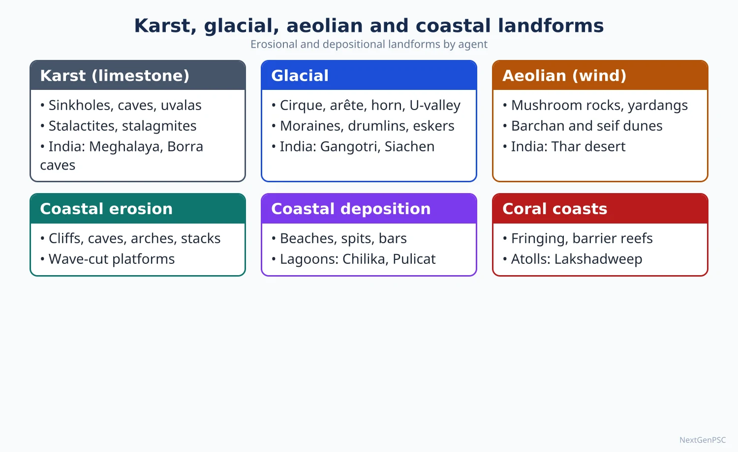
1. Karst: process
Meaning: karst is terrain formed by solution of soluble rocks, mainly limestone and dolomite; the name comes from the Kras region of Slovenia, studied by Jovan Cvijić (Das Karstphänomen, 1893).
Process (carbonation): rainwater absorbs carbon dioxide from air and soil to form weak carbonic acid, which turns insoluble calcium carbonate into soluble calcium bicarbonate and carries it away.
Conditions: thick, pure, well-jointed limestone; moderate to heavy rainfall; a deep water table so that water can circulate downward; vegetation that adds soil carbon dioxide.
2. Karst landforms
Lapies (karren): grooved, furrowed limestone surfaces; in Britain called limestone pavement with blocks (clints) separated by widened joints (grikes).
Sinkholes (dolines) and swallow holes: funnel-shaped depressions formed by solution or collapse, through which surface streams disappear underground.
Uvalas and poljes: uvalas are compound depressions formed by merging sinkholes; poljes are large flat-floored basins, often flooded seasonally, best seen in the Dinaric karst.
Blind valleys and dry valleys: valleys that end abruptly where the stream sinks.
Tower and cone karst: steep residual limestone hills in humid tropics, such as Guilin in China and Ha Long Bay in Vietnam.
Caves: underground passages enlarged along joints and bedding planes by flowing groundwater.
Speleothems: deposits formed when dripping water loses carbon dioxide and precipitates calcite: stalactites hang from the roof, stalagmites grow up from the floor, and the two join as pillars or columns; flowstone and curtains form on walls.
Indian examples: the caves of Meghalaya, including the Krem Liat Prah system in the Jaintia Hills (among the longest known caves in India), Mawsmai near Sohra (Cherrapunji) and Siju in the Garo Hills; Borra caves in the Ananthagiri hills and Belum caves in Kurnool district (Andhra Pradesh); Kutumsar cave in Kanger Valley National Park (Chhattisgarh).
Scientific value: a stalagmite from Mawmluh cave in Meghalaya was used to define the Meghalayan Age, the latest stage of the Holocene beginning about 4,200 years ago (International Commission on Stratigraphy, 2018).
3. Glaciers: processes
Types: valley (alpine) glaciers in mountains, piedmont glaciers spreading at mountain feet, and continental ice sheets (Antarctica, Greenland).
Erosion: plucking (quarrying) of jointed rock frozen to the ice; abrasion by rock fragments embedded in the ice, leaving striations; freeze-thaw weathering of valley sides.
Movement: by internal deformation of ice and basal sliding on meltwater.
4. Glacial erosional landforms
Cirque (corrie, cwm): an armchair-shaped hollow at the head of a glacier; after melting it may hold a small lake called a tarn.
Arête and horn: a knife-edged ridge between two cirques; a pyramidal peak (horn) where three or more cirques meet, such as the Matterhorn in the Alps.
U-shaped valley (glacial trough): a river valley widened and deepened by ice into a steep-sided, flat-floored trough.
Truncated spurs: interlocking spurs of the earlier river valley cut off by the glacier as it straightens its path, leaving steep triangular faces along the trough.
Hanging valleys: tributary valleys left high above the deepened main trough, often with waterfalls.
Roche moutonnée and crag and tail: rock knobs smoothed on the up-ice side and plucked steep on the down-ice side; a crag with a tapering tail of debris behind it.
Fjords: drowned glacial troughs on coasts, such as those of Norway, Chile and New Zealand.
5. Glacial depositional landforms
Moraines: unsorted debris (till); lateral moraines along valley sides, medial moraines where glaciers join, terminal moraines at the snout and ground moraine beneath.
Drumlins: smooth, elongated hills of till with the blunt end facing up-ice, often in groups described as a 'basket of eggs'.
Eskers and kames: eskers are winding ridges of sorted sand and gravel laid by meltwater streams under the ice; kames are mounds deposited at the ice edge.
Outwash plains and kettle holes: sheets of sorted gravel laid by meltwater beyond the snout, with hollows left by melting blocks of buried ice.
Erratics: boulders carried far from their source rock.
Indian glaciers: Siachen (about 76 km, in the Karakoram, among the longest outside the polar regions), Gangotri (about 30 km, source of the Bhagirathi at Gaumukh, retreating for over a century), Zemu in Sikkim (the largest in the eastern Himalaya), Pindari and Milam in Uttarakhand.
Hazards: glacial lake outburst floods (GLOFs) from moraine-dammed lakes, such as Chorabari lake above Kedarnath (2013) and South Lhonak lake in Sikkim (October 2023).
6. Aeolian processes and landforms
Processes: deflation (lifting and removal of loose particles), abrasion (sand-blasting of rocks), and attrition (particles wearing each other down).
Transport: R.A. Bagnold (The Physics of Blown Sand and Desert Dunes, 1941) showed that most sand moves by saltation (short bouncing jumps) within about a metre of the ground, with surface creep and suspension of dust.
Erosional forms: deflation hollows (the Qattara Depression in Egypt), desert pavement or reg (stones left after fines are blown away), yardangs (streamlined ridges parallel to the wind), zeugen (tabular ridges with soft rock undercut), mushroom or pedestal rocks and ventifacts (wind-faceted stones).
Barchan dunes: crescent-shaped dunes with horns pointing downwind, formed where sand is limited and wind direction is constant.
Seif or longitudinal dunes: long ridges parallel to the dominant wind.
Transverse dunes: ridges at right angles to the wind where sand is plentiful.
Parabolic dunes: U-shaped dunes with horns pointing upwind, anchored by vegetation; common on coasts and semi-arid margins.
Star dunes: pyramid-shaped dunes formed by winds from several directions.
Loess: thick wind-blown silt deposits, such as the Loess Plateau of China.
Indian examples: the Thar desert of Rajasthan has barchan, longitudinal, transverse and parabolic dunes, with shifting dunes around Jaisalmer (Sam) and Barmer; playa lakes such as Sambhar; cold-desert dunes at Hunder in the Nubra valley of Ladakh.
7. Coastal processes
Wave erosion: hydraulic action (air compressed in cracks), abrasion (waves hurling sand and pebbles), attrition (pebbles grinding each other) and solution.
Constructive and destructive waves: gentle, flat waves with strong swash build beaches; steep, frequent waves with strong backwash erode them.
Longshore drift: waves approaching at an angle move sediment along the coast in a zig-zag path, feeding spits and bars.
Classification of coasts: D.W. Johnson (1919) classified shorelines as of submergence, emergence, neutral and compound; Hermann Valentin (1952) classified coasts as advancing or retreating.
8. Coastal landforms
Erosional: cliffs and wave-cut notches, wave-cut platforms, sea caves, arches, stacks and stumps, headlands and bays.
Depositional: beaches, spits (sand ridges attached at one end), bars (across a bay mouth), tombolos (bars joining an island to the mainland), barrier islands (long offshore sand islands parallel to the coast), lagoons behind them, and tidal mudflats and salt marshes.
West coast of India: narrower, with cliffs and headlands on the Konkan coast, laterite cliffs at Varkala, and lagoons (kayals) such as Vembanad in Kerala; the columnar basalt of St Mary's Islands off Karnataka.
East coast of India: broad, with deltas of the Mahanadi, Godavari, Krishna and Kaveri, long beaches and lagoons: Chilika in Odisha (India's largest brackish-water lagoon, cut off by a sand bar), and Pulicat on the Andhra Pradesh-Tamil Nadu border, separated from the sea by the barrier island of Sriharikota.
Islands: the natural rock arch at Shaheed Dweep (Neil Island) in the Andamans; coral atolls of Lakshadweep and coral islands in the Gulf of Mannar (coral reef theories are covered in Chapter 6).
Coastal change: the National Centre for Coastal Research's study for 1990–2018 found about one-third of India's mainland coast eroding, about a quarter accreting and the rest stable.
9. Diagrams to draw
Karst block diagram: limestone with lapies on top, a sinkhole and swallow hole, a cave below with stalactites, stalagmites and a pillar, and an underground stream emerging as a spring.
Glaciated valley: before-and-after sketches: a V-shaped river valley with interlocking spurs, then a U-shaped trough with truncated spurs, a hanging valley with a waterfall, a cirque with a tarn, an arête and a horn.
Dune types: plan sketches of a barchan (horns downwind), parabolic (horns upwind), longitudinal and star dune with wind arrows.
Coast: a headland showing cave → arch → stack → stump; a spit growing by longshore drift; a barrier island with a lagoon behind it (Pulicat and Sriharikota).
10. Using it in the exam
10-mark answer: explain one landform (speleothem, truncated spur, barchan, barrier island) with process, diagram and example.
15-mark answer: landforms of one agent, erosional and depositional, with an Indian example for each.
20-mark answer: compare landforms of two agents, or discuss coastal landforms and coastal management in India.
Keywords: carbonation, speleothem, polje, plucking, abrasion, cirque, truncated spur, moraine, saltation, barchan, longshore drift, barrier island, lagoon.
One-line definition: karst is a landscape shaped mainly by the dissolution of soluble rock, with underground drainage and few surface streams.
| Agent | Main processes | Erosional landforms | Depositional landforms | Indian examples |
|---|---|---|---|---|
| Groundwater (karst) | Carbonation, solution | Lapies, sinkholes, uvalas, poljes, caves | Stalactites, stalagmites, pillars, flowstone | Meghalaya caves, Borra, Belum, Kutumsar |
| Glaciers | Plucking, abrasion, freeze-thaw | Cirque, arête, horn, U-valley, truncated spur, hanging valley | Moraines, drumlins, eskers, kames, outwash plain | Siachen, Gangotri, Zemu; GLOF lakes |
| Wind | Deflation, abrasion, attrition | Deflation hollows, yardangs, zeugen, mushroom rocks | Barchan, seif, transverse, parabolic and star dunes; loess | Thar dunes near Jaisalmer; Hunder in Nubra |
| Waves | Hydraulic action, abrasion, attrition, longshore drift | Cliffs, platforms, caves, arches, stacks | Beaches, spits, bars, tombolos, barrier islands, lagoons | Chilika, Pulicat-Sriharikota, Vembanad; Neil Island arch |
| Dune | Shape and orientation | Conditions |
|---|---|---|
| Barchan | Crescent, horns downwind | Limited sand, steady one-way wind |
| Seif (longitudinal) | Long ridge parallel to the wind | Limited sand, winds from two nearby directions |
| Transverse | Ridge at right angles to the wind | Plentiful sand |
| Parabolic | U-shape, horns upwind | Vegetation anchors the arms; coasts and semi-arid margins |
| Star | Radiating arms | Winds from several directions |
Mains points
- For any landform question, give the process first, then the form, a labelled diagram and an Indian example.
- Speleothems: explain carbonation and redeposition of calcite, distinguish stalactites from stalagmites, and cite Meghalaya caves and the Meghalayan Age.
- Truncated spurs and hanging valleys need a before-and-after diagram of a river valley converted into a glacial trough.
- For dunes, show orientation relative to wind; a common mistake is drawing barchan and parabolic horns the same way.
- For barrier islands and lagoons, use Sriharikota-Pulicat and the Chilika sand bar; link to coastal erosion data and coastal regulation.
- Connect landforms to hazards and use: GLOFs in the Himalaya, desertification in the Thar, cave tourism, coastal erosion.
- Classify coasts with Johnson (1919) and contrast India's west and east coasts.
Did you know?
- Memory trick: stalaCtites hang from the Ceiling, stalaGmites grow from the Ground.
- India's rocket launch port at Sriharikota stands on a barrier island, with Pulicat lagoon on one side and the Bay of Bengal on the other.
Applied Geomorphology: Geohydrology, Economic Geology and Environment
Applied geomorphology uses knowledge of landforms and processes to solve practical problems. In geohydrology it locates aquifers, recharge zones and palaeochannels; in economic geology it guides the search for placer, residual (laterite-bauxite) and structurally controlled deposits; and in the environment it supports hazard zonation, site selection for dams, roads and towns, river and coastal management, and environmental impact assessment. India's falling water tables, landslides and coastal erosion make it highly relevant.
In simple words
Applied geomorphology means using our understanding of landforms to make practical decisions.
It is like a doctor reading an X-ray before surgery: before digging a well, building a dam or a road, we read the land to know where water lies, where minerals collect and where slopes may fail.
It saves lives and money in a country with landslides, floods and water shortages.
UPSC asks how geomorphology helps in groundwater, mineral exploration, hazards and planning, with Indian examples.
1. Concept of applied geomorphology
Definition: the application of geomorphological knowledge of landforms, materials and processes to resource use, hazard reduction, engineering and environmental management.
Key works: R.U. Cooke and J.C. Doornkamp, Geomorphology in Environmental Management (1974), and J.R. Hails (ed.), Applied Geomorphology (1977), helped establish the field.
Tools: geomorphological mapping, terrain evaluation, morphometry, remote sensing and GIS, field surveys and dating techniques.
Indian mapping: the National Remote Sensing Centre (ISRO) has prepared geomorphological and lineament maps of India at 1:50,000 scale, used by groundwater and planning agencies.
2. Geohydrology: basic concepts
Porosity and permeability: porosity is the share of pore space in rock; permeability is the ease with which water flows through it; clay is porous but nearly impermeable, sand and gravel are both porous and permeable.
Aquifer types: an unconfined aquifer has a free water table; a confined (artesian) aquifer lies between impermeable layers and is under pressure; a perched aquifer sits on a local impermeable lens above the main water table.
Aquitard and aquiclude: an aquitard transmits water slowly; an aquiclude is practically impermeable.
Darcy's law (1856): Henry Darcy showed that groundwater flow is proportional to hydraulic gradient and permeability, the basis of groundwater hydraulics.
Recharge and discharge: rain and river seepage recharge aquifers; springs, rivers, wells and evaporation discharge them.
3. Landforms and groundwater
Alluvial plains: thick, layered sands of the Indo-Gangetic plain form one of the world's largest aquifer systems; the bhabar zone at the mountain foot is a major recharge zone, and water re-emerges in the terai.
Hard-rock terrain: much of Peninsular India is underlain by granite, gneiss and basalt, where water occurs only in weathered zones and fractures, so yields are low and wells fail in drought.
Valley fills and buried channels: palaeochannels (old buried river courses), such as those mapped in north-west India, hold good groundwater and are targets for recharge.
Lineaments: straight features seen on satellite images, often fractures, guide well siting in hard rock.
Karst and spring systems: mountain springs depend on recharge areas; a NITI Aayog working group (2018) estimated about 5 million springs in India, many in the Himalaya, with a large share drying or becoming seasonal.
Coastal aquifers: over-pumping causes seawater intrusion, as in parts of the Saurashtra and Tamil Nadu coasts.
4. Groundwater in India: issues
Dependence: India is the world's largest user of groundwater, which supplies most irrigation and rural drinking water.
Assessment: the Central Ground Water Board's 2024 assessment put the national stage of extraction at about 60% of extractable resources, with over-exploited blocks concentrated in Punjab, Haryana, Rajasthan, Delhi and parts of the south.
Quality: arsenic in the Ganga-Brahmaputra alluvium (West Bengal, Bihar, Assam), fluoride in hard-rock areas (Rajasthan, Telangana and others), and nitrate from fertilisers.
Responses: Atal Bhujal Yojana (launched 2019, community-led management in seven states), Jal Shakti Abhiyan ('Catch the Rain'), the Aquifer Mapping and Management programme of CGWB, check dams and recharge shafts guided by geomorphological mapping.
5. Economic geology: landforms and minerals
Placer deposits: heavy, durable minerals concentrated by running water or waves; beach placers of ilmenite, rutile, zircon and monazite at Chavara (Kerala), Manavalakurichi (Tamil Nadu) and Chhatrapur (Odisha); river placer gold elsewhere in the world.
Residual deposits: intense tropical weathering removes silica and leaves aluminium and iron; bauxite on laterite-capped plateau surfaces, such as Panchpatmali in Koraput (Odisha), the Netarhat and Lohardaga area (Jharkhand), Amarkantak (Madhya Pradesh-Chhattisgarh) and Kutch (Gujarat).
Iron ore on old surfaces: high-grade hematite caps ridges and plateaus of ancient planation surfaces, as at Bailadila (Chhattisgarh) and the Singhbhum-Keonjhar belt (Jharkhand-Odisha).
Structural traps: anticlines and faults trap petroleum and gas, as in the Digboi field (Assam) and Mumbai High; Gondwana coal lies in faulted basins of the Damodar, Mahanadi and Godavari.
Construction materials: river sand, gravel and stone; unregulated sand mining deepens river beds, lowers water tables and undermines bridges, which led to the Sustainable Sand Mining Management Guidelines (2016).
Mine environment: geomorphology guides spoil-dump stability, drainage and reclamation of mined land, as in the Jharia coalfield with its underground fires and subsidence.
6. Environment and engineering
Hazard zonation: mapping of landslide, flood, erosion and subsidence risk (for example the Geological Survey of India's landslide susceptibility maps and flood-prone area maps).
Dams and reservoirs: site selection needs stable rock, low seismic risk and low sediment yield; reservoir sedimentation, as in Bhakra, Hirakud and others, shortens dam life; the safety of Tehri dam in a seismic zone was long debated.
Roads, tunnels and towns in mountains: alignments must avoid active slides and weak zones; the Silkyara tunnel collapse in Uttarakhand (November 2023, all 41 workers rescued after 17 days) and the Joshimath subsidence (2023) show the cost of ignoring terrain.
River management: embankments confine rivers but raise beds and cause breaches (Kosi 2008); geomorphologists argue for floodplain zoning and giving rivers room.
Coastal management: shoreline change mapping, setback lines under the Coastal Regulation Zone Notification (2019), and soft defences such as beach nourishment and mangroves rather than only sea walls.
Urban geomorphology: encroachment on floodplains and drainage channels worsens urban floods, as in Chennai (2015) and Mumbai (2005).
Environmental impact assessment: terrain, drainage and soil analysis form the baseline for EIA of mines, dams and highways.
7. Debates
Engineering versus nature: structural measures (embankments, dams, sea walls) give quick protection but may shift risk elsewhere; geomorphologists generally favour working with natural processes.
Scale and prediction: landforms respond to thresholds and extreme events, so predictions carry uncertainty.
8. Diagrams and maps to draw
Aquifer cross-section: show an unconfined aquifer with water table, a confined aquifer between clay layers with its recharge area on a hill, an artesian well flowing at the surface, and a perched water table on a clay lens.
Ganga plain groundwater profile: north-south section: Shiwaliks → bhabar (recharge, deep water table) → terai (springs, marshy) → alluvial plain with layered aquifers.
India map: shade over-exploited groundwater areas in the north-west, arsenic belt in the Ganga-Brahmaputra plain, fluoride areas in Rajasthan and the Deccan; mark bauxite (Koraput, Lohardaga, Amarkantak) and beach placers (Chavara, Manavalakurichi, Chhatrapur).
Hazard zonation sketch: a valley slope map with zones of high, medium and low landslide susceptibility and a proposed road alignment avoiding the high zone.
9. Using it in the exam
10-mark answer: define applied geomorphology and give three uses with Indian examples.
15-mark answer: role of geomorphology in groundwater exploration or mineral exploration, with a diagram.
20-mark answer: applied geomorphology in environmental management in India: hazards, water, minerals, planning, with a map.
Keywords: terrain evaluation, aquifer, recharge zone, palaeochannel, lineament, placer, residual deposit, hazard zonation, EIA, sustainable sand mining.
One-line definition: applied geomorphology is the use of knowledge about landforms and surface processes to plan and manage the human use of the land.
| Type | Structure | Water level | Indian setting |
|---|---|---|---|
| Unconfined | Permeable layer open to the surface | Free water table rising and falling with recharge | Shallow alluvial aquifers of the Ganga plain |
| Confined (artesian) | Permeable layer between impermeable beds | Under pressure; may flow at the surface | Deeper aquifers of the alluvial plains and some coastal sedimentary basins |
| Perched | Local impermeable lens above the main water table | Small, seasonal | Hill slopes and laterite terrain |
| Fractured hard-rock | Water in weathered zone and fractures | Patchy, low yield | Granite-gneiss and Deccan basalt areas of the Peninsula |
| Field | Use of geomorphology | Indian example |
|---|---|---|
| Groundwater | Locating aquifers, recharge zones, palaeochannels | Bhabar recharge zone; palaeochannels of north-west India |
| Minerals | Placers, residual and surface-controlled ores | Chavara beach sands; Koraput bauxite; Bailadila iron ore |
| Hazards | Landslide, flood and subsidence zonation | Joshimath (2023), Wayanad (2024), Kosi (2008) |
| Engineering | Dam, tunnel and road siting | Silkyara tunnel (2023); Tehri dam debate |
| Coasts | Shoreline change and setback lines | NCCR shoreline mapping; CRZ Notification 2019 |
Mains points
- Structure answers by the three syllabus words: geohydrology, economic geology and environment, with an Indian example for each.
- For groundwater, link landform units (bhabar, terai, alluvial plain, hard-rock plateau, palaeochannels) to aquifer behaviour and give the CGWB extraction figure with its year.
- For minerals, distinguish placer, residual and structural deposits; laterite-bauxite of the Eastern Ghats and beach placers of Kerala are favourite examples.
- For environment, cover hazard zonation, site selection, river and coastal management and EIA, with recent Indian events (Joshimath, Silkyara, Wayanad).
- Include an aquifer cross-section and an India map; both lift marks in this topic.
- A common mistake is writing general environmental points without any landform-process link; always say which landform or process matters.
- End with the case for working with natural processes and for using remote sensing and GIS in planning.
Did you know?
- The black sands of the Chavara coast in Kerala look dark because they are rich in heavy minerals such as ilmenite, sorted and concentrated by the waves themselves.
UPSC Previous Year Questions: Geomorphic Processes and Landscape Development
From 2014 to 2026 UPSC asked 32 question parts worth 460 marks from this chapter, all in Paper I. The most-asked topics are geomorphic cycles and landscape development (9 parts, 135 marks) and denudation chronology, erosion surfaces and slopes (8 parts, 125 marks), followed by channel morphology and fluvial landforms (7 parts, 95 marks). Every question below has a model answer written to the UPSC word limit.
In simple words
Read the question and write your own answer first, keeping to about 150 words for 10 marks, 200 for 15 and 250 for 20.
Then read the Approach line and the model answer, and check whether you defined the term, named the right geographer, gave examples and drew a diagram.
Note what you missed, revise that topic in the notes, and rewrite the answer a few days later.
1. Geomorphic Cycles and Landscape Development (Davis, Penck, King)
Example 1 (UPSC 2023, 15 marks): Define Peneplains. Describe the landscape features associated with peneplains under different geomorphic cycles.
Paper and question: Paper I, Q3(b)
Approach: Define the peneplain with Davis, then describe the end-surface and its features under the humid (Davis), Penck, semi-arid (King), arid, karst and periglacial cycles, with Indian and world examples; draw comparative end-surface profiles.
A peneplain (from the Latin paene, ‘almost’) is the low, gently undulating, almost featureless surface that W.M. Davis (1899) proposed as the end product of the cycle of erosion, when prolonged downwasting reduces a region nearly to base level.
Humid fluvial cycle (Davis): in old age divides are lowered and become indistinct, valley sides are very gentle, and rivers meander lazily across broad floodplains with oxbow lakes, levees and marshes. Isolated residual hills of resistant rock, called monadnocks after Mount Monadnock in New Hampshire, rise above the surface.
Penck’s model: with waning uplift, slopes retreat and their concave lower parts extend until they meet, giving an end surface (Endrumpf) with low convex-concave hills.
Semi-arid cycle (L.C. King): parallel retreat of scarps widens pediments, which coalesce into a pediplain studded with inselbergs and bornhardts, as on the erosion surfaces of southern Africa.
The arid cycle (Davis, 1905) ends in a rock-floored plain with inselbergs, the karst cycle (Cvijić) in a corroded plain with hums, and Peltier’s periglacial cycle in a subdued surface with tors.
Diagram: Three profiles side by side — Davisian peneplain with a monadnock, Penck’s Endrumpf with concave slopes, and King’s pediplain with pediments and an inselberg.
Examples: the Schooley surface of the Appalachians (USA) and the stepped Ranchi and Pat surfaces of the Chotanagpur plateau are commonly cited as uplifted peneplains.
Since tectonic and climatic changes rarely let a cycle finish, most peneplains are relict or uplifted surfaces, and whether true peneplains form today is debated.
Example 2 (UPSC 2018, 10 marks): "Landscape is a function of structure, process and stage." Critique the statement.
Paper and question: Paper I, Q1(a)
Approach: Explain Davis’s trilogy, note its merits, then critique it (Penck, Hack’s dynamic equilibrium, climatic and systems approaches) and end with a balanced restatement; draw Davis’s cycle curve.
W.M. Davis (1899) summed up his cycle of erosion in the trilogy that landscape is a function of structure, process and stage. Structure means rock type and attitude (folds, faults, joints); process means the agents of erosion, chiefly running water; stage means youth, maturity and old age, that is, time.
Merits: it gave geomorphology a simple, genetic and sequential framework; structural control is visible in cuestas and hogbacks.
Critique: first, it assumes rapid uplift followed by long stillstand, whereas Walther Penck argued that uplift and erosion proceed together. Second, J.T. Hack’s dynamic equilibrium (1960) holds that landforms adjust to rock and process and can remain time-independent, so ‘stage’ loses meaning.
Third, it neglects climatic change and the climatic geomorphology of Peltier and Büdel. Fourth, it is descriptive and qualitative; Strahler and Chorley’s process and systems approaches demanded measurement.
Diagram: Davis’s cycle curve showing rapid uplift, then decline of relief through youth, maturity and old age, beside a flat Hack-type equilibrium curve.
Thus the trilogy remains a useful teaching device but is better restated as landscape being a function of structure, process, time, climate and tectonics.
Example 3 (UPSC 2017, 20 marks): Discuss the concept of Periglacial cycle as propounded by Peltier.
Paper and question: Paper I, Q4(a)
Approach: Introduce Peltier’s climatic geomorphology and morphogenetic regions, describe the stages of the periglacial cycle with processes and landforms, give present and relict examples, and critically assess the model; draw the stage profiles.
Louis C. Peltier (1950) argued that Davis’s ‘normal’ humid cycle cannot explain landscapes shaped under cold climates. He divided the world into nine morphogenetic regions on the basis of mean annual temperature and rainfall, and proposed a separate cycle for the periglacial region, where frost action and mass movement replace running water as the dominant agents.
Processes: freeze–thaw (frost wedging) shatters exposed rock; solifluction moves the saturated active layer over permafrost; nivation deepens snow-patch hollows; meltwater is seasonal and weak.
Initial stage: a pre-existing fluvial landscape of valleys and convex–concave slopes comes under a periglacial climate when ice retreats or the climate cools.
Youth: intense frost weathering attacks summits and free faces, producing block fields (felsenmeer) and talus; solifluction carries debris to valley floors, which begin to fill.
Maturity: summits are lowered and slopes retreat and flatten; cryoplanation (altiplanation) benches develop; valleys are choked with solifluction debris, so relief falls by summit lowering and valley filling together.
Old age: a subdued surface of low, rounded or tor-crowned summits and smooth debris-mantled slopes results. When the climate warms, rivers resume work and incise the debris fills.
Diagram: Four cross-profiles (initial, youth, maturity, old age) showing frost-shattered summits, block fields, solifluction lobes, cryoplanation benches and filled valleys.
Examples: active periglacial landscapes in Siberia, Alaska and northern Canada, and in India in the high cold desert of Ladakh with patterned ground and rock glaciers; relict ‘head’ deposits and chalk coombes in southern England record Pleistocene periglaciation.
Assessment: Peltier pioneered climatic geomorphology, but the model inherits Davis’s weaknesses — assumed stillstand, little field measurement of process rates, and climates that rarely last long enough for a full cycle. Later workers such as H.M. French regard most periglacial landscapes as polygenetic. The cycle remains a useful framework for interpreting cold-climate relief.
Example 4 (UPSC 2016, 10 marks): Describe the "Basket of eggs topography".
Paper and question: Paper I, Q1(a)
Approach: Define the term as drumlin-field topography, describe drumlin shape, composition and orientation, the debated modes of origin and examples, with a sketch of a drumlin swarm.
Basket of eggs topography is the landscape of a glaciated lowland covered by a swarm of drumlins, which from above look like eggs lying half-buried in a basket.
A drumlin is a smooth, oval or elongated hill made mainly of glacial till, shaped under moving ice. Its long axis lies parallel to the direction of ice flow; the blunt, steeper stoss end faces up-ice and the tapering, gentler lee end points down-ice. Drumlins are commonly a few to some tens of metres high and often occur in hundreds.
Origin is debated: deposition and moulding of till by lodgement beneath the ice; deformation of soft subglacial sediment around obstacles and J. Shaw’s contested idea of sculpting by subglacial meltwater floods.
Examples: Clew Bay in western Ireland (partly drowned drumlins), the Eden Valley in England, and the drumlin field of western New York and Wisconsin in the USA.
Diagram: Plan view of a drumlin swarm with ice-flow arrow, and a long profile showing steep stoss end and gentle lee tail.
Significance: drumlin orientation is used to reconstruct the flow direction of Pleistocene ice sheets, and the hollows between them hold small lakes and bogs.
Example 5 (UPSC 2016, 20 marks): "In explaining the concept of 'Pediplanation', King combined the ideas of Davis, Penck and Wood with his own." Elaborate.
Paper and question: Paper I, Q2(a)
Approach: Introduce King’s pediplanation, then show what he took from Davis (cycle, base level, end surface), Penck (parallel retreat) and Wood (four slope elements), what he added himself (pediments, inselbergs, global cyclic surfaces), and critique; draw the four-element slope and pediplain sequence.
L.C. King, working in southern Africa, developed the concept of pediplanation (Canons of Landscape Evolution, 1953; Morphology of the Earth, 1962): landscapes are reduced not by downwearing to a peneplain but by the parallel retreat of scarps, leaving a pediplain of coalescing pediments.
From Davis: King kept the cyclic idea — uplift, followed by youth, maturity and old age — the control of base level, and the notion of an ultimate end surface. Each new uplift starts a new cycle, which spreads inland as a knickpoint migrates headward from the coast.
From Penck: King adopted the idea that slopes retreat parallel to themselves at constant angle instead of declining, so that steep scarps persist even in late stages, while the gentle lower slope extends.
From A. Wood (1942): King took Wood’s four slope elements — the convex waxing slope, the free face, the debris (constant) slope and the concave waning slope — and called this the standard hillslope. The waning slope becomes the pediment.
King’s own contributions: (i) pediments are cut by sheetwash and rillwash as the scarp retreats; (ii) pediments coalesce into a pediplain dotted with inselbergs and bornhardts; (iii) the semi-arid scarp-retreat model, not Davis’s humid model, is the ‘normal’ mode of landscape development worldwide; (iv) global cyclic surfaces such as the Gondwana, post-Gondwana and African surfaces can be correlated across continents.
Diagram: Wood–King four-element hillslope, and three stages showing a scarp retreating parallel, the pediment widening and a final pediplain with inselbergs.
In India, pediments and inselbergs mark the Aravalli flanks and the Bundelkhand and Chotanagpur uplands.
Critique: King underplayed climatic variation and deep chemical weathering (Büdel’s etchplain); parallel retreat is not universal; and his worldwide correlation of surfaces is debated and hard to date. Yet his synthesis made slope evolution, not just stage, central to cyclic geomorphology.
Example 6 (UPSC 2016, 15 marks): "Geological structure has a dominant control on landforms and is reflected on them." Discuss.
Paper and question: Paper I, Q4(b)
Approach: Identify the statement as Thornbury’s second fundamental concept, show control of lithology and of structure (folds, faults, joints, domes) on landforms and drainage with Indian and world examples, and add limits; draw structural landform sketches.
The statement is the second of W.D. Thornbury’s fundamental concepts of geomorphology (Principles of Geomorphology, 1954). Geological structure includes both lithology (rock type, hardness, permeability) and attitude (dip, folds, faults, joints).
Lithology: hard rocks stand out as ridges and soft rocks are worn into vales. Limestone gives karst with caves and sinkholes, as in Meghalaya and Kotumsar (Chhattisgarh); granite weathers into tors and inselbergs; horizontal Deccan basalt flows give flat-topped mesas and stepped (trap) slopes in the Western Ghats.
Folds: anticlines and synclines produce ridge-and-valley relief, as in the Jura and Appalachians; in the Shiwaliks, longitudinal synclinal valleys form duns such as Dehradun.
Faults: horsts and grabens give block mountains and rift valleys — the Narmada and Tapi rift valleys between the Vindhya–Satpura blocks, and the East African Rift; fault scarps show triangular facets.
Drainage reflects structure: trellis on folds, rectangular on jointed rock, radial on domes such as Amarkantak, and annular on eroded domes.
Diagram: Sketches of a cuesta and hogback, a horst–graben pair, and trellis and radial drainage patterns.
Limits: the same rock gives different forms in different climates (granite tors in humid lands, bornhardts in savannas); long erosion can produce inverted relief such as synclinal ridges; and planation surfaces cut across structure. Structure is thus a dominant, but not exclusive, control.
Example 7 (UPSC 2015, 10 marks): Attempt a classification of geomorphic processes from the zonal point of view.
Paper and question: Paper I, Q1(a)
Approach: Explain what a zonal (morphoclimatic) classification means, name Peltier, Tricart–Cailleux and Büdel, then list zones with dominant processes and Indian examples, and note the azonal processes; draw a latitudinal process-zone sketch.
A zonal classification groups exogenic processes by the climatic zones in which they dominate, since temperature and rainfall decide the type and rate of weathering and erosion. It rests on climatic geomorphology — L.C. Peltier’s morphogenetic regions (1950), J. Tricart and A. Cailleux’s morphoclimatic zones and J. Büdel’s climatogenetic zones.
Glacial zone: ice abrasion, plucking and frost shattering (Antarctica, Greenland, Himalayan glaciers).
Periglacial zone: frost wedging, solifluction, nivation and patterned ground (Siberia, Ladakh).
Humid mid-latitude zone: moderate chemical weathering, river erosion and soil creep (western Europe).
Humid tropical zone: deep chemical weathering, laterite and etchplains; landslides on wet slopes (Kerala, Amazonia).
Savanna zone: seasonal sheetwash, pediments and inselbergs (Deccan interior, East Africa).
Arid zone: mechanical weathering, wind deflation and abrasion, flash floods (Thar, Sahara).
Diagram: Pole-to-equator strip showing zones with their dominant process symbols.
Azonal processes — endogenic tectonics and volcanism, and coastal and karst processes — cut across zones. Since many landforms are relict from past climates, such a classification is indicative rather than rigid.
Example 8 (UPSC 2015, 20 marks): Discuss the contributions of the American School of Subaerial Denudation in geomorphology.
Paper and question: Paper I, Q2(a)
Approach: Place the American school in the nineteenth-century debate on subaerial versus marine denudation, then take Powell, Gilbert, Dutton and Davis in turn with their concepts and field areas, and assess their legacy; sketch base level and antecedent drainage.
In the mid-nineteenth century many British geologists, following Lyell, credited the sea with planing land surfaces. The surveys of the arid, well-exposed American West convinced a group of geologists that subaerial denudation — weathering and running water — sculpts most landscapes. This ‘American school’ laid the foundations of modern geomorphology.
J.W. Powell: after exploring the Colorado River, he introduced the concept of base level (1875), the lowest level to which a river can erode, and classified valleys as antecedent, consequent and superimposed, citing the Green River cutting through the Uinta Mountains as antecedent.
G.K. Gilbert: in the Report on the Geology of the Henry Mountains (1877) he stated laws of uniform slope, of structure and of divides, explained the graded stream as a balance between erosion and load, described laccoliths, and later studied Lake Bonneville and hydraulic-mining debris. His equilibrium ideas anticipated modern process geomorphology.
C.E. Dutton: in the Grand Canyon district he described the ‘great denudation’ of the plateaus and coined the term isostasy (1889), linking erosion with crustal uplift.
W.M. Davis: synthesising this work, he proposed the cycle of erosion (1889–1899) with structure, process and stage, a genetic classification of streams, and explanatory description; his model dominated geomorphology for half a century.
Diagram: Long profile of a river graded to base level, and a sketch of an antecedent river cutting a gorge across a rising fold.
Assessment: the school established fluvial dominance, quantitative field observation and a cyclic, historical view of landscape. Davis’s qualitative cycle later eclipsed Gilbert’s process approach until J.T. Hack and A.N. Strahler revived it after 1950. Its concepts — base level, grade, antecedence, isostasy — remain basic tools, for example in explaining the antecedent gorges of the Indus, Sutlej and Brahmaputra across the Himalaya.
Example 9 (UPSC 2015, 15 marks): "Present-day landforms bear more complexity than simplicity." Elucidate.
Paper and question: Paper I, Q4(b)
Approach: Link the statement to Thornbury’s concept that complexity of geomorphic evolution is more common than simplicity, explain the sources of complexity (polycyclic, polygenetic/polyclimatic, multiple processes, tectonics, exhumation, human action) with examples, and conclude; sketch a multicyclic valley-in-valley profile.
W.D. Thornbury (1954) stated as a fundamental concept that complexity of geomorphic evolution is more common than simplicity. He grouped landscapes as simple or compound (one or several dominant processes), monocyclic or multicyclic, and exhumed (resurrected) landscapes, and observed that most present-day landscapes are compound and multicyclic.
Polycyclic history: repeated uplift interrupts cycles, leaving stepped erosion surfaces, valley-in-valley forms, knickpoints and paired terraces, as on the Chotanagpur plateau and in the Narmada valley.
Polygenetic (polyclimatic) inheritance: Pleistocene climatic swings left relict forms — fossil dunes east of the Aravallis, lacustrine karewas in Kashmir, periglacial head deposits in England and pluvial lake shorelines of Lake Bonneville.
Several processes operate together: glacial, periglacial and fluvial work overlap in the Himalaya, while marine, fluvial and aeolian processes combine on the Kutch coast.
Active tectonics and exhumation: continuing Himalayan uplift tilts terraces and diverts rivers, and ancient surfaces buried under sediments are re-exposed, as with sub-Cretaceous or sub-Eocene surfaces.
Diagram: Valley-in-valley cross-profile with an old broad valley floor, a knickpoint, younger gorge and terrace remnants.
Human action — mining, dams, urbanisation — now adds an anthropogenic layer. Hence simple cyclic models must be used with caution, and explaining present landforms requires reading several episodes of process, climate and tectonics.
2. Denudation Chronology, Erosion Surfaces and Slope Development
Example 10 (UPSC 2025, 10 marks): What is solifluction? What are its impacts?
Paper and question: Paper I, Q1(b)
Approach: Define solifluction (Andersson) and gelifluction, explain the mechanism and resulting landforms, then list geomorphic and human impacts with Himalayan and Arctic examples; sketch solifluction lobes over permafrost.
Solifluction, a term introduced by J.G. Andersson (1906) from his work on Bear Island, is the slow downslope flow of water-saturated regolith. In periglacial areas it occurs when the thawed active layer moves over impermeable frozen ground (permafrost); this form is often called gelifluction.
Mechanism: summer thaw releases meltwater that cannot drain downward, so pore pressure rises and the soil loses strength; frost creep adds movement. Rates are usually a few centimetres a year.
Geomorphic impacts: lobes, terraces and sheets of debris; smoothing of slopes, lowering of summits and filling of valleys, central to Peltier’s periglacial cycle; relict ‘head’ deposits in southern England record Pleistocene solifluction.
Human impacts: tilting of poles and buildings, damage to roads and pipelines (the Trans-Alaska pipeline was raised on supports), and slope instability on high-altitude roads in Ladakh and Lahaul–Spiti. Permafrost thaw under warming is expanding these risks in the Arctic and the Himalaya.
Diagram: Slope profile showing active layer over permafrost, with tongue-shaped solifluction lobes and terrace risers.
Thus solifluction is a quiet but powerful agent of landscape smoothing and a growing hazard for cold-region infrastructure.
Example 11 (UPSC 2025, 20 marks): How does denudation chronology help in understanding the sequential development of landscapes and landforms? Elucidate.
Paper and question: Paper I, Q2(a)
Approach: Define denudation chronology (Wooldridge and Linton), explain the evidence and methods it uses, show how it sequences landscape history with British, American, African and Indian examples, and note limitations; draw a stepped-surface profile.
Denudation chronology is the reconstruction of the sequence of erosional and depositional episodes that produced a landscape. It treats relief as a historical document; the classic study is S.W. Wooldridge and D.L. Linton’s Structure, Surface and Drainage in South-East England (1939).
Evidence used: (i) erosion surfaces — accordant summits, benches and flats cutting across structure; (ii) river terraces and knickpoints marking renewed incision; (iii) drainage anomalies such as wind gaps, superimposed and captured streams; (iv) cover deposits, marine gravels and weathering mantles such as laterite.
Methods: superimposed and projected profiles, altimetric frequency curves, longitudinal profiles, field mapping of deposits, and today cosmogenic-nuclide and palaeomagnetic dating with DEM analysis.
How it sequences landscapes: Wooldridge and Linton read the Weald as a sub-Eocene surface, a Mio-Pliocene peneplain and a Plio-Pleistocene marine bench, with drainage superimposed from the marine cover. In the Appalachians, the Schooley, Harrisburg and Somerville surfaces were read as successive cycles; L.C. King traced the Gondwana, post-Gondwana and African surfaces across Africa.
India: the Chotanagpur plateau shows stepped surfaces — the high Pat lands, the Ranchi surface and a lower surface — separated by scarps and waterfalls such as Hundru, recording episodic uplift; planation surfaces have also been described on the Karnataka and Meghalaya plateaus.
Diagram: Stepped profile showing three erosion surfaces separated by scarps, a knickpoint on the river and paired terraces in the valley.
Value: it reveals the order of uplift, base-level change and climatic phases, explains polycyclic relief and anomalous drainage, and guides the search for residual ores such as bauxite on old lateritic surfaces.
Limitations: fragments are hard to correlate, surfaces may be structural benches or warped, older work lacked absolute dates, and climatic geomorphologists argue that etchplanation, not simple cycles, made many surfaces. With modern dating, it remains key to reading landform sequences.
Example 12 (UPSC 2022, 15 marks): Discuss the role of Slope, Altitude and Relief (SAR) in landscape development.
Paper and question: Paper I, Q3(c)
Approach: Define slope, altitude and relief and how each is measured, explain their joint control on energy, process and landform development with examples, and show their use in morphometric analysis and planning; include a relative relief map or hypsometric curve.
Slope, altitude and relief (SAR) are the three basic morphometric attributes of a landscape. They express the potential energy available to geomorphic agents and are themselves the product of tectonics and denudation.
Altitude, the height above mean sea level, controls temperature, precipitation and vegetation, and thus the vertical zoning of processes: glacial above the snowline, periglacial below it, fluvial lower down, as from the Great Himalaya to the Shiwaliks. High altitude also means a large height above base level and hence great erosive potential.
Relative relief, the difference between the highest and lowest points in a unit area (G.H. Smith, 1935), indicates dissection and stage: high in young, rejuvenated terrain such as the Himalaya and the Western Ghats escarpment, low on the Ganga plain and old plateau surfaces.
Slope, the angle of the ground (average slope by C.K. Wentworth’s method, 1930), governs runoff, infiltration, soil depth and mass movement. Steep slopes favour landslides and debris flows, as in Uttarakhand; gentle slopes favour deposition and soil formation.
Together SAR determine drainage density, valley form and sediment yield, and their altimetric analysis (hypsometric and altimetric frequency curves) helps identify erosion surfaces.
Diagram: Relative relief map of a small basin with class shading, beside a hypsometric curve contrasting a youthful and a mature basin.
Applications: landslide hazard zonation, land capability classification and watershed planning all rely on SAR layers in GIS. SAR therefore links process energy to landform evolution and to practical land management.
Example 13 (UPSC 2021, 10 marks): Describe the concept of 'Altiplanation'.
Paper and question: Paper I, Q1(a)
Approach: Define altiplanation (Eakin) and its synonym cryoplanation, explain the nivation–solifluction mechanism and resulting terraces, give examples and significance; sketch altiplanation terraces.
Altiplanation, a term used by H.M. Eakin (1916) for features in interior Alaska, is the formation of terrace-like benches and summit flats on hills in periglacial regions by frost action and mass movement. It is now usually called cryoplanation.
Mechanism: snow patches lodge at breaks of slope; repeated freeze–thaw under and around them (nivation) shatters the rock of the riser, so the scarp retreats. The debris is carried across the gently sloping tread by solifluction and sheetwash. As risers retreat, treads widen and may coalesce into a summit flat that cuts across rock structure.
Features: a staircase of treads, usually gently inclined, separated by steeper risers, with block fields and tors on the flats.
Diagram: Hill profile with stepped cryoplanation terraces, snow patches at the foot of risers and solifluction arrows across the treads.
Examples: Alaska and the Yukon, Siberia and the Urals; relict terraces are reported in formerly periglacial uplands of Europe.
Significance: altiplanation shows that planation can occur in cold climates without rivers, and it is a key mechanism in Peltier’s periglacial cycle, although the rate and climatic limits of the process are still debated.
Example 14 (UPSC 2020, 20 marks): Discuss the problems of erosional surfaces and explain the different methods to identify them with suitable diagrams.
Paper and question: Paper I, Q4(a)
Approach: Define erosion surfaces, list the problems of identifying, interpreting, correlating and dating them, then explain cartographic, statistical and field methods of identification with diagrams; draw superimposed/projected profiles and an altimetric frequency curve.
Erosion surfaces (planation surfaces) are extensive, relatively flat surfaces that cut across rocks of differing resistance and structure, produced by prolonged erosion towards a base level — peneplains, pediplains, etchplains or marine platforms.
Problems: (i) identification — later dissection leaves only fragments such as accordant summits and benches; (ii) structural mimicry — resistant horizontal beds or lava flows can produce benches unrelated to planation; (iii) origin — the same flat may be read as subaerial, marine, pediplain or etchplain; (iv) deformation — warping and faulting tilt surfaces so that one surface appears at several heights; (v) correlation across basins; (vi) dating, since older studies had no absolute ages.
Cartographic methods: superimposed profiles drawn along parallel lines show repeated flats at the same heights; projected profiles show only the skyline visible from a viewpoint; composite profiles combine the highest points of all profiles.
Statistical methods: the altimetric frequency curve (a histogram of spot heights or summit heights) shows peaks at the levels of surfaces; the hypsometric curve (A.N. Strahler, 1952) and the clinographic curve show breaks; average slope maps (Wentworth) and relative relief maps pick out low-slope flats; generalised contour maps remove valleys to reveal former surfaces.
Diagram: (a) Four superimposed profiles with flats marked at two heights; (b) an altimetric frequency curve with two peaks matching those heights.
Field and laboratory methods: mapping of residual deposits, laterite and bauxite cappings and marine gravels; river long profiles with knickpoints and terrace correlation; today DEM swath profiles, GIS slope analysis and cosmogenic-nuclide dating.
Example: these methods have been used to separate the Pat, Ranchi and lower surfaces of the Chotanagpur plateau. Since no single method is conclusive, surfaces should be accepted only when morphological, sedimentary and dating evidence agree.
Example 15 (UPSC 2017, 15 marks): "The knowledge of slope analysis has limited field application in the slope management." Explain.
Paper and question: Paper I, Q2(b)
Approach: Explain what slope analysis covers, show where it helps slope management, then explain why its field application is limited, and give a balanced conclusion with Indian examples; sketch a slope profile with units and a hazard map legend.
Slope analysis studies the angle, length, form and evolution of hillslopes — through slope maps (Wentworth’s method), morphological mapping, profile surveys, and models of slope evolution by Davis (decline), Penck (replacement), Wood and King (parallel retreat), and the nine-unit land-surface model of Dalrymple, Blong and Conacher (1968).
Uses in management: slope classes guide land capability, terracing and contour bunding; slope is a core input of landslide hazard zonation (for example under IS 14496 Part 2) and of road and building codes in hill towns.
Why application is limited: (i) slope angle alone does not decide stability — lithology, joints, weathering depth, pore-water pressure, vegetation and seismicity matter as much; (ii) theoretical models describe long-term evolution over millennia, not stability over years; (iii) slope maps are generalised at small scales, while failures are site-specific; (iv) data on soil strength and groundwater are scarce; (v) human cutting, loading and drainage changes alter slopes faster than models predict.
Evidence: the Joshimath subsidence (2023), on old landslide debris, and repeated failures along Himalayan highways show that slope maps without geotechnical and hydrological data mislead.
Diagram: Hillslope profile with Dalrymple units (interfluve, convex creep slope, fall face, transportational midslope, colluvial footslope, channel bed) and a three-class hazard legend.
The statement is therefore partly true: slope analysis is necessary but not sufficient. Integrated with geology, hydrology, GIS and monitoring, it becomes a strong tool for slope management.
Example 16 (UPSC 2014, 15 marks): State the concept of erosion surfaces and highlight the factors responsible for their development.
Paper and question: Paper I, Q3(b)
Approach: State the concept of erosion surfaces and their types with authors, then explain the factors (tectonic stability, base level, climate, lithology, time, episodic uplift, sea-level change) with examples; draw a sketch of multiple surfaces.
An erosion surface is an extensive, gently sloping surface that bevels rocks of varying structure and resistance, formed when denudation works long enough towards a stable base level. Types include the peneplain (Davis), pediplain (King), etchplain (E.J. Wayland, 1933; developed by Büdel), panplain of coalescing floodplains (C.H. Crickmay, 1933), marine platform and cryoplanation surface.
Tectonic stability: long quiescence lets erosion approach base level, as on the shields of peninsular India and Africa; renewed uplift raises the surface and starts a new cycle.
Stable base level: a steady sea level or local base level is needed; eustatic changes produce marine benches and terraces at successive heights.
Climate: humid climates favour downwearing and peneplains; semi-arid climates favour scarp retreat and pediplains; humid tropics favour deep weathering and etchplains when the regolith is stripped.
Lithology and structure: uniform, weakly resistant rocks are bevelled easily; resistant bodies survive as monadnocks or inselbergs.
Time and episodic uplift: surfaces need millions of years; repeated uplift produces a staircase of surfaces, as in the Pat and Ranchi surfaces of the Chotanagpur plateau and the African surfaces described by King.
Diagram: Block sketch showing two surfaces separated by a scarp, with monadnocks and a laterite capping.
Erosion surfaces thus record long interaction of tectonics, climate and time, and are key to denudation chronology.
Example 17 (UPSC 2014, 20 marks): Explain weathering and mass wasting, and describe their geomorphic significance.
Paper and question: Paper I, Q4(a)
Approach: Define weathering and its types with climatic control, define mass wasting and classify it by speed and material, then explain their geomorphic significance with Indian examples; draw Peltier’s weathering diagram or a mass-movement classification sketch.
Weathering is the in-situ breakdown of rocks at or near the surface by physical, chemical and biological agents, without significant transport. Mass wasting is the downslope movement of weathered material under gravity, aided by water but not carried by it.
Physical weathering: frost wedging in cold mountains, exfoliation and granular disintegration under large temperature ranges, salt crystallisation in deserts and on coasts, and pressure-release sheeting. Chemical weathering: solution and carbonation of limestone, hydrolysis of feldspars to clay, oxidation and hydration. Biological: root wedging, lichens and burrowing. L.C. Peltier (1950) showed that temperature and rainfall decide which type dominates.
Mass wasting by speed: slow — soil creep and solifluction; rapid flows — earthflow, mudflow, debris avalanche; landslides — slump, rockslide, debris slide; and rockfall from free faces.
Diagram: Peltier’s weathering-regions diagram (mean annual temperature against rainfall), or a triangle classifying mass movements by water content and speed.
Significance 1 — preparing material: weathering produces regolith and soil, without which rivers, wind and ice would have little load; deep tropical weathering gives laterite and residual bauxite in the Western Ghats and the Odisha plateau.
Significance 2 — landforms: tors, inselbergs, exfoliation domes, karst caves and sinkholes, talus cones and debris fans; mass wasting widens valleys and drives slope retreat in the models of Davis, Penck and King.
Significance 3 — hazards and environment: landslides such as Malin (Maharashtra, 2014), Kedarnath (2013) and Wayanad (Kerala, 2024) show the risk; weathering also controls soil fertility and the carbon cycle.
Weathering and mass wasting are thus the first link in denudation, connecting rock to landform, soil and hazard.
3. Channel Morphology and Fluvial Landforms
Example 18 (UPSC 2026, 10 marks): What is 'Helical' flow? How Helical flow accounts for meander modifications?
Paper and question: Paper I, Q1(a)
Approach: Define helical flow and explain its cause in a bend, then show how it erodes the outer bank, builds point bars and drives meander growth, migration and cut-off, with examples; draw a meander plan with a cross-section showing the spiral cell.
Helical flow is the corkscrew-like motion of water in a channel bend, in which a secondary cross-channel circulation is superimposed on the main downstream flow; James Thomson described it in river bends in 1876.
Cause: as water rounds a bend, centrifugal force piles surface water against the outer bank, raising the water surface there (superelevation). The resulting pressure gradient drives slower near-bed water towards the inner bank.
Meander modification: (i) the downwelling current scours the outer, concave bank, forming a deep pool and a steep cut bank; (ii) the bed current carries sediment to the inner bank, building a point bar and slip-off slope; (iii) erosion outside and deposition inside make the bend grow in amplitude and migrate laterally and downstream; (iv) as loops tighten, necks are breached, leaving oxbow lakes.
Diagram: Meander plan with thalweg, pools, riffles and point bars, and a cross-section at the bend showing the spiral cell, superelevated water surface, cut bank and point bar.
The meanders and oxbows of the Ganga in Bihar and the lower Mississippi illustrate this. Helical flow is therefore the hydraulic engine of meander evolution.
Example 19 (UPSC 2024, 15 marks): What is a Yazoo stream? Why are Yazoo basins the areas of repeated flooding? Give examples of Yazoo stream/areas from various parts of the world.
Paper and question: Paper I, Q4(b)
Approach: Define a Yazoo stream with its type example, explain why Yazoo basins flood repeatedly (levees, backswamps, backwater, soils, subsidence, embankments), then give examples from different regions; draw a floodplain cross-section and plan.
A Yazoo stream is a tributary that flows parallel to the main river across its floodplain for a long distance because the main river’s natural levees prevent it from joining, until it finds an opening downstream. The term comes from the Yazoo River, which runs beside the Mississippi before joining it near Vicksburg.
Why Yazoo basins flood repeatedly: (i) they lie in the backswamp zone, the lowest part of the floodplain behind levees, so water collects and cannot drain back to the main river; (ii) when the main river is high, its stage blocks the tributary mouth and causes backwater flooding; (iii) fine clayey backswamp soils and a high water table slow infiltration; (iv) levee breaches pour floodwater into the basin; (v) artificial levees confine the main river, raise its bed and flood stage, and leave the basin as a sump; (vi) drainage and compaction cause subsidence.
Examples: the Yazoo–Mississippi Delta in the USA, flooded in 1927 and by prolonged backwater flooding in 2019; the lower Huang He (China), whose raised, embanked bed keeps tributaries running parallel on the plain; and in India the Burhi Gandak, often cited as a Yazoo-type stream flowing parallel to the Gandak across north Bihar.
Diagram: Floodplain cross-section showing main channel, natural levees, backswamp and the Yazoo tributary, with a plan view of the tributary running parallel to its junction.
Management needs floodplain zoning, sluice gates and pumping at tributary outfalls, wetland retention and restraint in levee building, since Yazoo basins are natural flood storage areas.
Example 20 (UPSC 2022, 15 marks): Explain how various aspects of channel morphology are used in transportation, settlement and land use planning, flood control and flood management?
Paper and question: Paper I, Q2(b)
Approach: Identify the aspects of channel morphology (pattern, geometry, gradient, migration, bars and floodplain units), then take transportation, settlement and land-use planning, and flood control and management in turn with Indian and world examples; draw channel patterns and a floodplain zoning sketch.
Channel morphology covers channel pattern (straight, meandering, braided, anastomosing — L.B. Leopold and M.G. Wolman, 1957), cross-sectional geometry and its adjustment with discharge (hydraulic geometry, Leopold and Maddock, 1953), gradient, sinuosity, bars, migration rates and floodplain units such as levees, point bars and backswamps.
Transportation: navigation needs adequate depth and stable thalweg; braided, shifting channels like the Brahmaputra (National Waterway 2) and the Ganga (National Waterway 1) require dredging and channel marking. Bridges and roads are best sited where channels are narrow and stable, and bank protection guards approaches against migrating bends.
Settlement and land use: mapping of active meander belts and avulsion zones keeps towns and infrastructure away from hazardous ground, as on the Kosi fan; seasonally exposed char and diara lands are used for farming but not permanent buildings; the erosion of Majuli island shows the cost of ignoring bank migration.
Flood control and management: bankfull capacity and floodplain topography define flood zones; the Central Water Commission’s Model Bill for Flood Plain Zoning (1975) relies on such mapping. Embankments, spurs and revetments are placed at eroding cut banks; avulsion-prone reaches need monitoring, as the Kosi breach at Kusaha (2008) showed. Approaches such as the Dutch ‘Room for the River’ widen floodplains instead of raising levees.
Diagram: Plan sketches of straight, meandering and braided channels, and a floodplain cross-section with prohibited, restricted and safe zones.
Reading channel form thus allows planners to work with river dynamics rather than against them.
Example 21 (UPSC 2021, 15 marks): Stream basins and drainage divides are important components to delineate a watershed area. Explain.
Paper and question: Paper I, Q4(b)
Approach: Define watershed, stream basin and drainage divide, explain how basins (stream ordering, hierarchy) and divides (ridge lines, pour points) are used to delineate watersheds manually and in GIS, then give planning uses and limitations with Indian examples; draw a basin map with divide and stream orders.
A watershed is the area that drains all its runoff to a common outlet. It is defined by two components: the stream basin, the network of channels that collects the water, and the drainage divide (water parting), the ridge line separating flow into neighbouring basins.
Role of the stream basin: the outlet or pour point fixes the watershed; stream ordering (R.E. Horton, 1945; A.N. Strahler, 1952) creates a nested hierarchy, so a large basin divides into sub-basins, watersheds, sub-watersheds and micro-watersheds. The All India Soil and Land Use Survey’s Watershed Atlas of India uses such a hierarchical coding.
Role of the divide: the boundary is traced from the outlet along the highest ground, cutting contours at right angles, until it closes. In GIS, a DEM is used to compute flow direction and flow accumulation, and the divide emerges where flow diverges.
Uses: morphometric parameters (bifurcation ratio, drainage density, form factor) guide treatment priorities; the Integrated Watershed Management Programme (2009–10), now the watershed component of PMKSY (2015), plans soil and water conservation by micro-watershed, as in successes like Ralegan Siddhi and Sukhomajri.
Diagram: Basin map showing the divide as a dashed line, Strahler stream orders 1–3, the pour point and sub-watershed boundaries.
Limitations: divides are indistinct on flat plains, plateaus and karst, shift by headward erosion and stream piracy, and groundwater may cross them. Still, basins and divides together give the natural unit for land and water planning.
Example 22 (UPSC 2017, 15 marks): "Climate, slope gradient and rock structure influence the avulsion of channels." Explain.
Paper and question: Paper I, Q4(b)
Approach: Define avulsion and its mechanism (superelevation, gradient advantage, trigger), then explain the influence of climate, slope gradient and rock structure in turn with Kosi, Brahmaputra and Huang He examples; draw a plan of successive Kosi courses or a superelevated channel section.
Avulsion is the relatively sudden abandonment of a river channel in favour of a new course on its floodplain, fan or delta. It needs a setup — the channel bed and levees aggrade above the surrounding plain (superelevation), so a new path offers a steeper gradient — and a trigger, usually a major flood or a levee breach.
Climate: high and variable discharge drives avulsion. Monsoon floods, cloudbursts and glacial melt deliver large water and sediment loads in short periods; heavy sediment supply from the Himalaya makes the Kosi, Gandak and Tista aggrade fast.
Slope gradient: avulsion is common where gradient drops suddenly, as at mountain fronts and on fans and deltas, causing rapid deposition. The Kosi has shifted more than 100 km westward across its megafan over the last two centuries, and its 2008 breach at Kusaha re-occupied an old eastern course.
Rock structure and tectonics: active faults, tilting and subsidence guide rivers towards sinking blocks; the late eighteenth-century shift of the Brahmaputra into the Jamuna course in Bangladesh is often linked to tectonic movement and floods. Erodible banks and buried channels in unconsolidated alluvium ease avulsion, whereas resistant rock confines rivers.
Diagram: Plan of successive courses of the Kosi on its megafan, with a cross-section of a superelevated channel above the floodplain.
Embankments and barrages can delay avulsion but raise the bed and the eventual risk. Avulsion thus results from climate, slope and structure acting together.
Example 23 (UPSC 2015, 15 marks): Explain with examples as to how channel dynamics has been responsible for the development of alluvial fans and cones.
Paper and question: Paper I, Q3(b)
Approach: Define alluvial fans and cones, explain the channel processes at the mountain front (loss of confinement, gradient break, avulsion, sheetflood, debris flow, fanhead trenching) that build them, and give Himalayan and world examples; draw a fan plan and radial profile.
An alluvial fan is a fan- or cone-shaped body of sediment deposited where a stream leaves a confined mountain valley and enters an open plain. Steeper, smaller and coarser forms built by small streams or debris flows are called alluvial cones.
Channel dynamics at the apex: the channel loses confinement and spreads; the sudden break in gradient and increase in width reduce depth, velocity and competence, so the coarsest load is dropped first near the apex and finer material farther out, giving radial fining.
Channel switching: deposition raises the active channel until it overflows and avulses to a lower part of the fan; repeated switching of distributaries spreads sediment over the whole sector and builds the radial cone. Sheetfloods and braided channels dominate in flood; debris flows build steep lobes on cones.
Fanhead trenching: uplift, climate change or reduced sediment supply make the main channel incise the upper fan, shifting deposition to the toe; coalescing fans along a range form a bajada.
Diagram: Plan of a fan at a mountain front with apex, radiating distributaries and abandoned channels, and a radial profile showing concave form and grain-size fining.
Examples: the Kosi megafan in north Bihar and the Gandak and Tista fans; the bouldery Bhabar belt at the Himalayan foot is a series of coalescing fans; Death Valley fans in California and the bajadas of the Andes and Tibet.
Fans thus record the interplay of discharge, sediment and channel instability.
Example 24 (UPSC 2014, 10 marks): Define the term 'meander' and describe the basic characteristics of entrenched meander and ingrown meander.
Paper and question: Paper I, Q1(a)
Approach: Define a meander with sinuosity, then distinguish entrenched and ingrown meanders by origin, cross-profile and examples; draw cross-profiles of both.
A meander is a sinuous loop in a river course, named after the winding Büyük Menderes (ancient Maeander) river of Turkey. A channel is usually called meandering when its sinuosity — channel length divided by valley length — exceeds about 1.5 (Leopold and Wolman).
When a meandering river is rejuvenated by uplift or a fall in base level, it cuts down into bedrock while keeping its loops, producing incised meanders of two kinds.
Entrenched meanders: vertical incision is rapid compared with lateral migration, so the loops are cut almost straight down. The valley is a deep gorge with steep, nearly symmetrical walls on both sides. Example: the Goosenecks of the San Juan River, Utah.
Ingrown meanders: incision is slow and accompanied by lateral shifting, so the loops grow while cutting down. The cross-profile is asymmetrical, with a steep undercut cliff on the outer bank and a gentle slip-off slope on the inner bank.
Diagram: Two cross-profiles — a symmetrical gorge for entrenched and an asymmetrical cliff-and-slip-off-slope valley for ingrown meanders — with a plan view of an incised loop.
Both forms indicate rejuvenation and are evidence in denudation chronology.
4. Karst, Glacial, Aeolian and Coastal Landforms
Example 25 (UPSC 2025, 15 marks): Describe the process of formation of barrier islands and explain their significance.
Paper and question: Paper I, Q4(c)
Approach: Define barrier islands, explain the three theories of formation (offshore bar emergence, spit breaching, submergence of beach ridges) and Holocene sea-level rise, then their ecological, protective, economic and strategic significance with Indian and world examples; draw a cross-section and plan.
Barrier islands are long, narrow, shore-parallel ridges of sand and gravel, separated from the mainland by a lagoon, bay or marsh and cut by tidal inlets. They occur mostly on low-gradient, sediment-rich coasts with modest tides.
Formation — three classic hypotheses: (i) Élie de Beaumont (1845): waves breaking offshore build a submarine bar that grows upward and emerges as an island; (ii) G.K. Gilbert (1885): longshore drift extends a spit from a headland, which storms later breach to create inlets and detached islands; (iii) J.H. Hoyt (1967): beach ridges or dune lines formed at a lower sea level were isolated when the sea rose behind them and flooded the area landward.
Most present barriers formed during and after the Holocene transgression, when sea level rose rapidly until about 6,000–7,000 years ago and then stabilised; they migrate landward by storm overwash and inlet migration (rollover).
Diagram: Cross-section from mainland through lagoon, back-barrier marsh, dunes, beach and offshore, with a plan showing inlets and flood-tidal deltas.
Significance: they shield the mainland from storm surge and waves; their lagoons support fisheries, mangroves and birds — Chilika, protected by a barrier spit, and Pulicat behind Sriharikota island; they carry tourism and cities such as Miami Beach and the Outer Banks of North Carolina; and Sriharikota hosts India’s satellite launch centre.
They are vulnerable to sea-level rise, cyclones, sand mining and construction, so management should allow natural overwash and inlet dynamics rather than hard engineering.
Example 26 (UPSC 2024, 10 marks): What are 'truncated spurs'? Where and how are they formed?
Paper and question: Paper I, Q1(a)
Approach: Define truncated spurs, explain how a valley glacier cuts off interlocking spurs (and the fault-scarp variant), and name where they occur; draw before-and-after sketches of the valley.
Truncated spurs are steep, often triangular-faced cliffs along the sides of a glaciated valley, formed where the projecting ends of interlocking spurs of a former river valley have been cut off by a glacier.
How they form: a river cuts a winding V-shaped valley with interlocking spurs. When a valley glacier occupies it, the ice cannot bend round the spurs as water does; by abrasion and plucking it erodes their tips, straightening, widening and deepening the valley into a U-shaped trough. The spur ends are left as steep facets, often with hanging valleys and waterfalls between them.
Where: in glaciated mountains — the Lauterbrunnen valley in Switzerland, Yosemite Valley in California and Norwegian fjords; in India, in glaciated Himalayan valleys such as the Gangotri region.
Diagram: Two block sketches — a V-shaped river valley with interlocking spurs, and the same valley as a U-shaped trough with truncated spurs and a hanging valley.
Note: similar triangular facets also form where faulting truncates spurs along a fault scarp, as along the Wasatch Front in Utah. Truncated spurs are thus key evidence of past valley glaciation.
Example 27 (UPSC 2022, 10 marks): Define 'speleothem'. Discuss the various forms and features of speleothems.
Paper and question: Paper I, Q1(a)
Approach: Define speleothem and the chemistry of its deposition, describe the main forms (stalactite, soda straw, stalagmite, column, flowstone, drapery, helictite, rimstone, cave pearl) and their significance with Indian caves; draw a cave section with the forms labelled.
A speleothem (Greek spelaion, cave, and thema, deposit) is a secondary mineral deposit formed in a cave, most often of calcite. Rainwater charged with carbon dioxide dissolves limestone; when this water seeps into an air-filled cave, carbon dioxide degasses and calcium carbonate is precipitated.
Dripping forms: stalactites hang from the roof, beginning as hollow soda straws; stalagmites grow up from the floor beneath the drip; where the two meet they form columns or pillars.
Flowing forms: flowstone sheets coat walls and floors; draperies or curtains form where water runs down an inclined roof; rimstone dams (gours) build terraced pools.
Other forms: helictites grow in twisting directions under capillary forces; cave pearls form around nuclei in agitated pools; moonmilk is a soft white deposit.
Diagram: Cave cross-section labelling stalactite, soda straw, stalagmite, column, flowstone, drapery and rimstone pool.
Examples and significance: Borra and Belum caves (Andhra Pradesh), Kotumsar (Chhattisgarh) and the Meghalaya caves such as Mawmluh. Growth layers record past rainfall; a Mawmluh stalagmite defines the boundary of the Meghalayan Age (about 4,200 years ago) ratified in 2018, making speleothems valuable palaeoclimate archives.
5. Applied Geomorphology: Geohydrology, Economic Geology and Environment
Example 28 (UPSC 2026, 20 marks): "Environmental geomorphology deals with the impact of natural landforms and processes." Elucidate with suitable examples.
Paper and question: Paper I, Q2(a)
Approach: Define environmental geomorphology (Coates), elucidate the impact of landforms and processes on people through hazards, resources and site constraints with Indian and world examples, add the reverse human impact, and conclude with applications; draw a hazard-zonation or floodplain land-use sketch.
Environmental geomorphology is the practical use of geomorphology to understand how landforms and surface processes affect human life and activities, and how people in turn modify them. D.R. Coates, who edited Environmental Geomorphology (1971), helped establish it as a field.
Landforms and processes as hazards: active processes become hazards where people live. Landslides and debris flows on steep Himalayan slopes (Kedarnath, 2013; Joshimath subsidence, 2023); river floods and avulsion on the Kosi fan (2008); coastal erosion and cyclone surges on the low Odisha and Bengal coasts; earthquakes along the Himalayan thrusts; and glacial lake outbursts such as South Lhonak in Sikkim (2023).
Landforms as resources: alluvial plains provide fertile soil and aquifers — the Indo-Gangetic plain supports dense population; deltas give rice lands and fisheries; laterite plateaus hold bauxite; river beds supply sand and gravel; karst holds springs and caves for tourism.
Landforms as site constraints: slope, drainage and stability decide the siting of dams (Tehri), tunnels, highways, ports and cities; Mumbai’s reclaimed land and Kolkata on subsiding deltaic ground show the geomorphic risks of urban growth.
Diagram: Cross-section of a river valley from hillslope to floodplain marked with landslide zone, active channel, flood-prone zone and safe terrace for settlement.
The reverse link: human activity is now a major geomorphic agent — sand mining lowers river beds, dams starve deltas of sediment, urban encroachment on floodplains worsened the Chennai floods of 2015, and the shrinking Aral Sea shows large-scale change.
Applications: hazard zonation, environmental impact assessment, floodplain zoning, coastal regulation and land-capability planning all rest on environmental geomorphology. The statement captures its core, but the discipline equally studies human impact, aiming at development in harmony with surface processes.
Example 29 (UPSC 2026, 15 marks): What is scarification? List out various impacts and examples of scarification on land.
Paper and question: Paper I, Q3(c)
Approach: Define scarification as human scarring of the land surface (noting the narrower soil-loosening sense), list its forms, then its physical, hydrological, ecological and social impacts with Indian and world examples, and end with restoration; sketch a mined landscape profile.
In anthropogenic geomorphology, scarification refers to the scarring of the land surface by human excavation and disturbance — the removal of vegetation, soil and rock that leaves pits, cuts, trenches and spoil heaps. In soil science and forestry the term has a narrower sense: mechanically loosening or breaking the topsoil, for example to aid seed germination.
Forms: open-cast mine pits and quarries; spoil dumps and tailings; road and railway cuttings; sand and gravel pits in river beds; brick-kiln borrow pits; and ground cleared for construction.
Physical impacts: loss of topsoil, accelerated sheet and gully erosion, slope failure on cut faces and dumps, and land subsidence over underground workings, as in the Jharia coalfield, where mine fires also burn.
Hydrological impacts: altered drainage, lowered water tables near deep pits, siltation of streams, and acid mine drainage; riverbed sand mining lowers channel beds and undermines bridges.
Ecological and social impacts: habitat loss and fragmentation, dust and air pollution, loss of farmland and displacement. In India, iron-ore mining around Bellary (Karnataka) led to a Supreme Court ban in 2011, and illegal quarrying has scarred the Aravallis; worldwide, Bingham Canyon copper pit (USA) and the Alberta oil sands (Canada) are striking examples.
Diagram: Profile of a mined landscape showing an open pit, benches, spoil dump, subsided ground and a silted stream.
Reclamation — backfilling, terracing, topsoil replacement and afforestation, required under mine closure plans — can heal scars, but prevention through planning remains cheaper.
Example 30 (UPSC 2023, 10 marks): What are the environmental implications of economic geology? Discuss.
Paper and question: Paper I, Q1(e)
Approach: Define economic geology, then discuss the environmental implications of extracting and using earth materials (land, water, air, ecology, hazards) with Indian and world examples, note its positive role, and conclude with safeguards; sketch a mining-impact flow diagram.
Economic geology studies earth materials of economic value — metallic ores, fossil fuels, industrial minerals, building materials and groundwater — and their exploration and extraction. Each stage has environmental consequences.
Land: open-cast mining removes forest and topsoil and leaves pits and dumps, as in the Hasdeo Arand coalfield and the iron-ore belts of Odisha and Goa; underground mining causes subsidence, as at Jharia.
Water: acid mine drainage and heavy metals pollute streams; dewatering lowers water tables; tailings dams can fail catastrophically, as at Brumadinho in Brazil (2019).
Air and climate: dust, coal-fire smoke and the greenhouse gases from burning fossil fuels.
Hazards and health: river-bed sand mining destabilises channels; radioactive waste near uranium mines such as Jaduguda raises concern.
Positive role: geological knowledge identifies geogenic hazards such as arsenic in the Bengal basin groundwater, guides safe sites and supports mine reclamation.
Diagram: Flow diagram from extraction to processing to use, with impact arrows to land, water, air and people.
Safeguards include the EIA Notification (2006), District Mineral Foundations (2015) and the Sustainable Sand Mining Management Guidelines (2016).
Example 31 (UPSC 2020, 10 marks): Why is mapping important for analysing geo-hydrological investigations? Explain with relevant examples.
Paper and question: Paper I, Q1(b)
Approach: Define geohydrology, explain why mapping is essential (groundwater depends on spatially varying geology, landforms and recharge), list the thematic maps and their uses with Indian examples; sketch an overlay of thematic layers into a groundwater-prospect map.
Geohydrology studies the occurrence, movement and quality of groundwater as controlled by geology. Since aquifers vary sharply over short distances with rock type, structure and landform, investigations must be spatial, and mapping is their basic tool.
Thematic maps: lithology identifies porous alluvium, fractured basalt or granite; structural maps of faults, joints and lineaments show conduits in hard rock; geomorphological maps pick out valley fills, buried channels and pediments as good aquifers; drainage density, slope, soil and land-use maps indicate recharge.
Hydrological maps: water-table and potentiometric contours show flow direction, depth and recharge or discharge zones; water-quality maps show contamination.
Diagram: Overlay of lithology, lineament, geomorphology and slope layers combined in GIS into a groundwater-prospect map.
Examples: the Central Ground Water Board’s National Aquifer Mapping and Management Programme (NAQUIM) maps aquifers for planning; satellite-based groundwater prospect maps guide well siting in the Deccan basalts; palaeochannel mapping in western Rajasthan, and arsenic and fluoride mapping in the Bengal basin and Rajasthan, protect health.
Mapping thus converts point data into decisions on drilling, recharge structures and regulation of over-exploited areas.
Example 32 (UPSC 2018, 15 marks): "Geomorphological changes are largely responsible for environmental hazards in the Himalayan region." Comment with relevant examples.
Paper and question: Paper I, Q3(b)
Approach: Explain why the Himalaya is geomorphologically dynamic, link each geomorphic change (uplift and faulting, river incision and steep slopes, glacial retreat, sediment flux) to specific hazards with dated examples, then comment on human and climatic triggers and conclude; draw a Himalayan cross-section with thrusts and hazard zones.
The Himalaya is a young fold-and-thrust mountain system still rising as the Indian plate converges with Eurasia. Continuous geomorphological change — uplift, faulting, river incision, glacial retreat and mass movement — makes it one of the most hazard-prone mountain regions.
Tectonic uplift and faulting: movement on the Main Central Thrust, Main Boundary Thrust and Himalayan Frontal Thrust causes earthquakes — Uttarkashi (1991), Chamoli (1999) and Gorkha, Nepal (2015) — which trigger thousands of landslides and shatter rocks.
Incision and steep slopes: rivers cutting into rising rock create deep gorges and over-steepened slopes in fractured rocks; landslides such as Malpa (1998) and Varunavat, Uttarkashi (2003) result. Joshimath’s subsidence (2023) occurred on old landslide debris.
Glacial retreat: shrinking glaciers leave unstable moraines and moraine-dammed lakes; outbursts and rock–ice avalanches caused the Kedarnath disaster (2013), the Rishiganga–Chamoli flood (2021) and the South Lhonak GLOF in Sikkim (2023).
High sediment flux causes debris flows, rapid filling of reservoirs and downstream floods.
Diagram: North–south Himalayan cross-section showing the MCT, MBT and HFT, with zones of glacial lakes, landslides and foothill floods.
Comment: geomorphic change is the underlying cause, but cloudbursts, extreme monsoon rainfall linked to climate change, unplanned roads, tunnelling and hydropower act as triggers. Hazard zonation, early warning for glacial lakes and slope-sensitive construction are therefore essential.
Mains points
- Models of landscape evolution recur almost every year: Davis, Penck, King, Peltier and Hack — examiners reward correct attribution, the stages or slope elements, and a short critique.
- Concept statements are often Thornbury’s fundamental concepts (structure as a dominant control, complexity over simplicity); identify the source, then argue both sides with examples.
- Erosion surfaces and denudation chronology need method as well as theory — superimposed and projected profiles, altimetric frequency curves, hypsometric curves — so draw them.
- Fluvial questions (helical flow, Yazoo streams, avulsion, fans, channel morphology) expect a labelled plan and cross-section and Indian rivers such as the Kosi, Ganga and Brahmaputra.
- Applied geomorphology questions are rising since 2018: link landforms to hazards, mining and groundwater, and cite dated Himalayan events and Indian programmes accurately.
- Every answer should carry at least one diagram; a clean labelled sketch often earns more than an extra paragraph.
Did you know?
- A stalagmite from Mawmluh cave in Meghalaya was chosen to mark the start of the Meghalayan Age, the latest division of geological time, ratified in 2018.
Geography Optional: All chapters
- Exam Pattern, Syllabus and Strategy
- The Earth's Interior and Tectonics
- Geomorphic Processes and Landscape Development
- Climatology: Atmosphere and Circulation
- Climatology: Weather Systems, Climates and Climate Change
- Oceanography
- Biogeography
- Environmental Geography
- Perspectives in Human Geography
- Economic Geography
- Population Geography
- Settlement Geography
- Regional Planning
- Models, Theories and Laws in Human Geography
- India: Physical Setting I
- India: Physical Setting II
- Resources of India
- Agriculture in India
- Industry in India
- Transport, Communication and Trade
- Cultural Setting and Population of India
- Settlements in India
- Regional Development and Planning in India
- Political Aspects
- Contemporary Issues
- Places for the Map Question