
Geography Optional · UPSC Notes
India: Physical Setting I — UPSC Geography Optional Notes
Free, exam-focused notes for UPSC Prelims and Mains, with Prelims tips and Mains points for every topic. 5 topics.
Open in the interactive reader: bookmarks, progress tracking and read-aloud.
India's Location and Space Relationship with Neighbours
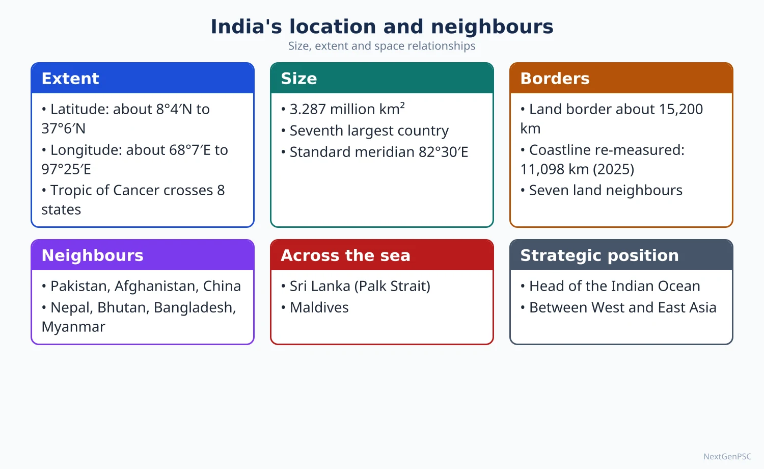
India lies wholly in the Northern and Eastern Hemispheres, between about 8°4′N and 37°6′N and 68°7′E and 97°25′E, with an area of 32.87 lakh km² (about 2.4% of the world). Its relative location at the head of the Indian Ocean, between West Asia and East Asia, and its long land frontier with seven neighbours shape its trade, security and diplomacy. UPSC asks how this space relationship creates both opportunities (connectivity, maritime reach) and challenges (disputed borders, migration, river sharing).
In simple words
Every country has an address on the globe: its latitude and longitude, and who lives next door.
India's address is special: it sits like a peninsula pushing into the middle of the Indian Ocean, with the Himalaya as a wall in the north and seven neighbours along its land border.
Think of a house at a busy crossroads with a large garden facing the sea: it gets visitors and trade, but also boundary quarrels.
UPSC asks how India's position helps its trade and influence and what problems its borders create.
1. Concepts and Definitions
Absolute (mathematical) location: position fixed by latitude and longitude; mainland India extends from about 8°4′N (Kanyakumari) to 37°6′N and from 68°7′E (Gujarat) to 97°25′E (Arunachal Pradesh); Indira Point in Great Nicobar (about 6°45′N) is the southernmost point of Indian territory.
Relative (situational) location: position in relation to other places, oceans and routes; India is central to the Indian Ocean rim, lies between the oil-rich Gulf and the manufacturing economies of East Asia, and sits astride the sea lanes linking the Suez Canal and the Strait of Malacca.
Size: 32,87,263 km² (Survey of India), the seventh largest country; north–south extent about 3,214 km and east–west about 2,933 km.
Standard meridian: 82°30′E, passing near Mirzapur (Uttar Pradesh); the 30° longitude spread gives about two hours of time difference between Gujarat and Arunachal Pradesh.
Tropic of Cancer (23°30′N): passes through eight states: Gujarat, Rajasthan, Madhya Pradesh, Chhattisgarh, Jharkhand, West Bengal, Tripura and Mizoram, dividing India into a tropical south and a subtropical north.
Space relationship: the pattern of physical, economic, cultural and political interaction a country has with its neighbours; geographers study it through frontiers and boundaries, connectivity, river basins and shared ecosystems.
Frontier vs boundary: a frontier is a zone (outward-looking, a belt of contact), a boundary is a line (inward-looking, a limit of sovereignty), following Ladis Kristof's distinction (1959).
Peninsular character: south of about 22°N India narrows into a peninsula flanked by the Arabian Sea and the Bay of Bengal, so no place in the peninsula is far from the sea, which moderates climate and favours ports and fisheries.
2. Land and Maritime Frontiers
Land frontier: about 15,200 km, shared with seven countries; approximate lengths (Ministry of Home Affairs, Department of Border Management): Bangladesh 4,096.7 km, China 3,488 km, Pakistan 3,323 km, Nepal 1,751 km, Myanmar 1,643 km, Bhutan 699 km, Afghanistan 106 km (in the area of Ladakh under Pakistani occupation).
Coastline: traditionally given as 7,516.6 km (mainland plus islands); a re-measurement using a finer scale (reported by the Ministry of Home Affairs in 2024–25) put it at about 11,098.8 km, the rise coming from method, not from new land.
Maritime zones (UNCLOS 1982): territorial sea 12 nautical miles, contiguous zone 24 nm, Exclusive Economic Zone (EEZ) 200 nm; India's EEZ is about 2.02 million km², among the largest in the Indian Ocean.
Maritime neighbours: Sri Lanka (across the Palk Strait and Gulf of Mannar), Maldives (south of Lakshadweep across the Eight Degree Channel), Indonesia, Thailand and Myanmar (near the Andaman and Nicobar Islands; the Ten Degree Channel separates the Andaman and Nicobar groups).
Natural barriers and gateways: the Himalaya and the Purvanchal hills form a high northern and eastern wall, while passes such as Khyber (in Pakistan), Nathu La and Shipki La, and the open Gangetic delta in the east have historically channelled trade and invasions.
Island territories: Andaman and Nicobar Islands command the approach to the Strait of Malacca; Lakshadweep sits near the Arabian Sea shipping routes.
3. India and Each Neighbour
Pakistan: partition boundary (Radcliffe Line, 1947), the Line of Control in Jammu and Kashmir, Sir Creek dispute in the Rann of Kutch; the Indus Waters Treaty (1960) allocated the eastern rivers (Ravi, Beas, Sutlej) to India and western rivers (Indus, Jhelum, Chenab) mainly to Pakistan; India placed the treaty in abeyance in April 2025 after the Pahalgam attack.
China: undemarcated boundary; Line of Actual Control (LAC) in three sectors: western (Aksai Chin, Ladakh), middle (Himachal Pradesh, Uttarakhand) and eastern (McMahon Line, Arunachal Pradesh); the Galwan clash (2020) and later disengagement show the boundary's fragility; China's upstream dams on the Yarlung Tsangpo (Brahmaputra) raise water concerns.
Nepal: open border under the 1950 Treaty of Peace and Friendship; Kalapani–Lipulekh–Limpiyadhura dispute; Kosi and Gandak agreements; Himalayan rivers give hydropower and flood links.
Bhutan: close partner; hydropower (Chukha, Tala, Mangdechhu) exported to India; the Doklam plateau (2017 stand-off) lies near the narrow Siliguri Corridor.
Bangladesh: longest land boundary; Land Boundary Agreement (2015) exchanged 111 Indian and 51 Bangladeshi enclaves; Ganga Water Treaty (1996, Farakka) runs for 30 years; Teesta water sharing remains unsettled; riverine and char areas make fencing difficult.
Myanmar: gateway to Southeast Asia; Kaladan Multi-Modal Transit Transport Project (Sittwe port), India–Myanmar–Thailand Trilateral Highway; Free Movement Regime along the border was scrapped by India in 2024 and fencing announced.
Sri Lanka and Maldives: maritime neighbours; Katchatheevu and fishing disputes in the Palk Bay; India's security role through SAGAR (2015) and its upgrade MAHASAGAR (2025).
4. Theory and Debates
Heartland and Rimland: Halford Mackinder (1904) saw Eurasia's interior as the 'pivot area'; Nicholas Spykman (1944) argued the Rimland, which includes India, holds the key to world power; India's rimland position explains its double orientation, continental and maritime.
Sea power: A.T. Mahan (1890) linked national power to command of the sea; K.M. Panikkar (India and the Indian Ocean, 1945) applied this to India, arguing India's security depends on the Indian Ocean.
Boundary classification: Richard Hartshorne (1936) classified boundaries as antecedent, subsequent, superimposed and relict; the Radcliffe Line is a superimposed boundary drawn across a settled cultural landscape, while the McMahon Line follows a physical (watershed) logic but remains disputed.
Natural vs artificial boundaries: the Himalayan watershed principle (crest line) is debated; China rejects the McMahon Line drawn at the Simla Convention (1914); this is a disputed point.
Size and shape: India's compact, peninsular shape gives a long coastline relative to area, which favours maritime trade but demands large naval and coastal security investment.
Connectivity debates: 'Neighbourhood First' (2014) and 'Act East' (2014, upgraded from Look East of 1991) aim to turn borders into bridges; critics point to slow project delivery compared with China's Belt and Road Initiative.
5. Maps and Diagrams to Draw
Location map: draw India's outline, mark the Tropic of Cancer across the eight states, the standard meridian 82°30′E through Mirzapur, and the extreme points (Indira Col/Siachen area in the north as claimed, Kanyakumari, Guhar Moti in Kutch, Kibithu in Arunachal Pradesh).
Neighbours map: shade each neighbour lightly, write the border length along each frontier, and mark the LoC and LAC with dashed lines, the Siliguri Corridor with an arrow, and the McMahon Line in the east.
Indian Ocean centrality sketch: place India at the centre, draw arrows to the Strait of Hormuz, Bab-el-Mandeb, Suez and Malacca, mark the Ten Degree, Nine Degree and Eight Degree Channels and the Andaman and Nicobar chain.
River-sharing sketch: show the Indus, Ganga–Brahmaputra–Meghna and Kosi basins crossing borders, labelling the Farakka barrage and the main treaties.
Flow diagram: location → physical setting (Himalaya, ocean) → climate (monsoon) → economy (trade, energy imports) → geopolitics (neighbourhood policy) shows the chain examiners like.
Keep maps neat: north arrow, rough scale, legend with three to five symbols only.
6. Using It in the Exam
10 marks (150 words): one-line definition of space relationship, a quick map of neighbours with border lengths, two opportunities and two challenges, one-line conclusion on Neighbourhood First.
15 marks (200 words): absolute and relative location, maritime centrality, one paragraph each on the northern and eastern neighbours, a map and a short way forward.
20 marks (250 words): add theory (Mackinder, Spykman, Panikkar), boundary classification (Hartshorne), river-sharing and connectivity projects, and a balanced conclusion.
Keywords examiners look for: relative location, Indian Ocean centrality, Siliguri Corridor, LAC and LoC, transboundary rivers, Act East and Neighbourhood First.
Attributed idea: K.M. Panikkar argued that whoever controls the Indian Ocean holds India at their mercy; quote it as his view (paraphrased).
Avoid treating location as only latitude and longitude: always connect it to climate, trade and security.
| Neighbour | Border length (km, MHA) | Indian states/UTs on border | Key geographic issue |
|---|---|---|---|
| Bangladesh | 4,096.7 | West Bengal, Assam, Meghalaya, Tripura, Mizoram | Riverine border, Teesta sharing, migration |
| China | 3,488 | Ladakh, Himachal Pradesh, Uttarakhand, Sikkim, Arunachal Pradesh | Undemarcated LAC, Brahmaputra dams |
| Pakistan | 3,323 | Gujarat, Rajasthan, Punjab, Jammu and Kashmir, Ladakh | LoC, Sir Creek, Indus waters |
| Nepal | 1,751 | Uttarakhand, Uttar Pradesh, Bihar, West Bengal, Sikkim | Open border, Kalapani, Kosi floods |
| Myanmar | 1,643 | Arunachal Pradesh, Nagaland, Manipur, Mizoram | Porous hill border, Act East links |
| Bhutan | 699 | Sikkim, West Bengal, Assam, Arunachal Pradesh | Hydropower, Doklam near Siliguri Corridor |
| Afghanistan | 106 | Ladakh (area under Pakistani occupation) | Wakhan Corridor, no direct access |
Mains points
- Questions often ask how India's location is a 'geopolitical asset' or how its 'space relationship' with neighbours affects development; always cover both continental and maritime dimensions.
- Draw a neighbours map with border lengths and mark the Siliguri Corridor, LoC, LAC and McMahon Line; a map is expected in almost every answer here.
- Link location to the Indian Ocean: EEZ, sea lanes, choke points, Andaman and Nicobar Islands, SAGAR/MAHASAGAR.
- Use river sharing (Indus, Ganga, Teesta, Brahmaputra) as the physical geography bridge between neighbours.
- Common mistake: listing neighbours like a GK answer; instead classify issues as boundary, water, migration, connectivity and security.
- Quote Spykman's Rimland and Panikkar's Indian Ocean view to add theoretical depth, and end with connectivity projects and cooperation frameworks (BIMSTEC, BBIN).
Did you know?
- Memory trick for the eight Tropic of Cancer states, west to east: 'Good Rulers Make Children Join With Their Mothers' (Gujarat, Rajasthan, MP, Chhattisgarh, Jharkhand, West Bengal, Tripura, Mizoram).
- India is the only country after which an ocean is named.
Geological Structure and Relief
India's geology spans from Archaean rocks over 2.5 billion years old in the Peninsula to young Tertiary Himalayan folds and Quaternary alluvium in the plains. The northward drift of the Indian Plate after the break-up of Gondwanaland and its collision with Eurasia built the Himalaya and the Indo-Gangetic trough, while the stable Peninsular shield preserves ancient rocks, the Gondwana coal basins and the Deccan Traps. Structure explains relief, drainage, soils and the distribution of minerals.
In simple words
Rocks are the pages of the Earth's diary, and India's diary has very old and very new pages.
The south (the Peninsula) is like an old, hard table top that has stayed stable for billions of years, while the Himalaya is like a carpet crumpled when India pushed into Asia.
Knowing which rocks lie where tells us why coal is in Jharkhand, iron ore in Odisha and fertile soil in the Ganga plain.
UPSC asks to link geological history with relief, minerals and earthquakes.
1. Concepts and Definitions
Geological structure: the arrangement of rock types, their age, folding, faulting and the tectonic history of a region; it controls landforms (relief), drainage and mineral wealth.
Shield (craton): a large, stable block of ancient crystalline rocks that has not been folded for a very long time; the Indian Peninsula is a shield made of several cratons (Dharwar, Bastar, Singhbhum, Bundelkhand, Aravalli).
Orogeny: mountain building by compression at convergent plate margins; the Himalayan orogeny began with the India–Eurasia collision about 50 million years ago (estimates range roughly 55–40 Ma and are debated).
Geosyncline: an older concept (James Hall, J.D. Dana, later Kober) for a long, subsiding marine trough where sediments accumulate and are later folded; the Tethys Sea between Angaraland and Gondwanaland is the classic Indian example.
Gondwanaland: the southern part of Pangaea, named by Eduard Suess after the Gond region of central India, where Gondwana rocks were first described.
Relief: the difference in elevation and the overall shape of land; India's relief ranges from sea level on the coasts to 8,586 m at Kangchenjunga, the highest peak fully in Indian territory.
2. Rock Systems of India (Oldest to Youngest)
Archaean system (over 2,500 million years): granites, gneisses and schists formed from the earliest crust; Bundelkhand gneiss, Peninsular gneiss of Karnataka and Tamil Nadu; base for most metallic minerals.
Dharwar system (about 2,500–1,800 Ma): highly metamorphosed sediments; rich in iron ore, manganese, gold and copper (Kolar and Hutti gold fields, Singhbhum copper, Bailadila iron in Chhattisgarh); the Aravalli range is built of Dharwar-age rocks.
Cuddapah system (Proterozoic): unmetamorphosed or slightly metamorphosed shales, quartzites and limestones in the Cuddapah basin of Andhra Pradesh; sources of building stone, asbestos and barytes.
Vindhyan system (Proterozoic): sandstones, shales and limestones stretching from Sasaram (Bihar) to Chittorgarh (Rajasthan); red sandstone used in Mughal monuments, diamonds of Panna (Madhya Pradesh) and cement-grade limestone.
Gondwana system (Upper Carboniferous to Jurassic, about 300–150 Ma): freshwater sediments laid down in rift (graben) troughs along the Damodar, Mahanadi, Son, Godavari and Wardha valleys; they hold about 98% of India's coal reserves.
Deccan Traps (end-Cretaceous, about 66 Ma): fissure eruptions of basalt over about 5 lakh km² in Maharashtra, Gujarat, Madhya Pradesh and Karnataka; weathered into black (regur) soil; linked by many scientists to the Réunion hotspot and the mass extinction debate.
Tertiary system (about 66–2.6 Ma): rocks of the Himalaya, the Siwalik foothills, the Assam and Gujarat oil basins and Tertiary coal of Assam and Meghalaya.
Quaternary (last 2.6 Ma): alluvium of the Indo-Gangetic plain, older bhangar and newer khadar, coastal deltas and desert sands.
3. Tectonic Evolution and Relief
Drift of the Indian Plate: after Gondwanaland split in the Jurassic–Cretaceous, the Indian Plate moved north at one of the fastest rates known (estimates of about 15–20 cm per year in the Late Cretaceous), passing over the Réunion hotspot.
Collision: the Tethyan sediments were squeezed and thrust southward; the Himalaya rose in phases, with major thrusts (from north to south): the Indus–Tsangpo Suture Zone, the Main Central Thrust, the Main Boundary Thrust and the Himalayan Frontal Thrust.
Three parallel ranges: Greater Himalaya (Himadri), Lesser Himalaya (Himachal), Outer Himalaya (Siwalik), separated by longitudinal valleys (duns such as Dehradun).
Foredeep: the weight of the Himalaya bent the plate down, forming the Indo-Gangetic trough, which rivers filled with alluvium; depth of alluvium is several kilometres in places.
Peninsular relief: block mountains and plateaus; the Satpura and Vindhya are associated with faults along the Narmada–Son rift; the Western Ghats are a faulted, uplifted edge (escarpment); the Eastern Ghats are discontinuous, eroded hills.
Present activity: the Indian Plate still moves north-north-east at about 4–5 cm per year; this causes Himalayan earthquakes (e.g. 2015 Gorkha earthquake in Nepal) and uplift.
Seismic zones: the Bureau of Indian Standards seismic zoning map (IS 1893, 2002 edition) has four zones, II to V; Zone V includes the Himalaya, North-East, Kutch and the Andaman and Nicobar Islands; a revised 2025 code introduced an additional highest zone for the Himalayan arc, so check the latest edition.
4. Indian Examples Linking Structure, Relief and Resources
Chota Nagpur Plateau (Jharkhand, Odisha, Chhattisgarh): Archaean and Dharwar rocks with Gondwana coal basins, making it the mineral heartland (Jharia, Bokaro, Raniganj coalfields; Noamundi and Gua iron ore).
Deccan Plateau: basalt plateaus with step-like 'trap' topography (Mahabaleshwar, Sahyadri), black soil for cotton.
Aravalli range: worn-down remnant of an ancient fold mountain; Guru Shikhar (1,722 m) on Mount Abu is the highest point; rich in copper (Khetri), zinc and lead (Zawar).
Meghalaya Plateau: a detached part of the Peninsular block separated by the Garo–Rajmahal gap; Tertiary coal and limestone.
Assam and Gujarat (Cambay) basins and Mumbai High: Tertiary sedimentary basins bearing petroleum.
Kerala coast placers: monazite and ilmenite sands derived from the weathering of crystalline rocks.
5. Theory and Debates
Geosyncline vs plate tectonics: early explanations of the Himalaya (Kober's orogen theory) used the geosyncline concept; since the 1960s plate tectonics (Hess, Wilson, Morgan, McKenzie, Le Pichon) explains the Himalaya as a continent–continent collision.
Timing of collision: debated; some workers argue for initial contact about 55–50 Ma, others for a later 'hard' collision near 40–35 Ma.
Deccan volcanism and extinction: scholars debate whether the Deccan eruptions, the Chicxulub impact, or both caused the end-Cretaceous extinction; present it as debated.
Origin of the Western Ghats: one view sees them as a fault scarp produced when the western part of the Peninsula subsided into the Arabian Sea; another stresses flexural uplift and erosion; both are discussed.
Tilt of the Peninsula: the general eastward tilt explains why most Peninsular rivers flow to the Bay of Bengal, while the Narmada and Tapi flow west through rift valleys.
6. Maps and Diagrams to Draw
Geological map of India: shade the Archaean–Dharwar shield in the south and east, Cuddapah basin in Andhra Pradesh, Vindhyan belt across central India, Gondwana strips along the Damodar, Mahanadi and Godavari, the Deccan Traps in the west-centre, Tertiary in the Himalaya and North-East, and Quaternary alluvium in the plains.
North–south cross-section: draw from the Tibetan plateau through the Indus–Tsangpo suture, the Greater, Lesser and Siwalik ranges with thrust lines (MCT, MBT, HFT) to the Indo-Gangetic trough and the Peninsular shield.
Plate-drift sketch: show India's position at about 70 Ma, 50 Ma and today with arrows and the Réunion hotspot.
Gondwana graben sketch: a block diagram with downfaulted troughs containing coal seams between faults.
Seismic zone map: outline India and colour Zones II to V; label Kutch, the Himalaya and the North-East.
7. Using It in the Exam
10 marks: table of major rock systems with age and one resource each, plus a small map; finish with one line on how structure guides mineral planning.
15 marks: tectonic history (Gondwana break-up, drift, collision), resulting relief divisions and a cross-section.
20 marks: structure–relief–drainage–resource linkage, debates (collision timing, Western Ghats origin), seismic hazard and the geological map.
Keywords: Peninsular shield, Dharwar, Gondwana graben, Deccan Traps, Tethys, Main Central Thrust, foredeep, seismic zonation.
Attributed idea: Eduard Suess coined 'Gondwanaland' and 'Tethys', recognising the common geology of India and the southern continents.
Common mistake: calling the Aravalli the 'youngest' or the Himalaya 'old'; always give the age ordering correctly.
| Rock system | Approximate age | Main areas | Economic importance |
|---|---|---|---|
| Archaean | Over 2,500 Ma | Karnataka, Tamil Nadu, Bundelkhand, Chota Nagpur | Granite, gneiss; base for metallic minerals |
| Dharwar | About 2,500–1,800 Ma | Karnataka, Aravalli, Singhbhum, Bastar | Iron ore, manganese, gold, copper |
| Cuddapah | Proterozoic | Cuddapah basin (Andhra Pradesh) | Building stone, asbestos, barytes |
| Vindhyan | Proterozoic | Sasaram to Chittorgarh | Sandstone, limestone, Panna diamonds |
| Gondwana | About 300–150 Ma | Damodar, Mahanadi, Son, Godavari valleys | About 98% of coal reserves |
| Deccan Traps | About 66 Ma | Maharashtra, Gujarat, MP | Basalt, black soil |
| Tertiary | About 66–2.6 Ma | Himalaya, Assam, Gujarat, Mumbai High | Petroleum, Tertiary coal |
| Quaternary | Last 2.6 Ma | Indo-Gangetic plain, deltas, Thar | Fertile alluvium, groundwater |
Mains points
- UPSC links structure to resources: expect questions like 'geological structure and mineral distribution' or 'Gondwana coal'; always use a table of rock systems.
- Explain relief as an outcome of tectonics: shield, collision, foredeep; draw the north–south cross-section with thrust lines.
- Bring in hazards: seismic zones and Himalayan earthquakes show that structure is active, not only historical.
- Mention debated points (collision timing, Deccan Traps and extinction, Western Ghats origin) as debated; examiners reward balance.
- Use Indian place names for every rock system (Panna, Kolar, Jharia, Mumbai High) instead of generic statements.
- Common error: confusing Gondwana (rock system and coal) with Gondwanaland (supercontinent); define both clearly.
Did you know?
- Memory trick for the order of Indian rock systems: 'A Dog Can Visit Grandma's Delhi Terrace Quietly' (Archaean, Dharwar, Cuddapah, Vindhyan, Gondwana, Deccan Traps, Tertiary, Quaternary).
- Marine fossils found high in the Himalaya are evidence that these rocks once lay at the bottom of the Tethys Sea.
Drainage Systems and Watersheds
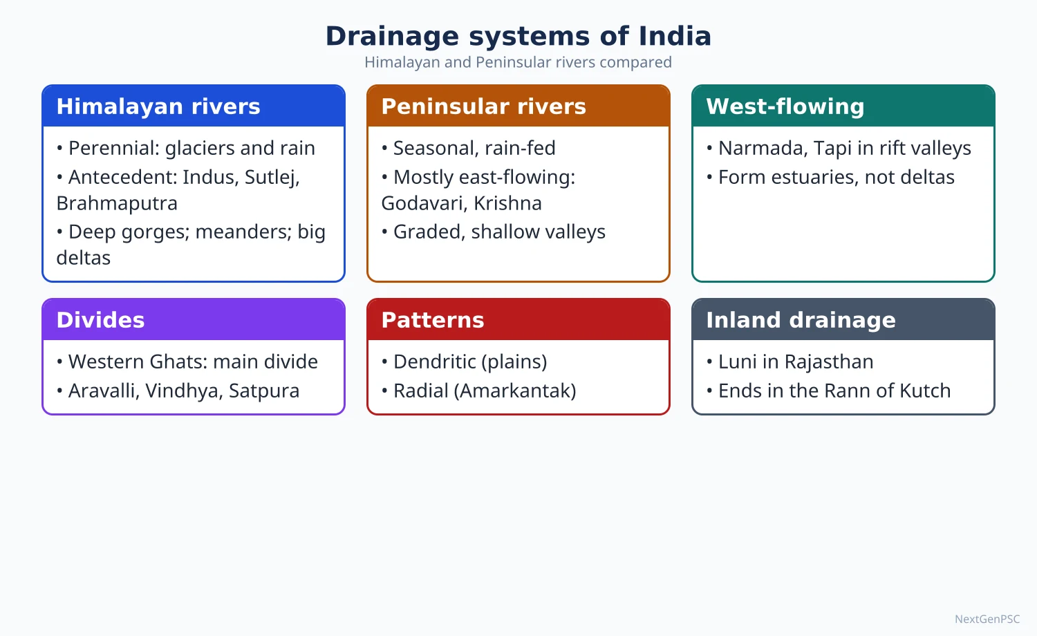
India's rivers fall into two families: the perennial, snow-and-rain-fed Himalayan rivers (Indus, Ganga, Brahmaputra systems) and the mostly rain-fed, seasonal Peninsular rivers (Mahanadi, Godavari, Krishna, Kaveri flowing east; Narmada and Tapi flowing west). Their courses reflect structure: antecedent gorges across the Himalaya, rift-valley rivers in the Peninsula and an eastward tilt of the plateau. A watershed (drainage basin) is the natural unit for water, soil and land planning in India.
In simple words
A river system is like a tree: small streams are twigs, tributaries are branches and the main river is the trunk.
The land area that sends all its rain into one river is its watershed, like a funnel collecting water.
Himalayan rivers flow all year because of melting snow; Peninsular rivers shrink in summer.
This matters for irrigation, floods, hydropower and water disputes, and UPSC asks why the two systems differ and how watershed planning helps drylands.
1. Concepts and Definitions
Drainage: the flow of water through well-defined channels; a drainage system is the network of a main river and its tributaries.
Drainage basin (catchment): the area drained by a river and its tributaries; the boundary between two basins is the water divide; in Indian usage 'watershed' often means a small basin (roughly up to a few thousand hectares) used as a planning unit.
Drainage patterns: dendritic (tree-like, on uniform rocks: Indo-Gangetic plain), trellis (on folded rocks: parts of the Himalaya and the Singhbhum belt of Chota Nagpur), radial (from a central high: Amarkantak, from which the Narmada, Son and Johila radiate), centripetal (into a basin: Loktak lake area in Manipur), rectangular (on jointed rocks), and annular.
Antecedent river: a river older than the uplift across which it flows, cutting a gorge as the land rises; the Indus, Sutlej and Brahmaputra (Dihang) cross the Greater Himalaya in deep gorges.
Superimposed river: a river that developed on an upper rock cover and kept its course when cutting down into different underlying structures; the Subarnarekha and Damodar are often cited.
Consequent and subsequent rivers: consequent rivers follow the initial slope (most east-flowing Peninsular rivers); subsequent rivers develop along weak zones.
Regime: the seasonal pattern of flow; Himalayan rivers have a double peak (snowmelt in early summer and monsoon rain), Peninsular rivers a single monsoon peak.
2. The Himalayan Drainage
Indus system: rises near Lake Mansarovar in Tibet, enters India in Ladakh, length about 2,880 km; tributaries Jhelum, Chenab, Ravi, Beas and Sutlej (Sutlej rises at Rakas Tal and crosses at Shipki La).
Ganga system: Bhagirathi (Gaumukh, Gangotri glacier) and Alaknanda meet at Devprayag; length about 2,525 km; basin covers about 26% of India's area; left-bank tributaries Ramganga, Gomti, Ghaghara, Gandak, Kosi; right-bank Yamuna and Son.
Brahmaputra system: rises in the Chemayungdung glacier near Mansarovar as the Tsangpo, turns round Namcha Barwa, enters Arunachal Pradesh as the Siang (Dihang), joins Dibang and Lohit; braided channel with Majuli, one of the largest river islands; enters Bangladesh as the Jamuna.
Evolution debate: E.H. Pascoe (1919) and G.E. Pilgrim proposed a single 'Indo-Brahma' or 'Siwalik river' flowing west along the Himalayan front, later dismembered by uplift of the Potwar plateau and the Delhi ridge; this hypothesis is debated.
Features: deep gorges, V-shaped valleys, rapids in the mountains; meanders, oxbow lakes, braiding and shifting courses in the plains (the Kosi has shifted westward by over 100 km in about 200 years and is called the 'sorrow of Bihar').
3. The Peninsular Drainage
Main water divide: the Western Ghats, close to the west coast; hence most large rivers (Mahanadi, Godavari, Krishna, Kaveri) flow east to the Bay of Bengal and form deltas.
Godavari: rises near Trimbakeshwar (Nashik), about 1,465 km, the largest Peninsular basin, often called the 'Dakshin Ganga'.
Krishna: rises near Mahabaleshwar, tributaries Koyna, Tungabhadra, Bhima; Kaveri: rises at Talakaveri (Brahmagiri, Kodagu), receives both south-west and north-east monsoon rain, so flows more evenly; Mahanadi: rises near Sihawa (Chhattisgarh), Hirakud dam.
West-flowing rivers: Narmada (rises at Amarkantak) and Tapi flow through rift valleys and form estuaries, not deltas; short, swift Western Ghat rivers (Sharavathi with Jog Falls, Periyar, Mandovi) form waterfalls.
Rivers of the Ganga's peninsular side: Chambal, Betwa, Ken and Son flow north to join the Yamuna–Ganga, showing the northward slope of the Malwa–Bundelkhand upland; Chambal's badlands (ravines) result from gully erosion.
Inland drainage: the Luni in Rajasthan ends in the Rann of Kutch; parts of the Thar have no outlet to the sea.
4. Watersheds and Watershed Management
Hierarchy: the All India Soil and Land Use Survey (AIS&LUS) watershed atlas divides India into water resource regions → basins → catchments → sub-catchments → watersheds, with sub-watersheds and micro-watersheds below, giving a nested coding system.
Watershed management: integrated treatment of land and water in a basin, from ridge to valley: contour bunds, trenches, check dams, farm ponds, afforestation and pasture development, aimed at soil conservation, groundwater recharge and livelihoods.
Indian programmes: Drought Prone Areas Programme (1973), Desert Development Programme (1977–78), National Watershed Development Project for Rainfed Areas (1990–91), Hariyali guidelines (2003), Integrated Watershed Management Programme (2009–10), now the Watershed Development Component of the Pradhan Mantri Krishi Sinchayee Yojana (WDC-PMKSY, and WDC-PMKSY 2.0 from 2021–22).
Success stories: Ralegan Siddhi (Maharashtra, Anna Hazare), Hiware Bazar (Maharashtra), Sukhomajri (Haryana, social fencing and water sharing), Alwar johads by Tarun Bharat Sangh (Rajendra Singh) that revived the Arvari river.
Principles: people's participation, equity in water sharing, ridge-to-valley sequence, convergence with MGNREGA works.
5. Theory and Debates
Horton (1945) and Strahler (1952): stream ordering and the laws of stream number and length allow quantitative comparison of Indian basins (morphometric analysis is a standard method in Indian research).
Interlinking of Rivers (ILR): the National Perspective Plan (1980) has a Himalayan component (14 links) and a Peninsular component (16 links); the Ken–Betwa link (approved December 2021, foundation stone December 2024) is the first under implementation; critics raise ecological costs (Panna Tiger Reserve), displacement and the idea of 'surplus' basins; it is a debated policy.
Big dams vs small structures: the Narmada (Sardar Sarovar) debate contrasts irrigation and power gains with displacement; watershed advocates argue decentralised harvesting is cheaper and fairer.
Inter-state disputes: Kaveri (tribunal award 2007, Supreme Court judgment 2018, Cauvery Water Management Authority), Krishna, Mahadayi; they show river basins cross political boundaries.
River rejuvenation: Namami Gange (2014) addresses pollution and e-flows; debates continue over minimum ecological flow.
6. Maps and Diagrams to Draw
River map of India: draw the Indus, Ganga and Brahmaputra with main tributaries, the Peninsular rivers with deltas on the east coast and estuaries on the west, and the main water divides (Himalayan crest, Western Ghats, Vindhya–Satpura, Aravalli).
Comparison sketch: a two-column labelled diagram contrasting a Himalayan river (gorge, meander, delta) with a Peninsular river (waterfall, shallow valley, delta or estuary).
Drainage patterns: small sketches of dendritic, trellis, radial (Amarkantak), centripetal (Loktak) patterns with Indian names.
Watershed sketch: a basin outline with ridge line, contour bunds on upper slopes, check dams in the drainage line and farm ponds in the valley (ridge-to-valley sequence).
Kosi shifting: lines showing successive channels moving west across north Bihar.
7. Using It in the Exam
10 marks: table comparing Himalayan and Peninsular rivers, one river map.
15 marks: structural control of drainage (antecedent gorges, rift valleys, tilt), patterns with examples, map.
20 marks: watershed concept, hierarchy, programmes, case studies and critique, or ILR with pros and cons.
Keywords: antecedent drainage, water divide, regime, dendritic and trellis, ridge-to-valley, WDC-PMKSY, interlinking.
Attributed idea: Pascoe's 'Indo-Brahma' hypothesis of a single westward Himalayan river is a classic, debated explanation of the Himalayan drainage.
Always write basin names with states and mention one current scheme with its year.
| Feature | Himalayan rivers | Peninsular rivers |
|---|---|---|
| Source of water | Snow, glaciers and monsoon rain | Mainly monsoon rain |
| Flow | Perennial | Seasonal; low flow in summer |
| Age and stage | Young; actively eroding | Old; graded, shallow valleys |
| Valleys | Deep gorges, V-shaped (antecedent) | Broad, shallow; rift valleys for Narmada and Tapi |
| Course in plains | Meanders, braiding, shifting (Kosi) | Fixed courses on hard rocks |
| Mouth | Large deltas (Ganga–Brahmaputra) | Deltas on east coast, estuaries on west coast |
| Use | Irrigation canals, hydropower in mountains | Tank and reservoir irrigation, hydropower at falls |
Mains points
- Explain drainage through structure: antecedent Himalayan gorges, rift valleys of the Narmada and Tapi, eastward tilt, Western Ghats as the main divide.
- Always draw a river map; for watershed questions, draw a ridge-to-valley treatment sketch.
- Watershed answers should cover the concept, hierarchy, programmes (DPAP to WDC-PMKSY 2.0) and case studies (Ralegan Siddhi, Sukhomajri, Alwar).
- For interlinking of rivers give both sides: water transfer and irrigation versus ecology, cost and displacement; cite the Ken–Betwa link.
- Link drainage to floods (Kosi, Brahmaputra), disputes (Kaveri) and pollution (Namami Gange) to show applied geography.
- Common mistake: stating that all Peninsular rivers form deltas; the Narmada and Tapi form estuaries.
Did you know?
- Amarkantak plateau is a natural radial-drainage example: the Narmada flows west while the Son and the Johila flow north-east from almost the same high ground.
- The Brahmaputra is unusual in Indian tradition for being called by a masculine name, 'son of Brahma'.
Physiographic Regions of India
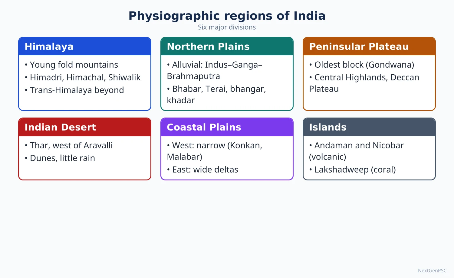
India is commonly divided into six physiographic divisions: the Northern and North-Eastern Mountains, the Northern Plains, the Peninsular Plateau, the Indian Desert, the Coastal Plains and the Islands. Each has a distinct geological origin, relief, drainage, soil and human use. Geographers such as O.H.K. Spate and R.L. Singh refined this into hierarchies of macro, meso and micro regions used for regional planning.
In simple words
If you fly from Kashmir to Kanyakumari you see snowy mountains, then flat green plains, then old rocky plateaus, with sandy desert to the west and beaches along the coasts.
These big landscape units are physiographic regions, like the different rooms of one large house.
Each room has its own climate, soil, crops and way of life.
UPSC asks you to describe these regions, compare them and explain how they shape the economy and settlement.
1. Concepts and Definitions
Physiography: the description of landforms in terms of their structure, process and stage (W.M. Davis's trilogy); a physiographic region is an area of broadly uniform relief and geological history.
Regionalisation: dividing space into regions on chosen criteria; physiographic regions are formal (homogeneous) regions, unlike functional (nodal) regions.
Hierarchy of regions: R.L. Singh (India: A Regional Geography, 1971) used macro, meso, minor and micro regions; O.H.K. Spate (India and Pakistan: A General and Regional Geography, 1954) divided the subcontinent into the Himalayan mountain wall, the Indo-Gangetic plains and the Peninsular block with many sub-regions.
Six-fold scheme (NCERT and most textbooks): Northern and North-Eastern Mountains; Northern Plains; Peninsular Plateau; Indian Desert; Coastal Plains; Islands.
Trans-Himalaya: ranges north of the Greater Himalaya: Karakoram (K2, 8,611 m, in Pakistan-occupied territory claimed by India), Ladakh and Zaskar ranges.
Bhabar, Terai, Bhangar, Khadar: sub-units of the northern plains from the foothills southwards: bhabar (pebble zone where streams disappear), terai (marshy zone where they reappear), bhangar (older raised alluvium with kankar) and khadar (newer flood-plain alluvium).
2. The Northern and North-Eastern Mountains
Greater Himalaya (Himadri): average height about 6,000 m; peaks such as Kangchenjunga (8,586 m), Nanda Devi (7,816 m); granite core; glaciers (Gangotri, Zemu).
Lesser Himalaya (Himachal): 3,700–4,500 m; Pir Panjal, Dhauladhar, Mahabharat ranges; hill stations (Shimla, Mussoorie, Nainital, Darjeeling).
Siwalik (Outer Himalaya): 900–1,100 m; unconsolidated sediments; duns (Dehradun, Kotli Dun, Patli Dun); highly erodible.
Regional divisions (Sidney Burrard's river-based scheme): Punjab Himalaya (Indus–Sutlej), Kumaon Himalaya (Sutlej–Kali), Nepal Himalaya (Kali–Tista), Assam Himalaya (Tista–Dihang).
Purvanchal: after the Dihang gorge the mountains turn south: Patkai Bum, Naga hills, Manipur hills, Mizo (Lushai) hills; mostly sedimentary rocks.
Use: water towers of India, hydropower, forests, tourism, horticulture (apples in Himachal and Kashmir); hazards include landslides, glacial lake outburst floods (South Lhonak GLOF, Sikkim, October 2023) and earthquakes.
3. The Northern Plains
Origin: formed by deposition of the Indus, Ganga and Brahmaputra in the Himalayan foredeep; area about 7 lakh km², length about 2,400 km, width 240–320 km.
Divisions (west to east): Punjab plains (doabs between five rivers), Ganga plains (upper, middle, lower; from Haryana to West Bengal), Brahmaputra valley in Assam.
Gradient and features: very gentle slope; Ambala lies on the water divide between the Indus and Ganga systems; features include levees, oxbow lakes, bluffs, chaurs (wetlands) in Bihar and the Sundarbans delta.
Importance: the Ganga basin is commonly cited as home to about 43% of India's population (Census 2011-based estimates); fertile soils, groundwater, high cropping intensity and dense settlement; the cradle of Indian civilisation.
Problems: floods (Kosi, Brahmaputra), waterlogging and salinity (Punjab, Haryana canal areas), groundwater decline, arsenic in groundwater (lower Ganga plain).
4. The Peninsular Plateau
Extent: a triangular tableland of about 16 lakh km² bounded by the Aravalli, the Vindhya and the Rajmahal hills in the north, the Western Ghats and Eastern Ghats on the sides; average height 600–900 m.
Central Highlands: north of the Narmada: Malwa plateau, Bundelkhand, Baghelkhand, Chota Nagpur plateau (rich in minerals), Meghalaya (Shillong) plateau and Karbi Anglong as eastern extensions.
Deccan Plateau: south of the Narmada: Maharashtra plateau (basalt), Karnataka plateau, Telangana plateau; Satpura range and Mahadeo and Maikal hills on the north.
Western Ghats (Sahyadri): continuous, average 900–1,600 m; Anamudi (2,695 m) in the Anaimalai hills is the highest peak of Peninsular India; passes Thal ghat, Bhor ghat and the Palghat gap.
Eastern Ghats: discontinuous, cut by east-flowing rivers; Mahendragiri (1,501 m) and Jindhagada (about 1,690 m, Andhra Pradesh) are often cited as highest; the two Ghats meet in the Nilgiris (Doddabetta, 2,637 m).
Use: minerals (iron, coal, bauxite, manganese), black soil cotton, tank irrigation in the south, plantations in the Western Ghats; problems: drought, soil erosion, tribal displacement by mining.
5. Desert, Coasts and Islands
Indian (Thar) Desert: west of the Aravalli; less than about 25 cm rain in the west; sand dunes (barchans, longitudinal dunes), playas (Sambhar, Didwana salt lakes), the Luni river; Indira Gandhi Canal has changed land use in the north-west.
West coast plains: narrow; Kachchh and Kathiawar in Gujarat, Konkan (Maharashtra, Goa), Kanara (Karnataka), Malabar (Kerala) with kayals (backwaters such as Vembanad); submergent coast with natural harbours (Mumbai, Mormugao, Kochi).
East coast plains: broad, emergent; Utkal (Odisha), Andhra (Northern Circars), Coromandel (Tamil Nadu); deltas of the Mahanadi, Godavari, Krishna and Kaveri; lagoons such as Chilika and Pulicat.
Islands: Andaman and Nicobar (about 572 islands; a continuation of the Arakan Yoma fold; Barren Island is India's only active volcano) and Lakshadweep (36 islands, coral atolls on the Laccadive–Chagos ridge).
6. Theory and Debates
Criteria debate: schemes differ on whether to use relief alone, or relief with structure and drainage; Spate and Learmonth emphasised structure, R.L. Singh combined physical and cultural criteria for lower-order regions.
Boundaries: regional boundaries are transition zones, not lines; e.g. the Aravalli separates the desert from the plateau but the change is gradual.
Davisian vs King's view of the Peninsula: the Peninsula is often described as an old, 'senile' surface (Davis), while others see multiple erosion surfaces formed by pediplanation (L.C. King), seen in stepped plateaus of Karnataka and Chota Nagpur; this is debated.
Planning use: physiographic regions underlie hill area development, desert development, coastal zone management and the Planning Commission's agro-climatic zones (1988–89).
Human–environment link: following Vidal de la Blache's possibilism, each region shows distinctive genres de vie: pastoral transhumance (Gaddis, Bakarwals) in the Himalaya, intensive rice cultivation in deltas, millet and pastoral economy in the Thar.
7. Maps and Diagrams to Draw
Physiographic map: outline India; shade the six divisions in different patterns; label the Greater Himalaya, Purvanchal, Indo-Gangetic plains, Thar, Central Highlands, Deccan, Western and Eastern Ghats, coastal plains and island groups; add main peaks.
Profile across the plains: a north–south sketch from the Siwalik through bhabar, terai, bhangar and khadar to the river.
West–east section of the Peninsula: show the steep Western Ghats escarpment, the plateau sloping east and the broad east coast deltas.
Himalayan divisions sketch: four segments between the Indus, Sutlej, Kali, Tista and Dihang rivers.
8. Using It in the Exam
10 marks: six divisions in a table with relief, rocks and economic use, plus a small map.
15 marks: detailed description of one division (e.g. Western Ghats or Northern Plains) with sub-regions and a diagram.
20 marks: compare schemes of regionalisation (NCERT, Spate, R.L. Singh), discuss criteria and planning relevance, with a map.
Keywords: physiography, structure–process–stage, macro and meso regions, bhabar–terai, escarpment, emergent and submergent coasts.
Attributed idea: R.L. Singh's regional hierarchy (macro, meso, minor, micro) remains the standard Indian scheme for regional geography of India.
| Division | Origin and rocks | Relief features | Economic use |
|---|---|---|---|
| Northern mountains | Tertiary folding; sedimentary and crystalline | Parallel ranges, gorges, glaciers | Hydropower, forests, tourism, horticulture |
| Northern plains | Quaternary alluvium in foredeep | Flat; bhabar, terai, bhangar, khadar | Intensive agriculture, dense settlement |
| Peninsular plateau | Archaean shield, Gondwana, Deccan basalt | Plateaus, block mountains, Ghats | Minerals, cotton, plantations |
| Indian desert | Aeolian sand over older rocks | Dunes, playas | Pastoralism, canal irrigation, solar power |
| Coastal plains | Marine and fluvial deposits | West: narrow, submergent; East: broad, deltaic | Ports, fisheries, rice, tourism |
| Islands | Andaman: fold mountains; Lakshadweep: coral | Hilly islands; atolls | Strategic bases, fisheries, eco-tourism |
Mains points
- Expect questions on one region in depth (Western Ghats, Northern Plains, Thar) or on comparing schemes of physiographic regionalisation.
- Always include a physiographic map of India with labelled divisions and peaks; it is the single most useful diagram for Paper II.
- Connect each region to economy and hazards: Himalaya (hydropower, GLOFs), plains (agriculture, floods), plateau (minerals, drought), coasts (ports, cyclones).
- Cite Spate (1954) and R.L. Singh (1971) for regional hierarchies; mention the criteria used.
- Use the bhabar–terai–bhangar–khadar sequence with a profile sketch for any question on the northern plains.
- Avoid vague descriptions; give heights, names of ranges, passes and lakes.
Did you know?
- Order of Himalayan sub-divisions west to east by bounding rivers: 'Indian Students Know Their Duty' (Indus, Sutlej, Kali, Tista, Dihang) gives Punjab, Kumaon, Nepal and Assam Himalaya.
UPSC Previous Year Questions: India: Physical Setting I
From 2014 to 2026 UPSC asked 17 question parts worth 215 marks from this chapter in Paper II. Drainage systems (8 parts) and geological structure and relief (5 parts) dominate, followed by the physiographic divisions of the Peninsula and a single question on India's space relationship with its neighbours. Every question below has a model answer written to the UPSC word limit, with the map or diagram an examiner expects.
In simple words
Read the question and write your own answer first, keeping to the word limit (10 marks about 150 words, 15 marks about 200, 20 marks about 250).
Then compare it with the model answer: did you define the term, name real rivers, rock systems and places, give a figure with its year, and draw a map or diagram?
Note what you missed in one line and reread that part of the notes before trying the next question.
1. India's Location and Space Relationship with Neighbours
Example 1 (UPSC 2016, 10 marks): Mention the space relationship of India with neighbouring countries.
Paper and question: Paper II, Q1(c)
Approach: Define space relationship (relative location), then go round India's land and maritime neighbours, showing how the physical setting shapes links and frictions. Draw a sketch map of India and its neighbours.
Space relationship is India's relative location: how its position, size and physical barriers link it to, or separate it from, its neighbours. India lies at the centre of South Asia and at the head of the Indian Ocean.
Land neighbours: a land border of about 15,200 km touches seven countries (Ministry of Home Affairs): Bangladesh (4,096 km, the longest), China (3,488 km), Pakistan (3,323 km), Nepal (1,751 km), Myanmar (1,643 km), Bhutan (699 km) and Afghanistan (106 km). The Himalaya walls off China, crossed only by passes such as Nathu La, while open plains tie Nepal, Bhutan and Bangladesh to India through shared rivers and culture.
Maritime neighbours: Sri Lanka lies across the Palk Strait, the Maldives across the Eight Degree Channel, and Indonesia, Thailand and Myanmar close to the Andaman and Nicobar Islands.
Implications: this centrality makes India the hub of SAARC and BIMSTEC, but long borders also bring disputes (LAC, LoC) and river-sharing issues.
Map: Outline map of South Asia showing India's land boundary with seven neighbours (border lengths), the Himalayan passes, the Palk Strait, the Eight and Ten Degree Channels and the Andaman Sea neighbours.
Used through the Neighbourhood First policy, this proximity can become regional prosperity.
2. Geological Structure and Relief
Example 2 (UPSC 2026, 10 marks): Briefly describe the origin, distribution and economic significance of Cuddapah and Dharwar rock systems of India.
Paper and question: Paper II, Q1(b)
Approach: Treat the two systems separately under origin, distribution and economic significance. Draw a map of the Dharwar belts and the crescent-shaped Cuddapah basin.
The Dharwar system is India's oldest metamorphosed sedimentary sequence, formed in the Archaean to early Proterozoic, roughly 3.0–2.0 billion years ago. Sediments eroded from Archaean gneisses filled narrow troughs and were then folded and metamorphosed into schists, quartzites and banded iron formations.
Distribution: the Dharwar–Shimoga–Chitradurga belts of Karnataka, the Iron Ore Series of Singhbhum (Jharkhand) and Keonjhar (Odisha), and the Bailadila range (Chhattisgarh). Significance: India's richest metallic belt, with iron ore (Bailadila, Kudremukh, Noamundi), manganese, gold (Hutti, and the now-closed Kolar mines), copper and chromite.
The Cuddapah system (Proterozoic, roughly 1.9–1.0 billion years ago) lies unconformably over the Dharwars and consists of largely unmetamorphosed shales, sandstones, quartzites and limestones laid down in synclinal basins.
Distribution: the crescent-shaped Cuddapah basin of Kadapa and Kurnool (Andhra Pradesh), with equivalents in Chhattisgarh, Kaladgi (Karnataka) and the Delhi system of Rajasthan. Significance: cement-grade limestone, Cuddapah slab building stone, barytes (Mangampet), asbestos and uranium (Tummalapalle).
Map: Outline map of Peninsular India marking the Dharwar belts of Karnataka, Singhbhum–Keonjhar and Bailadila, and the Cuddapah basin of Andhra Pradesh.
Together these Precambrian systems form the mineral base of India's steel and cement industries.
Example 3 (UPSC 2025, 10 marks): Referring to the location and physical formation of karewas, highlight their economic significance.
Paper and question: Paper II, Q1(b)
Approach: Locate the karewas, explain their lake origin step by step, then give their economic uses and threats. Draw a cross-section of the Kashmir valley.
Karewas (locally wudur) are flat-topped, terrace-like plateaus of unconsolidated lake deposits on the flanks of the Kashmir valley, especially on the Pir Panjal side.
Formation: in the Pleistocene, uplift of the Pir Panjal blocked the valley's drainage and created a vast lake. Clay, silt, sand and glacial boulders, with lignite seams and fossils, built up in it to several hundred metres. When an outlet was cut near Baramulla, the lake drained, the Jhelum and its tributaries dissected the deposits, and the remnants survive as karewas.
Economic significance: their fine, well-drained soils are ideal for saffron, notably at Pampore (Pulwama); Kashmir saffron received a GI tag in 2020. They also carry almond, walnut and apple orchards, and their clays are used for bricks.
Threats: clay excavation for highway and railway embankments and urban sprawl around Srinagar are eroding karewas and the saffron area.
Diagram: Cross-section of the Kashmir valley showing the Pir Panjal and Great Himalaya on either side, the Jhelum on the valley floor and terraced karewa deposits on the flanks.
Karewas are thus both an archive of Himalayan climate history and the base of Kashmir's high-value farming, and deserve protection as geo-heritage.
Example 4 (UPSC 2024, 10 marks): Discuss the basis of various explanations for the formation of Shiwalik.
Paper and question: Paper II, Q1(b)
Approach: State what the Shiwaliks are made of, then set out each explanation of their origin with its basis (evidence), ending with the present consensus. Draw a cross-section of the Himalayan foreland.
The Shiwaliks are the outermost Himalayan foothills, built of Miocene to early Pleistocene sandstones, clays and conglomerates (molasse) eroded from the rising Himalaya and rich in vertebrate fossils.
Single river hypothesis: E.H. Pascoe (the Indobrahm) and G.E. Pilgrim (the Siwalik River), both in 1919, proposed one great river flowing north-west along the Himalayan foot from Assam to Punjab, later dismembered into the Indus, Ganga and Brahmaputra. Basis: the continuous belt of similar sediments along the range.
Alluvial fan hypothesis: later work found palaeocurrents pointing mainly southward, as in fans built by many separate transverse rivers at the mountain front, like today's Kosi megafan. Basis: palaeocurrent directions and coarsening-upward sequences.
Foreland basin model: the load of Himalayan thrust sheets flexed the Indian plate into a foredeep in front of the Main Boundary Thrust, which filled with molasse; movement on the Himalayan Frontal Thrust then folded and uplifted it. Basis: thrust geometry and seismic profiles.
Diagram: North–south cross-section showing the Greater and Lesser Himalaya, the Main Central and Main Boundary Thrusts, folded Shiwalik molasse, the Himalayan Frontal Thrust and the Ganga plain foredeep.
Today the foreland-basin and fan explanation is widely accepted; the single-river idea survives as a historical hypothesis.
Example 5 (UPSC 2023, 10 marks): Describe the origin, distribution and economic significance of Gondwana system of rocks in India.
Paper and question: Paper II, Q1(b)
Approach: Use the three directives as headings: origin, distribution and economic significance. Draw a map of the Gondwana coalfields.
The Gondwana system, named by H.B. Medlicott after the Gond kingdoms of central India, comprises freshwater river and lake deposits of late Carboniferous to early Cretaceous age, laid down when India was part of Gondwanaland.
Origin: faulting of the old Peninsular block produced linear troughs (grabens) along today's river valleys. Rivers filled them with sand, mud and swamp vegetation of the Glossopteris flora, which subsidence buried and turned into coal. The sequence begins with the glacial Talchir tillite, followed by the coal-bearing Barakar and Raniganj stages.
Distribution: the Damodar valley (Raniganj, Jharia, Bokaro), the Son valley (Singrauli), the Mahanadi valley (Talcher, Ib valley) and the Godavari–Wardha valley (Singareni).
Economic significance: these basins hold nearly all of India's coal (commonly put at about 98%), whose total resources were about 389 billion tonnes (GSI, 1 April 2024). They also yield fire clay and coal-bed methane and host the Dhanbad–Durgapur mining and steel belt.
Map: Outline map of India marking the Damodar, Son, Mahanadi and Godavari Gondwana basins with Jharia, Raniganj, Singrauli, Talcher and Singareni coalfields.
The system underpins India's energy security, though its use must now be balanced with mine-land restoration.
Example 6 (UPSC 2017, 15 marks): Justify the inclusion of Meghalaya in Peninsular India and discuss its vegetation and soil types.
Paper and question: Paper II, Q7(c)
Approach: First justify, with structural, rock and relief evidence, that the Meghalaya plateau is a detached part of the Peninsular block; then describe its vegetation and soils with their controls. Draw a sketch map showing the Malda gap.
The Meghalaya (Shillong) plateau of the Garo, Khasi and Jaintia hills lies in the north-east but geologically belongs to the Peninsular block, separated from it by the alluvium-filled Malda (Garo–Rajmahal) gap.
Justification: (i) its core is Archaean gneiss and granite with Proterozoic Shillong Group quartzites, the same shield rocks as Chotanagpur; (ii) it is a stable, block-faulted horst, not folded like the Himalaya and Purvanchal; (iii) the Dauki fault on its southern edge and the down-faulted Malda gap, later filled by Ganga–Brahmaputra deposits, show how it was severed; (iv) its flat-topped, dissected surface resembles the Peninsular pat lands.
Vegetation: heavy orographic rain (Mawsynram and Sohra receive over 11,000 mm a year) supports tropical wet evergreen and semi-evergreen forests on the southern scarps and Garo hills (Nokrek Biosphere Reserve). The cooler central Khasi hills carry subtropical broadleaf and Khasi pine forests, and sacred groves such as Mawphlang preserve relict forest, while jhum has left grass and bamboo on degraded slopes.
Soils: intense leaching produces acidic red loamy and lateritic soils, laterite on plateau tops, organic-rich forest soils under dense cover, and alluvium in the Garo foothill valleys.
Map: Sketch map showing the Peninsular plateau, the Malda gap, the Meghalaya plateau with the Garo, Khasi and Jaintia hills, and the Dauki fault.
Meghalaya is thus a Peninsular block in a north-eastern setting, where ancient rocks and extreme rainfall together shape distinctive forests and leached soils.
3. Drainage Systems and Watersheds
Example 7 (UPSC 2024, 15 marks): Discuss the variations in nature of glaciers in India and the emerging issues due to climate change.
Paper and question: Paper II, Q3(b)
Approach: First classify the variation in Indian glaciers by region, nourishment and type, then discuss the climate-change issues (retreat, water security, glacial lakes and hazards) with recent examples. Draw a map of Himalayan glacier regions.
India's Himalaya holds about 9,575 glaciers (Geological Survey of India), the largest store of fresh water outside the polar regions and the source of the Indus, Ganga and Brahmaputra.
Regional variation: the Karakoram carries the longest glaciers, such as Siachen (about 76 km), many of which have been stable or even advancing (the 'Karakoram anomaly'). The western Himalaya (Kashmir, Himachal) has glaciers fed mainly by winter snow from western disturbances, while the central and eastern Himalaya (Gangotri in Uttarakhand, Zemu in Sikkim) have summer-accumulation glaciers fed by the monsoon, which are more sensitive to warming. Trans-Himalayan Ladakh has small, cold, dry glaciers.
Types: valley glaciers (Gangotri), cirque and hanging glaciers, and debris-covered glaciers whose rock mantle slows melting.
Emerging issues: (i) accelerating retreat, with Hindu Kush Himalayan glaciers losing mass 65% faster in 2011–2020 than in the previous decade (ICIMOD, 2023); (ii) growth of glacial lakes and glacial lake outburst floods, as at South Lhonak (Sikkim, October 2023), which destroyed the Teesta-III dam at Chungthang; (iii) rock–ice avalanches such as Chamoli (February 2021); (iv) an expected 'peak water' followed by declining dry-season flows, threatening irrigation, hydropower and drinking water.
Map: Outline map of the Indian Himalaya marking the Karakoram (Siachen), western (Kolahoi), central (Gangotri) and eastern (Zemu) glacier regions with South Lhonak and Chamoli.
Long-term glacier monitoring, early-warning systems for high-risk glacial lakes and basin-level water planning are therefore essential.
Example 8 (UPSC 2021, 15 marks): Describe the salient features of east-flowing rivers of India.
Paper and question: Paper II, Q4(b)
Approach: Name the main east-flowing rivers and then list their salient features (source, gradient, regime, valleys, deltas, uses), explaining each by structure. Draw a map of Peninsular rivers.
The east-flowing rivers of Peninsular India drain about three-quarters of the plateau into the Bay of Bengal: the Mahanadi (about 851 km), Godavari (about 1,465 km, the largest Peninsular river), Krishna (about 1,400 km) and Kaveri (about 800 km), with smaller rivers such as the Subarnarekha, Brahmani, Pennar and Vaigai.
Source and direction: most rise in the Western Ghats close to the Arabian Sea (Godavari at Trimbakeshwar, Krishna near Mahabaleshwar, Kaveri at Talakaveri) and flow east because the plateau tilts east after the uplift of the Western Ghats; the Mahanadi rises near Sihawa in Chhattisgarh.
Valleys and gradient: flowing over old, hard rocks, they have reached a mature, graded stage with broad, shallow valleys, but fall in rapids where they cross scarps (Shivanasamudra falls on the Kaveri) and pass through gaps in the Eastern Ghats.
Regime: they are rain-fed and seasonal, with high monsoon floods and low winter flow; the Kaveri is steadier because it receives both the south-west and north-east monsoons.
Mouths: they carry heavy silt over gentle coastal plains and build fertile deltas (Mahanadi, Godavari–Krishna, Kaveri), the rice bowls of the east coast.
Uses and issues: their large basins support major projects (Hirakud, Nagarjuna Sagar, Polavaram, Mettur) and hence interstate disputes over Krishna and Kaveri waters.
Map: Outline map of Peninsular India showing the Mahanadi, Godavari, Krishna and Kaveri with their sources, deltas and main dams.
These rivers are thus the lifelines of the eastern plateau and coast, needing basin-wide cooperative management.
Example 9 (UPSC 2019, 10 marks): Present the salient features of West flowing rivers of India.
Paper and question: Paper II, Q5(a)
Approach: Group the west-flowing rivers (Narmada–Tapi, Gujarat rivers, short Western Ghats streams) and list their salient features with structural reasons. Draw a map of west-flowing rivers.
The west-flowing rivers drain into the Arabian Sea and fall into three groups: the Narmada and Tapi, the rivers of Gujarat and Rajasthan (Sabarmati, Mahi, and the inland Luni), and numerous short streams of the Western Ghats (Mandovi, Zuari, Sharavati, Periyar, Bharathapuzha).
Rift valleys: the Narmada (about 1,312 km, from Amarkantak) flows west through a rift valley between the Vindhyas and the Satpuras, and the Tapi (about 724 km, from Multai) through a parallel trough; both cut gorges such as the Marble Rocks at Bhedaghat.
Estuaries, not deltas: they enter the sea through funnel-shaped estuaries (Narmada at Bharuch, Tapi at Surat) because hard rocks supply little silt and tidal currents carry it away.
Western Ghats streams: short, swift and steep, with waterfalls such as Jog Falls on the Sharavati, so they are suited to hydropower (Idukki on the Periyar, Koyna) though not to navigation.
Map: Outline map of western India showing the Narmada and Tapi rift valleys, the Sabarmati, Mahi and Luni, and the main Western Ghats rivers with Jog Falls.
Though they carry only a small share of Peninsular runoff, these rivers sustain projects like Sardar Sarovar and Ukai and the densely settled Konkan–Malabar coast.
Example 10 (UPSC 2018, 10 marks): Explain the changing river courses and their impacts on the riparian population in India with suitable examples.
Paper and question: Paper II, Q5(b)
Approach: Explain why rivers change course, give named Indian examples, and then the impacts on people living along them, ending with remedies. Draw a sketch of the Kosi's shifting courses.
Rivers in the Indo-Gangetic–Brahmaputra plains change course through avulsion (sudden jumps to a new channel), meander migration and braiding, driven by heavy Himalayan silt, flat gradients, floods, earthquakes and embankment failure.
Examples: the Kosi has migrated westward across its megafan by over 100 km in the last two centuries, and in August 2008 broke its embankment at Kusaha (Nepal), returning to an old course and affecting millions in north Bihar. The Brahmaputra's braiding and bank erosion have shrunk Majuli island, while the Ganga has eroded its left bank in Malda and Murshidabad.
Impacts on riparian people: loss of homes and farmland, repeated displacement and landlessness, the insecure life of char (sandbar) dwellers, sand-casting of fields, waterlogging, disease, disputes over newly formed land, and damage to roads and embankments.
Diagram: Sketch of the Kosi megafan showing its eighteenth-century eastern course, the present embankment-confined channel and the 2008 Kusaha breach.
Floodplain zoning, river-space approaches instead of rigid embankments, early warning and resettlement policies are needed to live with dynamic rivers.
Example 11 (UPSC 2017, 15 marks): Drainage pattern in Peninsular India is a result of its geological structure and topography. Elaborate.
Paper and question: Paper II, Q8(b)
Approach: Show, region by region, how structure (tilt, rifts, domes, rock type) and relief explain each Peninsular drainage feature and pattern. Draw a map of Peninsular drainage with the water divide.
Peninsular India is an ancient, rigid block, and its drainage has adjusted over a long time to its structure (tilts, faults and rock types) and topography, making it a classic example of structural control.
Eastward tilt: uplift of the western edge raised the Western Ghats as the main water divide close to the west coast, so the Mahanadi, Godavari, Krishna and Kaveri flow east across the whole plateau, while western slopes have short, parallel, swift streams.
Rift valleys: the Narmada and Tapi flow west through fault troughs against the general slope, and the Damodar flows east through a Gondwana rift, showing that faults override the regional tilt.
Domes and northward slope: radial drainage spreads from the Amarkantak plateau (Narmada, Son, Mahanadi) and the Ranchi–Hazaribagh plateau, while the Chambal, Betwa and Ken flow north down the slope of the Malwa and Bundelkhand plateaus to the Yamuna.
Rock type: dendritic patterns develop on the uniform Deccan basalt and granite, trellis and rectangular patterns on folded and jointed rocks of the Singhbhum and Vindhyan regions, and waterfalls where rivers cross hard scarps (Jog, Hundru, Dhuandhar).
Maturity: long erosion over hard rocks has produced broad, graded valleys with low gradients, except at scarps and gorges.
Map: Map of Peninsular India showing the Western Ghats divide, east-flowing rivers, the Narmada–Tapi rifts, the Damodar trough and radial drainage from Amarkantak.
Peninsular drainage is therefore largely an expression of geology, unlike the antecedent Himalayan rivers.
Example 12 (UPSC 2016, 10 marks): Explain the shifting of river courses and river capturing in the Himalayas.
Paper and question: Paper II, Q1(b)
Approach: Define river capture and course shifting, explain the mechanisms, then give Himalayan examples of each, noting where they are debated. Draw a sketch of the Yamuna–Sutlej shifts.
River capture (piracy) occurs when a vigorous stream erodes headward and diverts the upper course of a weaker neighbour, leaving an elbow of capture and a beheaded stream. Course shifting is the lateral migration or avulsion of a channel.
Why the Himalaya: continuing uplift, steep gradients, heavy monsoon rain, weak sedimentary rocks, earthquakes and enormous sediment loads make Himalayan rivers unusually active.
Capture examples: the Yamuna is thought to have once flowed south-west into the Ghaggar–Hakra system before being diverted east to the Ganga, while the Sutlej shifted west to the Indus; the resulting drying of the Ghaggar–Hakra is linked to the lost Saraswati (debated). The Tsangpo is often described as captured by the Siang through the Namcha Barwa gorge (debated).
Shifting examples: the Kosi's westward migration, the Teesta's switch from the Ganga to the Brahmaputra after the 1787 flood, and the braiding Brahmaputra after the 1950 Assam earthquake.
Diagram: Sketch of north-west India showing the former south-westward courses of the Yamuna and Sutlej into the Ghaggar–Hakra and their present courses to the Ganga and Indus.
These shifts are clues to Himalayan neotectonics and must guide flood planning in the plains.
Example 13 (UPSC 2014, 10 marks): How is drainage pattern determined by the water divide?
Paper and question: Paper II, Q1(c)
Approach: Define a water divide and show with Indian examples how its position, shape and height determine the direction, length and pattern of drainage. Draw a map of India's major water divides.
A water divide is the elevated line (ridge, upland or watershed) separating adjacent drainage basins; rain falling on either side flows to different river systems.
Position of the divide: where it lies close to one coast, drainage becomes asymmetric. The Western Ghats divide stands near the Arabian Sea, so short, swift parallel streams flow west while long rivers (Godavari, Krishna, Kaveri) flow east to the Bay of Bengal.
Shape of the divide: a central dome produces radial drainage, as from Amarkantak (Narmada west, Son north, Mahanadi east) and from Parasnath on the Chotanagpur plateau; an enclosing rim produces centripetal drainage, as in the Loktak basin of Manipur.
Height and continuity: the low Aravalli–Delhi ridge and the almost imperceptible Ambala upland separate the Indus and Ganga systems, while the main Himalayan divide lies north of the highest peaks, so antecedent rivers (Indus, Sutlej, Brahmaputra) cut gorges across the Great Himalaya.
Map: Outline map of India showing the Himalayan, Aravalli–Ambala, Vindhya–Satpura and Western Ghats divides with arrows for river flow.
Thus the divide sets the direction, length and pattern of rivers, and watershed planning must start from it.
Example 14 (UPSC 2014, 20 marks): Highlight the socio-economic and ecological roles of River Cauvery in its riverine tract.
Paper and question: Paper II, Q3(a)
Approach: Introduce the Kaveri basin, then discuss its socio-economic roles (irrigation, power, drinking water, culture) and ecological roles (forests, wildlife, delta, wetlands), followed by the problems that threaten them. Draw a map of the Kaveri basin.
The Kaveri rises at Talakaveri in the Brahmagiri hills of Kodagu (Karnataka) and flows about 800 km south-east through Karnataka and Tamil Nadu to the Bay of Bengal, draining a basin of about 81,155 km² that also includes parts of Kerala and Puducherry.
Irrigation and agriculture: the Grand Anicut (Kallanai), attributed to the Chola king Karikala around the 2nd century CE, is among the oldest working water-regulating structures in the world. The Krishnaraja Sagar (1932) and Mettur (1934) dams and the delta canals make the Thanjavur–Thiruvarur–Nagapattinam delta the rice bowl of Tamil Nadu, growing kuruvai and samba crops.
Power and water supply: Shivanasamudra (1902) was one of Asia's earliest hydroelectric stations, and the river supplies drinking water to Bengaluru, Mysuru and many Tamil Nadu towns.
Culture: pilgrim centres such as Talakaveri, Srirangapatna and the island temple of Srirangam, and festivals like Aadi Perukku, make the river central to regional identity.
Ecological roles: the upper basin's Western Ghats forests in Kodagu and the Nagarhole–Bandipur–Mudumalai–BRT tiger landscape form part of the Nilgiri Biosphere Reserve. Ranganathittu bird sanctuary, the Cauvery Wildlife Sanctuary (habitat of the hump-backed mahseer) and the Point Calimere wetlands near the delta support rich biodiversity.
Problems: the long interstate dispute was settled by the Supreme Court in February 2018, allocating 404.25 TMC ft to Tamil Nadu, 284.75 to Karnataka, 30 to Kerala and 7 to Puducherry, overseen by the Cauvery Water Management Authority. Sand mining, textile effluents in the Noyyal, falling delta flows, seawater intrusion and the proposed Mekedatu dam remain contentious.
Map: Map of the Kaveri basin showing Talakaveri, the main tributaries, KRS, Mettur, Shivanasamudra, the Grand Anicut, Srirangam and the delta districts.
The Kaveri is thus an economic lifeline and an ecological corridor, best managed as a single basin through cooperative water sharing and river restoration.
4. Physiographic Regions of India
Example 15 (UPSC 2023, 10 marks): Explain the geological characteristics and ecological significance of the Eastern Ghats.
Paper and question: Paper II, Q5(c)
Approach: Describe the extent, rocks and tectonic history of the Eastern Ghats, then their ecological significance (forests, biodiversity, watershed, tribes). Draw a map of the Eastern Ghats.
The Eastern Ghats are a discontinuous chain of hills running roughly parallel to the east coast from the Mahanadi in Odisha to the Nilgiris, breached by the Godavari, Krishna and Kaveri.
Geology: they form the Eastern Ghats Mobile Belt of Proterozoic high-grade metamorphic rocks, chiefly khondalites (named after the Khond tribe) and charnockites. These rocks were deformed and metamorphosed in an ancient collision of the Indian shield with East Antarctica about a billion years ago. Unlike the Western Ghats they are old, eroded residual hills, rising to about 1,680 m at Arma Konda.
Ecological significance: dry and moist deciduous forests with sal, teak and red sanders shelter tigers in Nagarjunsagar–Srisailam and the Papikonda National Park. The hills are the source of rivers such as the Vamsadhara and Nagavali, home to tribes like the Chenchus and Kondhs, and the Koraput region is a recognised centre of rice diversity.
Map: Outline map of eastern India marking the Eastern Ghats from Odisha to the Nilgiris with Arma Konda, the river gaps, Nallamala and Papikonda.
Mining and forest loss threaten this fragile belt, which needs the same conservation attention as the Western Ghats.
Example 16 (UPSC 2021, 15 marks): Describe the structure and relief features of Deccan Plateau.
Paper and question: Paper II, Q6(c)
Approach: Define the extent of the Deccan plateau, explain its structure (Deccan Trap basalts over the Archaean shield) and then describe its relief subdivisions. Draw a map and a west–east section.
The Deccan plateau is the triangular tableland south of the Narmada, bounded by the Satpura–Mahadeo–Maikal ranges in the north, the Western Ghats in the west and the Eastern Ghats in the east, sloping gently eastward.
Structure: its north-western half is formed by the Deccan Traps, horizontal flood basalts erupted at the end of the Cretaceous (around 66 million years ago) as India passed over the Réunion hotspot. Successive flows, thickest (over a kilometre) near the west coast and thinning eastward, buried the older surface. The south and east expose the Archaean shield of gneisses, granites and Dharwar schists, and the plateau was tilted east when the western margin was uplifted.
Relief: (i) the Maharashtra plateau of basalt shows step-like trap topography with flat-topped mesas and buttes and broad valleys of the Godavari, Bhima and Krishna; (ii) the Karnataka plateau rises to the Malnad hills in the west (Mullayanagiri, about 1,925 m) and falls to the rolling Maidan in the east; (iii) the Telangana plateau of granite and gneiss has tors, inselbergs and tank-dotted plains at 300–600 m.
Rivers flow east in mature valleys, and the basalt has weathered into fertile black regur soils.
Map: Outline map of the Deccan plateau with its boundaries and the Maharashtra, Karnataka and Telangana plateaus, plus a west–east section showing the Western Ghats scarp and eastward-thinning basalt.
The Deccan is thus a lava-capped ancient shield whose structure explains its relief, drainage and soils.
Example 17 (UPSC 2018, 20 marks): Distinguish the geographical aspects of North-Western lava plateau and Chotanagpur plateau of peninsular India.
Paper and question: Paper II, Q2(a)
Approach: Introduce both plateaus, then distinguish them point by point (geology, relief, drainage, climate, soils and vegetation, minerals, economy and people), ending with a judgement. Draw a comparative sketch map.
The North-Western lava plateau (chiefly the Malwa plateau) and the Chotanagpur plateau (mainly Jharkhand) are both parts of the Peninsular block but differ sharply.
Geology: the lava plateau is built of horizontal Deccan Trap basalt of end-Cretaceous age, while Chotanagpur is an ancient Archaean shield of granite and gneiss with Dharwar schists and down-faulted Gondwana troughs along the Damodar.
Relief: the lava plateau is a gently undulating tableland of about 300–600 m with flat-topped hills and step-like scarps; Chotanagpur is a series of erosion surfaces, from high pat lands (Netarhat, about 1,000 m) to the Ranchi and Hazaribagh plateaus, with residual hills such as Parasnath (1,365 m).
Drainage: the Chambal, Kali Sindh and Betwa flow north to the Yamuna, cutting the Chambal ravines (badlands); Chotanagpur has radial drainage (Damodar, Subarnarekha, Barakar) with waterfalls such as Hundru and Dassam at the plateau edges.
Climate, soils and vegetation: Malwa is semi-arid to sub-humid with black cotton soils and dry deciduous teak forest; Chotanagpur receives more rain (roughly 1,200–1,400 mm) and has red and lateritic soils under moist deciduous sal forest.
Resources and economy: the lava plateau has few minerals and is agricultural, growing soybean, cotton and wheat. Chotanagpur is India's mineral heartland, with coal (Jharia, Bokaro), iron ore, mica, copper and uranium (Jaduguda), and the steel cities of Jamshedpur and Bokaro.
People: both are tribal homelands, the Bhils in Malwa and the Santhal, Munda, Oraon and Ho in Chotanagpur, but mining has caused much greater displacement in Chotanagpur.
Map: Sketch map of central and eastern India marking the Malwa lava plateau with the Chambal, and the Chotanagpur plateau with Ranchi, Hazaribagh, the Damodar and main coal and steel centres.
In short, one is a young volcanic agricultural plateau and the other an ancient mineral-rich shield, so their development needs differ: water and soil conservation in Malwa, and inclusive, sustainable mining in Chotanagpur.
Mains points
- Rock systems (Dharwar, Cuddapah, Gondwana, Deccan Trap, Shiwalik, Karewa) are asked as 'origin, distribution and economic significance': answer in exactly those three blocks and link each system to named minerals and mining areas.
- Drainage questions reward the structural explanation: the eastward tilt of the Peninsula, rift valleys of the Narmada, Tapi and Damodar, antecedent Himalayan rivers and river capture.
- A sketch map of India is expected in almost every answer: river systems with their deltas and estuaries, rock-system belts, plateaus and the Malda gap.
- Paper II answers must carry Indian data with year and source (GSI coal inventory, Census, ISFR, Supreme Court Cauvery award 2018) and recent events such as the Chamoli disaster (2021) and the South Lhonak GLOF (2023).
- Close with a forward-looking line: river-basin management, glacier monitoring, conservation of the Eastern Ghats or sustainable mining.
Did you know?
- The Godavari, the longest Peninsular river at about 1,465 km, rises at Trimbakeshwar near Nashik only about 80 km from the Arabian Sea, yet it crosses the whole Peninsula to reach the Bay of Bengal because the plateau tilts east.
Geography Optional: All chapters
- Exam Pattern, Syllabus and Strategy
- The Earth's Interior and Tectonics
- Geomorphic Processes and Landscape Development
- Climatology: Atmosphere and Circulation
- Climatology: Weather Systems, Climates and Climate Change
- Oceanography
- Biogeography
- Environmental Geography
- Perspectives in Human Geography
- Economic Geography
- Population Geography
- Settlement Geography
- Regional Planning
- Models, Theories and Laws in Human Geography
- India: Physical Setting I
- India: Physical Setting II
- Resources of India
- Agriculture in India
- Industry in India
- Transport, Communication and Trade
- Cultural Setting and Population of India
- Settlements in India
- Regional Development and Planning in India
- Political Aspects
- Contemporary Issues
- Places for the Map Question