
Geography Optional · UPSC Notes
Political Aspects — UPSC Geography Optional Notes
Free, exam-focused notes for UPSC Prelims and Mains, with Prelims tips and Mains points for every topic. 5 topics.
Open in the interactive reader: bookmarks, progress tracking and read-aloud.
Geographical Basis of Federalism, State Reorganisation and New States
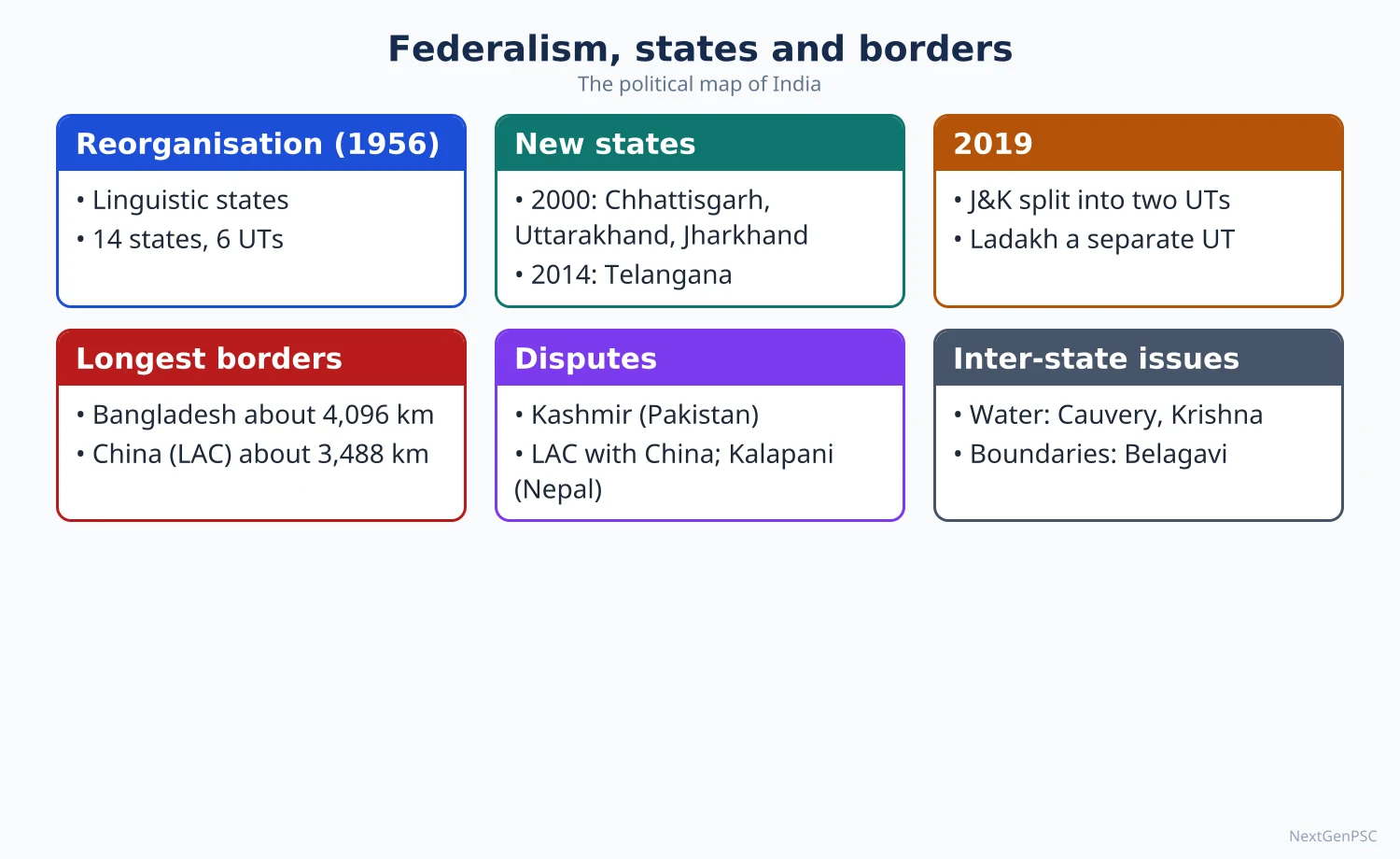
India is a federation because its size and its physical, linguistic and cultural diversity cannot be governed from one centre alone. The internal map was redrawn mainly on a linguistic basis by the States Reorganisation Act, 1956, and later on ethnic, tribal and developmental grounds, giving 28 states and 8 Union Territories today (2026). Political geography reads this as the spatial expression of the balance between unity and diversity.
In simple words
Federalism means power is shared between the Union government and the state governments, each with its own area of work.
Think of a large joint family where the head decides big matters but each branch runs its own kitchen in its own language and taste.
India drew its state boundaries mostly by language after 1956, and later created new states for tribal areas and neglected regions, which keeps the country united by giving regions a voice.
UPSC asks why India's federation has a geographical basis and whether smaller states help development.
1. Concepts and Definitions
Federalism: a system in which sovereignty is constitutionally divided between a central government and regional governments, each supreme in its own sphere; K.C. Wheare, in Federal Government (1946), gave this classic definition.
Quasi-federal: Wheare described the Indian Constitution as quasi-federal because the Union has strong overriding powers (Article 3, emergency provisions, residuary powers, All India Services).
Union of States: Article 1 calls India a 'Union of States', not a federation; B.R. Ambedkar explained in the Constituent Assembly that the Union is not the result of an agreement among states, so no state has the right to secede.
Indestructible Union of destructible States: a common description of India, because under Article 3 Parliament can create new states, alter boundaries or change names by simple majority, after only seeking the views of the state legislature concerned.
Cooperative federalism: Granville Austin used the term for India's working federation, where Union and states depend on each other; recent forms include the GST Council (2017) and NITI Aayog (2015) replacing the Planning Commission.
Political geography view: federalism is the spatial solution to the conflict between centripetal forces (forces that bind a state) and centrifugal forces (forces that divide it), concepts given by Richard Hartshorne (1950).
Raison d'être: Hartshorne's term for the idea that justifies a state's existence; for India it is the civilisational unity and shared freedom struggle that hold a diverse territory together.
2. Geographical Basis of Indian Federalism
Size: India covers about 3.287 million km², the seventh largest country, with over 1.4 billion people; one centre cannot administer such an area directly.
Physiographic diversity: the Himalaya, the Indo-Gangetic plains, the Peninsular plateau, the Thar desert, the coastal plains and two island groups form distinct natural regions with different economies and needs.
Linguistic diversity: the Eighth Schedule lists 22 languages; Census 2011 recorded 121 languages spoken by 10,000 or more people, and most languages are concentrated in compact areas, which made language a practical basis for states.
Ethnic and tribal regions: tribal belts of the Northeast, central India (Jharkhand, Chhattisgarh) and the Himalaya have distinct identities, protected by the Fifth and Sixth Schedules.
River basins and resources: rivers cross state lines, so water, minerals and forests create shared interests and conflicts that only a federal framework can manage (Article 262, inter-state tribunals).
Historical regions: older units such as Bengal, Punjab, Maratha country, Kalinga (Odisha), Andhra and Mysore gave cores around which modern states formed.
Strategic frontier: long land borders and a large coastline need special arrangements (Union Territories such as Ladakh and Andaman and Nicobar Islands, Sixth Schedule councils, Article 371 special provisions).
3. Process of State Reorganisation
At independence (1950): states were grouped into Part A (former provinces), Part B (former princely states), Part C (chief commissioners' provinces) and Part D (Andaman and Nicobar Islands).
Dhar Commission (1948): headed by S.K. Dhar, it preferred administrative convenience over language; the JVP Committee (Jawaharlal Nehru, Vallabhbhai Patel, Pattabhi Sitaramayya, 1948–49) also advised caution on linguistic states.
Andhra State (1 October 1953): formed for Telugu speakers out of Madras State after the fast unto death of Potti Sriramulu in December 1952; the first state created on a linguistic basis.
States Reorganisation Commission (1953): headed by Fazl Ali with K.M. Panikkar and H.N. Kunzru; its 1955 report accepted language as a major but not the only basis, and rejected the 'one language, one state' formula.
States Reorganisation Act, 1956: created 14 states and 6 Union Territories with effect from 1 November 1956; the same Act set up five Zonal Councils for inter-state cooperation.
Bombay Reorganisation Act, 1960: divided bilingual Bombay State into Maharashtra and Gujarat on 1 May 1960 after the Samyukta Maharashtra and Mahagujarat movements.
Nagaland (1963): created from the Naga Hills–Tuensang area of Assam, the first state formed on an ethnic-tribal basis.
Punjab Reorganisation Act, 1966: created Haryana and transferred hill areas to Himachal Pradesh; Chandigarh became a Union Territory serving as joint capital.
Northeast reorganisation: Himachal Pradesh became a state in 1971; Manipur, Tripura and Meghalaya became states in 1972; Sikkim became a state in 1975 (36th Amendment); Mizoram and Arunachal Pradesh became states in 1987, as did Goa.
Year 2000: Chhattisgarh (1 November, from Madhya Pradesh), Uttarakhand (9 November, from Uttar Pradesh) and Jharkhand (15 November, from Bihar) were created on grounds of tribal identity, hill identity and regional backwardness.
Telangana (2 June 2014): formed from Andhra Pradesh under the Andhra Pradesh Reorganisation Act, 2014, after a long movement based on regional backwardness, water and jobs; Hyderabad was joint capital for up to ten years, a period that ended on 2 June 2024.
Jammu and Kashmir Reorganisation Act, 2019: the state became two Union Territories, Jammu and Kashmir (with a legislature) and Ladakh (without one), from 31 October 2019.
Merger of 2020: Dadra and Nagar Haveli and Daman and Diu were merged into one Union Territory from 26 January 2020, giving the present count of 28 states and 8 Union Territories.
4. Bases of New States and Present Demands
Linguistic basis: Andhra (1953), Kerala, Karnataka (then Mysore) and others under the 1956 Act; Maharashtra and Gujarat (1960).
Ethnic and tribal basis: Nagaland, Meghalaya, Mizoram, Jharkhand and Chhattisgarh; tribal identity combined with geography of hills and forests.
Developmental and regional backwardness: Uttarakhand (hill neglect) and Telangana (unequal development within a linguistic state) show that language alone does not settle regional grievances.
Strategic and administrative basis: Union Territories such as Lakshadweep, Andaman and Nicobar Islands and Ladakh are kept under direct Union control for security and small population.
Pending demands (examples): Gorkhaland (Darjeeling hills, West Bengal), Vidarbha (Maharashtra), Bundelkhand (Uttar Pradesh–Madhya Pradesh), Harit Pradesh or Paschim Pradesh (western Uttar Pradesh), Saurashtra (Gujarat), Kodagu (Karnataka) and Bodoland (Assam).
Accommodation without statehood: autonomous councils such as the Bodoland Territorial Region (Bodo Accord, January 2020) and the Gorkhaland Territorial Administration (2012) show a middle path.
5. Theory and Debates: Small States
Arguments for small states: better administration, closer government, faster development of neglected areas, recognition of identity; B.R. Ambedkar's Thoughts on Linguistic States (1955) argued for dividing very large states such as Uttar Pradesh and Bihar.
Evidence (debated): Uttarakhand and Chhattisgarh recorded faster growth than their parent states in the 2000s, but Jharkhand's record of instability is often cited against the view; the outcome depends on governance, not size alone.
Arguments against: may encourage endless demands, create financial dependence on the Union, split river basins and mineral belts, and raise disputes over capitals, water and assets (Andhra Pradesh–Telangana).
Second SRC demand: many scholars and parties have called for a second States Reorganisation Commission to examine demands on fixed criteria; none has been set up so far.
Centripetal vs centrifugal: linguistic states were feared to be centrifugal, but most analysts now agree they strengthened national unity by satisfying regional identity (Paul Brass and others; this is a debated reading).
6. Maps and Diagrams to Draw
Map 1, evolution of states: draw an outline of India; shade the 14 states of 1956 in light lines; mark later creations with years in brackets: Maharashtra and Gujarat (1960), Nagaland (1963), Haryana (1966), Meghalaya, Manipur and Tripura (1972), Sikkim (1975), Mizoram and Arunachal Pradesh (1987), the three states of 2000, Telangana (2014) and Ladakh UT (2019).
Map 2, bases of states: use three shades: linguistic (south and west), ethnic-tribal (Northeast, Jharkhand, Chhattisgarh) and developmental (Uttarakhand, Telangana); add a legend.
Map 3, pending demands: mark Gorkhaland, Vidarbha, Bundelkhand, Harit Pradesh, Saurashtra and Bodoland with dots and labels.
Flow diagram: a box chain: diversity (physical, linguistic, ethnic) → regional identity → demand → Article 3 process → new state or autonomous council → outcome (integration or new demands).
7. Using it in the Exam
10-mark (150 words): define federalism, give three geographical bases with examples, end with one line on cooperative federalism; add a small sketch of India with 2–3 new states.
15-mark (200 words): introduction with Article 1 and Wheare; body on bases (physical, linguistic, ethnic, resource); a timeline of reorganisation; conclusion on balance of unity and diversity.
20-mark (250 words): add the small states debate with examples for and against, a map of state evolution and present demands, and a forward-looking conclusion (second SRC, fixed criteria, decentralisation).
Keywords: centripetal and centrifugal forces, linguistic reorganisation, Article 3, SRC 1955, Sixth Schedule, cooperative federalism.
Quotable line: Wheare called India 'quasi-federal', a unitary state with subsidiary federal features rather than a federal state with subsidiary unitary features (paraphrased).
| Year | State or change | Main basis |
|---|---|---|
| 1953 | Andhra State from Madras | Linguistic (Telugu) |
| 1956 | States Reorganisation Act: 14 states, 6 UTs | Linguistic and administrative |
| 1960 | Maharashtra and Gujarat from Bombay State | Linguistic |
| 1963 | Nagaland from Assam | Ethnic-tribal |
| 1966 | Haryana from Punjab; hill areas to Himachal | Linguistic (Punjabi, Hindi) |
| 1972 | Meghalaya, Manipur, Tripura as states | Ethnic-tribal |
| 1975 | Sikkim as 22nd state | Merger and strategic |
| 1987 | Mizoram, Arunachal Pradesh, Goa as states | Ethnic, strategic, linguistic |
| 2000 | Chhattisgarh, Uttarakhand, Jharkhand | Tribal, hill identity, backwardness |
| 2014 | Telangana from Andhra Pradesh | Regional backwardness |
| 2019–20 | J&K and Ladakh UTs; DNH and DD merged | Strategic and administrative |
Mains points
- Typical angles: geographical basis of Indian federalism; linguistic reorganisation as a unifying or divisive force; whether smaller states promote development; need for a second SRC.
- Always link politics to geography: physiography, language areas, tribal belts, river basins and resource regions, not only constitutional articles.
- Use a timeline table and an outline map of India showing states with their year of creation; examiners reward the map more than a long list.
- Give balanced evidence on small states: Uttarakhand and Chhattisgarh for, Jharkhand's instability and capital disputes against; call the outcome debated.
- Common mistake: writing a polity answer; keep Hartshorne's centripetal and centrifugal forces and the regional identity frame at the centre.
- Conclude with cooperative and competitive federalism (GST Council, NITI Aayog, Finance Commission) and fixed criteria for future demands.
Did you know?
- Memory trick for the three states of November 2000, in date order: C-U-J, 'Come Up Jointly': Chhattisgarh (1st), Uttarakhand (9th), Jharkhand (15th).
Regional Consciousness and Inter-State Issues
Regional consciousness is a people's sense of belonging to a region defined by language, culture, history or shared deprivation; when it turns into political demands it becomes regionalism. In India it shows up as demands for states or autonomy, sons-of-the-soil movements, and inter-state disputes over river water, boundaries, jobs and finances. Geography explains these disputes because rivers, resources and language areas do not match state boundaries.
In simple words
Regional consciousness is the feeling of 'we' that people of one region share because of language, food, history or a sense of being left behind.
It is like supporters of a local cricket team who love the national team too but cheer loudest for their own side.
It becomes a problem when states quarrel over a shared river, a border village or jobs for outsiders, so India needs tribunals and councils to settle such disputes peacefully.
UPSC asks about causes of regionalism and disputes such as Cauvery or Assam's boundaries.
1. Concepts and Definitions
Region: an area with internal homogeneity in one or more features (physical, cultural, economic) that sets it apart from neighbouring areas; Hartshorne treated regions as tools of areal differentiation.
Regional consciousness: the shared identity and loyalty of people towards their region; it can be positive (cultural pride, demand for good governance) or negative (hostility to outsiders).
Regionalism: the political expression of regional consciousness through demands for autonomy, statehood, special status, resources or protection of local interests.
Sub-nationalism: a strong regional identity within the nation, often language-based, as in Tamil Nadu, Punjab or the Northeast, that seeks recognition without rejecting the Indian state.
Sons-of-the-soil doctrine: the claim that local people have first right over jobs and land in their region; Myron Weiner analysed it in Sons of the Soil: Migration and Ethnic Conflict in India (1978) using Assam, Mumbai and Hyderabad.
Internal colonialism: Michael Hechter's model (1975) in which a core region exploits a peripheral one; some scholars apply it to mineral-rich tribal Jharkhand or the Northeast, a debated application.
2. Types of Regionalism in India
Supra-state regionalism: a group of states sharing an identity, such as the Northeast or South India, often visible in debates on language policy or the share of central taxes.
Inter-state regionalism: rivalry between states over water, boundaries or investment, such as Karnataka–Tamil Nadu on the Cauvery or Maharashtra–Karnataka on Belagavi.
Intra-state regionalism: a sub-region seeking a separate state or more funds, such as Vidarbha and Marathwada (Maharashtra), Saurashtra (Gujarat), Bundelkhand, the Darjeeling hills and Bodoland.
Ethnic regionalism: movements based on tribal or ethnic identity, such as the Naga, Mizo and Bodo movements, many settled by accords (Mizo Accord 1986, Bodo Accord 2020).
3. Geographical Causes of Regional Consciousness
Physical isolation: the Northeast is linked to the rest of India only through the narrow Siliguri corridor (about 20–22 km wide), which feeds a sense of distance and neglect.
Language and culture: compact language areas give strong identities; the anti-Hindi agitation in Tamil Nadu (1965) and later disputes over the three-language formula show this.
Uneven development: gaps between core and periphery, for example coastal Andhra versus Telangana before 2014 or western versus eastern Uttar Pradesh, create relative deprivation.
Resource control: states rich in coal and iron ore (Jharkhand, Odisha, Chhattisgarh) demand a larger share of royalty; downstream states demand water from upstream states.
Migration and jobs: in-migration changes the population mix; the Assam Movement (1979–85) against illegal migrants ended with the Assam Accord (1985), and the final NRC for Assam (August 2019) left out about 19 lakh people.
Fiscal and demographic concerns: southern states, which controlled population growth early, worry that population-based devolution and the delimitation of Lok Sabha seats after the first census following 2026 (84th Amendment, 2001) may reduce their share.
4. Inter-State River Water Disputes
Constitutional basis: Article 262 lets Parliament provide for adjudication of inter-state river disputes and bar the courts from them; the Inter-State River Water Disputes Act, 1956 provides for tribunals, and the River Boards Act, 1956 for boards.
Cauvery (Karnataka, Tamil Nadu, Kerala, Puducherry): tribunal final award 2007; the Supreme Court in February 2018 raised Karnataka's share to 284.75 TMC ft and set Tamil Nadu's at 404.25 TMC ft at Biligundlu; the Cauvery Water Management Authority was set up in 2018; disputes recur in deficit monsoon years and over Karnataka's Mekedatu project.
Krishna (Maharashtra, Karnataka, Andhra Pradesh, Telangana): the Bachawat tribunal award (1976) was followed by the Brijesh Kumar tribunal (reports 2010 and 2013); after Telangana was formed the Centre gave it further terms of reference in October 2023 to divide water between Andhra Pradesh and Telangana.
Mahadayi or Mandovi (Goa, Karnataka, Maharashtra): the tribunal award of August 2018 gave Karnataka 13.42 TMC ft, Goa 24 TMC ft and Maharashtra 1.33 TMC ft; Goa opposes Karnataka's Kalasa–Banduri diversion to the Malaprabha basin.
Mahanadi (Odisha, Chhattisgarh): Odisha objects to barrages built upstream in Chhattisgarh; the tribunal set up in 2018 had its term extended to January 2027 (notification of 2026).
Ravi–Beas and the SYL canal (Punjab, Haryana, Rajasthan): the Eradi tribunal (1986) has not given a final decision; Punjab's 2004 Act terminating water agreements was held unconstitutional by the Supreme Court in 2016, and the Sutlej–Yamuna Link canal remains incomplete in Punjab.
Other awards: Godavari (1980), Narmada (1979, basis of the Sardar Sarovar project) and Vansadhara (Odisha–Andhra Pradesh, 2017); Mullaperiyar dam (Kerala–Tamil Nadu) went to the Supreme Court, which allowed the water level to be raised to 142 ft in 2014.
Why disputes persist: rising demand from irrigation and cities, monsoon variability, delay in tribunals (often over a decade), weak data sharing, and use of water as an electoral issue.
Reform: the Inter-State River Water Disputes (Amendment) Bill, 2019, for a single permanent tribunal and a dispute resolution committee, was passed by the Lok Sabha in 2019 but has not been enacted; experts urge basin-level authorities and real-time telemetry.
5. Inter-State Boundary and Other Disputes
Belagavi (Maharashtra–Karnataka): Maharashtra claims Marathi-speaking villages in Belagavi and nearby districts; the Mahajan Commission report (1967) was rejected by Maharashtra, and the matter is pending in the Supreme Court.
Assam and its neighbours: most disputes arise from the carving of Nagaland, Meghalaya, Mizoram and Arunachal Pradesh out of Assam with boundaries based on colonial notifications; the Assam–Mizoram clash of 26 July 2021 left six Assam Police personnel dead.
Settlements: Assam and Meghalaya signed an MoU on 29 March 2022 settling 6 of their 12 disputed areas; Assam and Arunachal Pradesh signed an MoU on 20 April 2023 covering 123 disputed villages; Assam–Nagaland and Assam–Mizoram talks continue.
Chandigarh: claimed by both Punjab and Haryana since 1966; it remains a Union Territory and joint capital.
Jobs and domicile: Haryana's 2020 law reserving 75% of private-sector jobs for locals was struck down by the Punjab and Haryana High Court in November 2023; such laws reflect sons-of-the-soil pressure.
Mechanisms of cooperation: Inter-State Council (Article 263, set up in 1990 on the Sarkaria Commission's advice), five Zonal Councils (1956), the North Eastern Council (1971), river boards such as the Krishna and Godavari River Management Boards (2014) and the Supreme Court's original jurisdiction under Article 131.
6. Theory and Debates
Positive view: regionalism deepens democracy by giving voice to neglected areas; Rajni Kothari and other political scientists argued that regional parties and identities widened participation.
Negative view: it can breed parochialism, violence against migrants and obstruction of national projects such as river links or pipelines.
Development lens: most geographers see regional consciousness as a response to regional disparity; reducing disparity (backward area funds, Aspirational Districts Programme, 2018) reduces conflict.
Water lens: scholars of water governance argue for treating the river basin as the unit of planning instead of state boundaries; states resist because water is a State List subject (Entry 17, subject to Union List Entry 56).
7. Maps and Diagrams to Draw
Map 1, river water disputes: outline of India; draw the Cauvery, Krishna, Godavari, Mahanadi, Mahadayi, Narmada and Ravi–Beas–Sutlej with arrows from source to mouth; label the states in dispute along each river and write the year of the award beside it.
Map 2, boundary disputes: mark Belagavi, Chandigarh and the Assam boundary zones with Nagaland, Meghalaya, Mizoram and Arunachal Pradesh using hatched patches and a legend.
Map 3, regionalism types: shade supra-state (Northeast), intra-state demands (Vidarbha, Gorkhaland, Bodoland) and ethnic accords (Mizoram 1986, Bodoland 2020).
Diagram: a cycle: uneven development → relative deprivation → regional consciousness → political mobilisation → policy response (state, council, package) → reduced or renewed grievance.
8. Using it in the Exam
10-mark (150 words): define regional consciousness, give three geographical causes with one Indian example each, and close with one way to manage it.
15-mark (200 words): introduce with a definition and Weiner's sons-of-the-soil idea; body on types and causes; one paragraph on a water or boundary dispute; conclusion on cooperative mechanisms.
20-mark (250 words): add a map of disputes, a table of tribunal awards with years, both views of regionalism, and reforms such as a permanent tribunal and basin authorities.
Keywords: relative deprivation, sons-of-the-soil, Article 262, river basin approach, Inter-State Council, cooperative federalism.
Quotable idea: Myron Weiner showed that conflict is sharpest where migrants compete with a newly educated local middle class for the same jobs (paraphrase of his 1978 argument).
| River | States involved | Tribunal or award | Present position |
|---|---|---|---|
| Cauvery | Karnataka, Tamil Nadu, Kerala, Puducherry | Award 2007; Supreme Court verdict 2018 | Managed by Cauvery Water Management Authority; Mekedatu dispute |
| Krishna | Maharashtra, Karnataka, Andhra Pradesh, Telangana | Bachawat 1976; Brijesh Kumar 2010 and 2013 | Further reference for AP–Telangana since 2023 |
| Godavari | Maharashtra, Telangana, AP, Karnataka, MP, Chhattisgarh, Odisha | Bachawat award 1980 | Polavaram submergence concerns of Odisha and Chhattisgarh |
| Narmada | MP, Gujarat, Maharashtra, Rajasthan | Award 1979 | Implemented; Narmada Control Authority |
| Ravi–Beas | Punjab, Haryana, Rajasthan | Eradi tribunal 1986 | No final decision; SYL canal incomplete |
| Vansadhara | Odisha, Andhra Pradesh | Award 2017 | Implemented with joint supervision |
| Mahadayi | Goa, Karnataka, Maharashtra | Award 2018, notified 2020 | Goa opposes Kalasa–Banduri diversion |
| Mahanadi | Odisha, Chhattisgarh | Tribunal 2018 | Term extended to January 2027 |
Mains points
- Typical angles: causes and consequences of regionalism; sons-of-the-soil and migration; inter-state water disputes and their resolution; Northeast boundary disputes.
- Treat regional consciousness as neutral: show positive (identity, accountability) and negative (parochialism, violence) sides before concluding.
- Ground every cause in geography: isolation (Siliguri corridor), language areas, resource belts, river basins, uneven development.
- Water answers score well with a river map, a table of awards with years and the basin approach as the solution.
- Common mistake: listing disputes without status or dates; always write the year of the award or settlement and the current position.
- End with institutions: Inter-State Council, Zonal Councils, river management boards, permanent tribunal proposal, and cooperative federalism.
Did you know?
- Water is a State subject (Entry 17, State List), yet inter-state rivers fall under Union List Entry 56, which is why both states and the Centre claim a role in every river dispute.
- Memory trick for southern water disputes, north to south along the west: Mahadayi (Goa), Krishna (Deccan), Cauvery (south): 'My Kitchen Cooks'.
International Boundaries and Cross-border Terrorism
India has a land boundary of about 15,106.7 km with seven countries and a coastline re-measured in 2025 at 11,098.81 km. Most boundaries are colonial legacies (Radcliffe Line, McMahon Line, Durand Line), drawn across rivers, mountains and peoples, which explains the disputes with China and Pakistan and the porous borders with Bangladesh, Nepal and Myanmar. Cross-border terrorism, mainly from Pakistan, exploits this difficult terrain, so border management combines fencing, technology and the development of border villages.
In simple words
An international boundary is the line where India's territory ends and a neighbour's begins, on land or at sea.
It is like the wall between two houses: if the wall was built carelessly long ago, neighbours keep arguing about where it really runs.
India's borders cross high mountains, deserts, forests and rivers, so some are disputed and some are easy to cross illegally, which terrorists and smugglers misuse.
UPSC asks about boundary disputes, border management and the geography of cross-border terrorism.
1. Concepts and Definitions
Frontier and boundary: a frontier is a zone, often sparsely settled, between two states; a boundary is a precise line; Ladis Kristof (1959) contrasted the outward-looking frontier with the inward-looking boundary.
Genetic classification (Richard Hartshorne, 1936): antecedent (drawn before settlement), subsequent (drawn after settlement, following cultural divides), superimposed (imposed by outside powers ignoring culture) and relict (no longer functioning) boundaries.
Indian examples: the Radcliffe Line (1947) with Pakistan and Bangladesh is superimposed; the McMahon Line (1914) is largely a physiographic boundary along the Himalayan watershed; the old Bengal–Bihar internal lines are relict.
Line of Control (LoC): the military line in Jammu and Kashmir that grew out of the 1949 Karachi ceasefire line and was renamed by the Simla Agreement (1972).
Line of Actual Control (LAC): the line separating areas held by India and China; it is not demarcated on the ground and the two sides perceive it differently.
Cross-border terrorism: violence against civilians or security forces by groups trained, armed, financed or sheltered across an international border, often with state support.
2. India's Boundaries at a Glance
Land boundary: about 15,106.7 km with seven countries (Ministry of Home Affairs figures): Bangladesh 4,096.7 km, China 3,488 km, Pakistan 3,323 km, Nepal 1,751 km, Myanmar 1,643 km, Bhutan 699 km and Afghanistan 106 km.
Coastline: 11,098.81 km, as re-measured with a new method and promulgated in April 2025 (Ministry of Ports, Shipping and Waterways circular), compared with the long-used 7,516.6 km; the increase reflects finer measurement, not new land, and Gujarat now has the longest state coastline (2,340.62 km).
Maritime zones: under UNCLOS (1982), India has a 12 nautical mile territorial sea, 24 nautical mile contiguous zone and 200 nautical mile Exclusive Economic Zone of over 2 million km²; maritime boundaries are settled with Sri Lanka (1974, 1976), Maldives (1976), Indonesia and Thailand, and with Bangladesh by arbitration (2014).
Guarding forces: Border Security Force (Pakistan, Bangladesh), Indo-Tibetan Border Police (China), Sashastra Seema Bal (Nepal, Bhutan), Assam Rifles (Myanmar) and the Army on the LoC; the Coast Guard and Navy guard the sea.
3. India–China Boundary
Sectors: western (Ladakh, with Aksai Chin under Chinese control since the 1950s), middle (Himachal Pradesh and Uttarakhand, least disputed) and eastern (Sikkim and Arunachal Pradesh along the McMahon Line, which China does not accept).
Claims: China claims about 90,000 km² in Arunachal Pradesh, calls it 'Zangnan' and has issued lists of Chinese names for places there several times since 2017; India rejects these as invented names.
Shaksgam valley: Pakistan ceded it to China by a 1963 agreement that India does not recognise.
Flashpoints: the Doklam standoff (2017, about 73 days) at the India–Bhutan–China trijunction near the Siliguri corridor; the Galwan valley clash of 15 June 2020, in which 20 Indian soldiers died; friction at Pangong Tso, Gogra–Hot Springs, Depsang and Demchok.
Present position: the patrolling agreement of 21 October 2024 restored patrolling at Depsang and Demchok; Special Representatives talks resumed in December 2024 after five years, and border trade through Lipulekh, Shipki La and Nathu La was agreed to resume in 2025.
Geographical issues: high-altitude terrain (above 4,000 m), China's dual-use 'xiaokang' border villages and road and rail networks in Tibet, and the Brahmaputra (Yarlung Tsangpo) dam at Medog approved by China in 2024, which raises downstream concerns for Arunachal Pradesh and Assam.
4. India–Pakistan Boundary
Segments: the International Border from Gujarat through Rajasthan and Punjab to Jammu, the LoC across Jammu and Kashmir, and the Actual Ground Position Line in the Siachen glacier, held by India since Operation Meghdoot (1984).
Sir Creek: a tidal estuary of about 96 km between the Rann of Kachchh (Gujarat) and Sindh; India argues for a boundary in mid-channel (thalweg principle) while Pakistan claims the eastern bank; the dispute matters for the EEZ, fishing and possible hydrocarbons.
Kashmir: Pakistan occupies Pakistan-occupied Jammu and Kashmir and Gilgit-Baltistan, which India claims as part of its Union Territories of Jammu and Kashmir and Ladakh; the Kargil war (1999) followed intrusion across the LoC.
Indus Waters Treaty (1960): India placed the treaty in abeyance on 23 April 2025 after the Pahalgam attack; a Court of Arbitration at The Hague ruled in 2026 that the treaty remains in force, but India rejects the court's jurisdiction and maintains the abeyance (position as of late 2026).
5. Boundaries with Other Neighbours
Bangladesh: India's longest boundary, touching West Bengal, Assam, Meghalaya, Tripura and Mizoram; it crosses rivers, char lands and dense settlements, making it porous to illegal migration, cattle and drug smuggling and fake currency.
Land Boundary Agreement: the 1974 agreement and 2011 protocol were implemented through the 100th Constitutional Amendment (2015); on 31 July 2015, 111 Indian enclaves passed to Bangladesh and 51 Bangladeshi enclaves to India.
Bay of Bengal: the Permanent Court of Arbitration award of July 2014 gave Bangladesh about 19,467 km² of the 25,602 km² disputed sea area; New Moore (South Talpatti) island had already submerged.
Bangladesh water issues: the Ganga Water Treaty (1996) on Farakka sharing runs for 30 years and is due for renewal in 2026; a Teesta water-sharing agreement remains unsigned.
Nepal: an open border under the 1950 Treaty of Peace and Friendship, touching Uttarakhand, Uttar Pradesh, Bihar, West Bengal and Sikkim; Nepal's May 2020 map claims Kalapani, Lipulekh and Limpiyadhura (Uttarakhand), and the Susta area on the Gandak is disputed because the river has shifted.
Bhutan: a settled and peaceful border with Sikkim, West Bengal, Assam and Arunachal Pradesh; the 1949 treaty was revised in 2007; the China–Bhutan boundary talks over Doklam matter to India's security.
Myanmar: 1,643 km through the hills of Arunachal Pradesh, Nagaland, Manipur and Mizoram; the 1967 boundary agreement settled the line; the Free Movement Regime let residents near the border cross without a visa, but in February 2024 the Union Home Minister announced its scrapping and fencing of the whole border, later replaced by tighter pass-based movement.
Sri Lanka and Maldives: maritime only; the 1974 agreement recognised Kachchatheevu island in the Palk Strait as Sri Lankan, and arrests of Tamil Nadu fishermen remain a recurring issue.
6. Cross-border Terrorism: Geography and Response
Terrain: mountain passes and forests of the Pir Panjal and the LoC, riverine stretches in Punjab and Jammu, the Thar and Rann, dense hill forests on the Myanmar border, and a long coast create gaps that fencing cannot fully close.
Routes and methods: infiltration across the LoC, tunnels under the Jammu border, drones dropping weapons and drugs in Punjab (reported increasingly since 2019) and the sea route used in the Mumbai attack of 26 November 2008 (166 killed).
Major events: Pathankot (January 2016), Uri (September 2016) followed by surgical strikes, Pulwama (14 February 2019, 40 CRPF personnel killed) followed by the Balakot air strike, and Pahalgam (22 April 2025, 26 killed) followed by Operation Sindoor (7 May 2025).
Northeast: insurgent groups have used camps in Myanmar's Sagaing region; the June 2015 Army operation across the Myanmar border followed an ambush in Manipur.
Institutional response: National Investigation Agency (2008), coastal security network of radars after 2008, amendments to the Unlawful Activities (Prevention) Act (2019), and India's long campaign at the UN for a Comprehensive Convention on International Terrorism (proposed 1996).
Border management: the Comprehensive Integrated Border Management System uses smart fences, sensors and radars (pilot projects in Jammu and at Dhubri, Assam); the Vibrant Villages Programme (2023, northern border) and Vibrant Villages Programme-II (approved April 2025, ₹6,839 crore to 2028–29 for 1,954 villages on other land borders) aim to keep border villages populated.
International pressure: the Financial Action Task Force kept Pakistan on its grey list from 2018 to 2022 for weak action on terror financing.
7. Theory and Debates
Colonial legacy: most scholars trace India's disputes to British boundary-making that ignored ethnic and river geography (the Radcliffe Line was drawn in about five weeks in 1947).
Watershed vs historical claims: India supports the Himalayan watershed principle for the McMahon Line, while China relies on historical claims; this is the core of the debated eastern sector.
Hard vs soft borders: fencing improves security but cuts traditional cross-border ties of Nagas, Mizos and Bengali villagers; scholars of borderlands argue for 'soft borders' with trade and people-to-people links.
8. Maps and Diagrams to Draw
Map 1, land boundaries: outline of India; draw the boundary with each neighbour in a different line style and write its length; label the Radcliffe Line, LoC, AGPL (Siachen), LAC and McMahon Line; mark Sir Creek, Aksai Chin, Shaksgam, Doklam, Galwan, Kalapani and the Siliguri corridor.
Map 2, maritime boundary: draw the coast with the 12 nautical mile line and the EEZ; mark Palk Strait, Kachchatheevu, the Andaman and Nicobar and Lakshadweep islands and the 2014 India–Bangladesh line.
Map 3, terrorism geography: mark infiltration zones on the LoC, Pir Panjal, the Punjab drone belt, the Jammu tunnel zone, Mumbai's sea route and Northeast camps across the Myanmar border, with the year of major attacks.
Diagram: Hartshorne's genetic classification as four boxes with an Indian example under each.
9. Using it in the Exam
10-mark (150 words): give the boundary length and neighbours, the genetic type with an example, and one current issue; add a small map.
15-mark (200 words): introduction with lengths and colonial origin; body on two or three disputes with dates; conclusion on border management.
20-mark (250 words): add a full boundary map, a table of neighbours with lengths, states and issues, the terrain-terrorism link, and policy measures (CIBMS, Vibrant Villages, diplomacy).
Keywords: superimposed boundary, LAC, LoC, porous border, buffer, CIBMS, Vibrant Villages.
Quotable idea: Lord Curzon's Romanes Lecture Frontiers (1907) called frontiers the razor's edge on which questions of war and peace hang (paraphrased).
| Neighbour | Length (km) | Indian states and UTs on the border | Guarding force | Main issues |
|---|---|---|---|---|
| Bangladesh | 4,096.7 | West Bengal, Assam, Meghalaya, Tripura, Mizoram | BSF | Illegal migration, smuggling, Teesta, Ganga treaty renewal 2026 |
| China | 3,488 | Ladakh, Himachal Pradesh, Uttarakhand, Sikkim, Arunachal Pradesh | ITBP | Undemarcated LAC, Aksai Chin, Arunachal claim, Brahmaputra dam |
| Pakistan | 3,323 | Gujarat, Rajasthan, Punjab, Jammu and Kashmir, Ladakh | BSF; Army on LoC | Kashmir, Sir Creek, Siachen, terrorism, Indus treaty |
| Nepal | 1,751 | Uttarakhand, Uttar Pradesh, Bihar, West Bengal, Sikkim | SSB | Kalapani–Lipulekh–Limpiyadhura, Susta, open-border misuse |
| Myanmar | 1,643 | Arunachal Pradesh, Nagaland, Manipur, Mizoram | Assam Rifles | Insurgent camps, drugs, end of Free Movement Regime |
| Bhutan | 699 | Sikkim, West Bengal, Assam, Arunachal Pradesh | SSB | Doklam trijunction with China |
| Afghanistan | 106 | Ladakh (through Pakistan-occupied territory) | Not physically held | Area under Pakistani occupation |
Mains points
- Typical angles: genesis of India's boundaries and their disputes; India–China LAC and its geography; Sir Creek; India–Bangladesh border management; terrain and cross-border terrorism; Vibrant Villages.
- Always draw a boundary map with lengths and named disputed areas; this alone lifts an average answer.
- Use Hartshorne's genetic classification to give a geographical frame instead of a purely security narrative.
- Give dates for every event (Doklam 2017, Galwan 2020, LBA 2015, Pahalgam and Operation Sindoor 2025) and the present status, marking contested claims as contested.
- Common mistake: confusing LoC, LAC, AGPL and the International Border, or giving the old coastline figure without noting the 2025 re-measurement.
- Conclude with a balance of hard security (fencing, technology) and soft measures (border village development, trade, diplomacy).
Did you know?
- Memory trick for India's neighbours in order of boundary length: 'Big Cats Prowl Near My Big Area': Bangladesh, China, Pakistan, Nepal, Myanmar, Bhutan, Afghanistan.
India's Role in World Affairs; Geopolitics of South Asia and the Indian Ocean
Geopolitics studies how geography shapes the power and policy of states. India's size, population, economy and central position in South Asia and the Indian Ocean make it the natural core of the region, a role expressed through Neighbourhood First, Act East, SAGAR (2015) and MAHASAGAR (2025). China's growing presence through the Belt and Road Initiative and ports around the ocean has made the region a zone of strategic competition, in which India seeks strategic autonomy and the role of a net security provider.
In simple words
Geopolitics is the study of how a country's location, size and resources decide its power and its friends and rivals.
It is like a shop at a busy crossroads: its location alone gives it business, but also attracts competitors who want the same corner.
India sits at the centre of South Asia and juts into the Indian Ocean, through which much of the world's oil and trade passes, so it must protect sea routes and help neighbours while China competes for influence.
UPSC asks about India's role, South Asian geopolitics and Indian Ocean strategy.
1. Concepts and Definitions
Geopolitics: the term was coined by the Swedish political scientist Rudolf Kjellén (1899) for the study of the state as a geographical organism; Friedrich Ratzel's organic theory of the state and his idea of Lebensraum preceded it.
Sea power (Alfred Thayer Mahan): The Influence of Sea Power upon History (1890) argued that control of sea lanes, bases and choke points decides great-power status; it underlies Indian Ocean strategy today.
Heartland (Halford Mackinder, 1904): the pivot area of inner Eurasia; India lies in his 'inner or marginal crescent'.
Rimland (Nicholas Spykman, 1942–44): the coastal belt of Eurasia, including South Asia, which Spykman held more important than the heartland; India is a rimland power with both land and sea interests.
Panikkar on the Indian Ocean: K.M. Panikkar, in India and the Indian Ocean (1945), argued that India's security and freedom depend on control of the Indian Ocean, a founding idea of Indian maritime thinking.
Saul Cohen: divided the world into geostrategic realms and geopolitical regions; he treated South Asia as an independent geopolitical region dominated by India, and used the term shatterbelt for zones of great-power rivalry.
Choke point: a narrow sea passage through which much traffic must pass, such as the Strait of Hormuz, Bab-el-Mandeb, Strait of Malacca, Sunda and Lombok straits and the Mozambique Channel.
String of Pearls: a term from a 2004 study for the United States Defense Department describing Chinese-linked ports around India; India's partnerships with ports and islands are informally called a counter-strategy.
2. India's Role in World Affairs
From non-alignment to multi-alignment: India was a founder of the Non-Aligned Movement (Belgrade, 1961); today it follows strategic autonomy and multi-alignment, working with the United States, Russia, Europe, Japan and the Global South at once.
United Nations: a founding member (1945); elected eight times to the Security Council, most recently for 2021–22; long a leading contributor of troops to UN peacekeeping; it seeks a permanent seat with the G4 (Brazil, Germany, Japan).
G20 presidency (2023): the New Delhi summit admitted the African Union as a permanent member and India hosted 'Voice of the Global South' summits from 2023.
Groupings: BRICS (expanded from 2024), Shanghai Cooperation Organisation (full member since 2017), Quad with the United States, Japan and Australia (revived 2017, leaders' summits since 2021), I2U2 and the India–Middle East–Europe Economic Corridor announced in September 2023.
Global public goods: International Solar Alliance (launched 2015, headquarters Gurugram), Coalition for Disaster Resilient Infrastructure (2019), vaccine supplies under Vaccine Maitri (2021) and disaster relief as a first responder in the region.
Economic weight: one of the five largest economies by nominal GDP (IMF World Economic Outlook, 2025) and the most populous country since 2023 (UN estimates), which raises its voice in climate, trade and technology talks.
3. Geopolitics of South Asia
India-centric geography: India shares land or sea boundaries with every South Asian country, while most of them do not border each other; India holds over 70% of the region's population, an asymmetry that breeds both dependence and suspicion among smaller neighbours.
Physical frame: the Himalaya and Hindu Kush in the north, the Indian Ocean in the south and the Arakan Yoma in the east make South Asia a distinct physical unit, with shared rivers (Indus, Ganga, Brahmaputra) linking upstream and downstream states.
Regional bodies: SAARC (1985) has been stalled since the 2016 Islamabad summit was cancelled; India now favours BIMSTEC (1997), whose charter came into force in 2024, and sub-regional links such as the BBIN Motor Vehicles Agreement (2015).
Neighbourhood First (2014) and Act East (2014): the second upgraded the Look East policy of 1991, with the Northeast as the gateway to Southeast Asia.
China factor: the Belt and Road Initiative (2013) includes the China–Pakistan Economic Corridor through Pakistan-occupied territory, which India opposes; Chinese projects and loans in Sri Lanka, Nepal, Maldives, Bangladesh and Myanmar compete with Indian influence.
Recent shifts: Sri Lanka leased Hambantota port to a Chinese firm for 99 years (2017) and received about USD 4 billion of Indian support in its 2022 crisis; Maldives saw an 'India Out' campaign (2023) and withdrawal of Indian military personnel (2024), followed by a reset of ties; Bangladesh changed government in August 2024, cooling ties.
Connectivity projects: Kaladan Multi-Modal Transit Project (Kolkata–Sittwe–Mizoram), India–Myanmar–Thailand Trilateral Highway, Chabahar port in Iran (ten-year operating contract signed in May 2024) and the International North–South Transport Corridor to Russia.
Afghanistan and Pakistan: Pakistan denies India land transit to Afghanistan, so India uses Chabahar; Pakistan-based terrorism keeps India–Pakistan relations frozen, especially after the Pahalgam attack and Operation Sindoor (2025).
4. The Indian Ocean Realm
Physical setting: the third largest ocean, closed in the north by Asia, so its trade flows funnel through a few choke points at its edges; the Indian peninsula projects about 1,600 km into its centre.
Indian assets: a coastline of 11,098.81 km (2025 re-measurement), an EEZ of over 2 million km², the Andaman and Nicobar Islands overlooking the Malacca approaches and the Six and Ten Degree Channels, and Lakshadweep astride the Nine and Eight Degree Channels.
Economic stakes: most of India's trade by volume and the bulk of its crude oil imports come by sea from the Gulf, so security of sea lanes is a core national interest; the blue economy (fisheries, ports, offshore oil and seabed minerals) is a growth area.
SAGAR (March 2015): 'Security and Growth for All in the Region', announced in Mauritius; MAHASAGAR ('Mutual and Holistic Advancement for Security and Growth Across Regions') was announced in Mauritius in March 2025 as its wider successor.
Maritime institutions: Information Fusion Centre–Indian Ocean Region (Gurugram, 2018); Indian Ocean Naval Symposium (initiated by India, 2008); Indian Ocean Rim Association (1997, secretariat in Mauritius), whose chair India took in November 2025 for 2025–27; Colombo Security Conclave with India, Sri Lanka, Maldives, Mauritius and Bangladesh (fifth member, 2024), Seychelles as observer.
Access and partnerships: airstrip and jetty on Agalega island, Mauritius (inaugurated 2024); access to Duqm port, Oman (2018); cooperation at Sabang, Indonesia; logistics agreements with the United States (LEMOA, 2016), France (2018), Australia (2020) and Japan (2020).
Naval presence: anti-piracy patrols in the Gulf of Aden since 2008, Operation Sankalp in the Gulf of Oman (2019) and deployments against attacks on shipping in the Red Sea and Arabian Sea (2023–24); India presents itself as the first responder and net security provider.
Chinese presence: a naval base at Djibouti (2017), port projects at Gwadar (Pakistan), Hambantota (Sri Lanka) and Kyaukphyu (Myanmar), and frequent visits of research and survey vessels.
Chagos and Diego Garcia: the United Kingdom and Mauritius signed a treaty in May 2025 transferring sovereignty over the Chagos Archipelago to Mauritius while the UK–US base at Diego Garcia continues under a long lease; India supported Mauritius's claim.
Great Nicobar project: a transshipment port at Galathea Bay, airport and township planned to give India a hub near the Malacca route; it is debated because of rainforest loss, the Shompen and Nicobarese tribes and seismic risk.
5. Theory and Debates
Indo-Pacific: the idea of the two oceans as one strategic space gained ground after Japanese Prime Minister Shinzo Abe's 'Confluence of the Two Seas' speech in the Indian Parliament (2007); India's view stresses inclusiveness and ASEAN centrality.
Net security provider vs resources: critics argue that India's naval budget and shipbuilding lag behind China's, so its role depends on partnerships; supporters point to geography as India's lasting advantage.
Alliance vs autonomy: some analysts urge closer alignment with the United States against China; others argue that strategic autonomy, as shown in continued oil and defence ties with Russia, serves India better; this remains debated.
Big brother perception: smaller neighbours often see India as dominant; scholars recommend asymmetric generosity (the 'Gujral Doctrine' of 1996–97, non-reciprocal concessions to neighbours).
6. Maps and Diagrams to Draw
Map 1, Indian Ocean: draw the ocean with Africa, the Gulf, South Asia, Southeast Asia and Australia; mark the choke points (Hormuz, Bab-el-Mandeb, Malacca, Sunda, Lombok, Mozambique Channel) with small bars; draw the main sea lanes from the Gulf to East Asia as arrows passing south of India.
Map 2, competing presence: on the same map mark Chinese-linked sites (Djibouti, Gwadar, Hambantota, Kyaukphyu) with triangles and Indian partnerships (Chabahar, Duqm, Agalega, Sabang, Andaman and Nicobar Command at Port Blair) with circles; add a legend.
Map 3, South Asia: India at the centre with neighbours; draw the Kaladan route, Chabahar–INSTC, CPEC through Pakistan-occupied territory and the Siliguri corridor.
Diagram: concentric circles of India's foreign policy: immediate neighbourhood (Neighbourhood First), extended neighbourhood (Gulf, Central Asia, Southeast Asia), Indian Ocean littoral and global partners.
7. Using it in the Exam
10-mark (150 words): define the concept (for example SAGAR or a choke point), give India's interest and two examples, and add a small Indian Ocean sketch.
15-mark (200 words): introduce with Mahan or Panikkar; body on India's location, stakes and initiatives; conclusion on cooperation with littoral states.
20-mark (250 words): add a full map with choke points, Chinese and Indian sites, a comparison table and a balanced view of debates on capacity and alignment.
Keywords: rimland, sea power, choke point, SAGAR and MAHASAGAR, net security provider, strategic autonomy, Indo-Pacific.
Quotable idea: K.M. Panikkar held that while other countries consider the Indian Ocean one of several oceans, for India it is the vital sea on which its future depends (paraphrased).
| Choke point | Location | Significance for India |
|---|---|---|
| Strait of Hormuz | Between Iran and Oman | Route for most Gulf crude oil and LNG imports |
| Bab-el-Mandeb | Between Yemen and Djibouti | Link to the Red Sea and Suez Canal for trade with Europe; Houthi attacks 2023–24 |
| Strait of Malacca | Between Malaysia and Sumatra (Indonesia) | Main route to East Asia; near the Andaman and Nicobar Islands |
| Sunda and Lombok Straits | Within Indonesia | Alternatives to Malacca for large ships |
| Mozambique Channel | Between Mozambique and Madagascar | Route to southern Africa and around the Cape |
| Six and Ten Degree Channels | Between Great Nicobar and Sumatra; between Little Andaman and Car Nicobar | Approaches to Malacca overlooked by Indian islands |
| Site | Country | Linked power | Note |
|---|---|---|---|
| Gwadar | Pakistan | China | Terminal of CPEC near the Strait of Hormuz |
| Hambantota | Sri Lanka | China | Leased for 99 years (2017) |
| Kyaukphyu | Myanmar | China | Port and pipelines to Yunnan bypassing Malacca |
| Djibouti | Djibouti | China | First overseas Chinese naval base (2017) |
| Chabahar | Iran | India | Ten-year operating contract (2024); gateway to Afghanistan and Central Asia |
| Duqm | Oman | India | Access for Indian Navy (2018) |
| Agalega | Mauritius | India | Airstrip and jetty inaugurated (2024) |
| Diego Garcia | Chagos (Mauritius sovereignty under 2025 treaty) | UK and USA | Base continues under long lease |
Mains points
- Typical angles: India's role in the Indian Ocean; geopolitics of South Asia and China's presence; significance of choke points and island territories; India as net security provider; SAGAR and MAHASAGAR.
- Begin with a geopolitical thinker (Mahan, Mackinder, Spykman, Panikkar, Cohen) to give a geographical frame, then move to India.
- An Indian Ocean map with choke points, sea lanes and Chinese and Indian sites is the single biggest scoring element.
- Use dated examples: SAGAR 2015, IFC-IOR 2018, Agalega 2024, Colombo Security Conclave expansion 2024, MAHASAGAR 2025, IORA chair 2025–27.
- Common mistake: writing a general foreign-policy essay; keep location, sea lanes, islands, rivers and terrain at the centre.
- Conclude with a balanced view: strengths of location versus limits of naval capacity, and cooperation with littoral states and partners.
Did you know?
- The Indian Ocean is the only ocean named after a country.
- SAGAR also means 'ocean' in Hindi, and its 2025 successor MAHASAGAR means 'great ocean', a deliberate play on words.
UPSC Previous Year Questions: Political Aspects
From 2014 to 2026 UPSC asked 33 question parts worth 470 marks from Political Aspects in Paper II. The most-asked topic is India's role in world affairs and the geopolitics of South Asia and the Indian Ocean (15 parts), followed by international boundaries and cross-border terrorism (10), regional consciousness and inter-state issues (6) and federalism and state reorganisation (2). Every question below has a model answer written to the UPSC word limit, with a map or diagram.
In simple words
Read the question and spend 8–10 minutes writing your own answer first, with a rough map, before you look at the model.
Then compare: did you answer the directive word, name real places, boundaries and agreements with years, and draw a map?
Note the facts and map labels you missed, and rewrite one weak paragraph; this habit builds marks faster than reading alone.
1. Geographical Basis of Federalism, State Reorganisation and New States
Example 1 (UPSC 2022, 15 marks): Discuss the emergence of linguistic regions and states in India.
Paper and question: Paper II, Q7(b)
Approach: The question asks how language became a basis of regions and states; trace the geography of language regions, the stages of reorganisation from 1953 to 2014, and judge the outcome, with a map of the evolution of states.
A linguistic region is a compact area where one language dominates speech, literature and social life; in India such regions grew over centuries around cores such as Andhra, Kannada country, Maharashtra, Bengal and Odisha. The Eighth Schedule now lists 22 languages, most concentrated in contiguous areas.
Roots of the demand: the Indian National Congress reorganised its provincial committees on linguistic lines after the Nagpur session (1920), and the Odisha province (1936) was the first carved on language. After 1947 the Dhar Commission (1948) and the JVP Committee (1949) preferred administrative convenience and unity.
Andhra and the SRC: Potti Sriramulu's fast and death (December 1952) forced the creation of Andhra State (1 October 1953). The States Reorganisation Commission under Fazl Ali (report 1955) accepted language as an important but not the only basis, and the States Reorganisation Act, 1956 created 14 states and 6 Union Territories.
Later phases: Bombay was split into Maharashtra and Gujarat (1960) and Punjab into Punjab and Haryana with hill areas to Himachal Pradesh (1966). Later states (Nagaland 1963, Jharkhand, Chhattisgarh, Uttarakhand 2000, Telangana 2014) rested on tribal identity or regional backwardness, showing that a shared language did not end regional grievance.
Map: Outline map of India showing the 1956 states and later creations with years: Maharashtra and Gujarat (1960), Haryana (1966), the three states of 2000 and Telangana (2014).
Linguistic states proved largely centripetal: by satisfying cultural identity they strengthened administration in the people's language and national unity, although boundary disputes such as Belagavi persist.
Example 2 (UPSC 2020, 10 marks): Has the regional aspiration of the people of Jammu and Kashmir been addressed through re-organisation of the state? Make an assessment.
Paper and question: Paper II, Q1(d)
Approach: An assessment is needed: state what the 2019 reorganisation changed, then weigh the aspirations of the Kashmir valley, Jammu and Ladakh separately against outcomes, ending with a balanced verdict; a sketch map of the two Union Territories helps.
On 5 August 2019 Article 370 was made inoperative and the Jammu and Kashmir Reorganisation Act, 2019 split the state into two Union Territories from 31 October 2019: Jammu and Kashmir with a legislature and Ladakh without one. The Supreme Court upheld it in December 2023 and asked for early restoration of statehood.
Ladakh: its long demand for separation from Srinagar-centred rule was met, and five new districts were announced in 2024. Yet Leh and Kargil bodies now seek statehood and Sixth Schedule safeguards for land, jobs and the fragile environment; protests in Leh turned violent in September 2025.
Jammu: delimitation (2022) raised its Assembly seats to 43 against 47 for Kashmir, answering a long complaint of under-representation.
Kashmir valley: violence and stone-pelting fell and tourism revived, but loss of statehood was widely resented; elected government returned only after the 2024 Assembly elections, with limited powers.
Map: Sketch of the former state showing the UTs of Jammu and Kashmir and Ladakh, the Leh and Kargil districts, the Pir Panjal and the LoC.
Thus reorganisation met some aspirations, mainly Ladakh's separation and Jammu's representation, but created new ones; restoring statehood and safeguards for Ladakh would complete it.
2. Regional Consciousness and Inter-State Issues
Example 3 (UPSC 2025, 20 marks): "Socio-political landscape in India is a result of regional consciousness creating inter-state disputes." Discuss with region specific examples.
Paper and question: Paper II, Q4(a)
Approach: Discuss the statement critically: define regional consciousness, show with region-specific examples how it produces water, boundary, language and resource disputes, then show that it also has positive outcomes and that disputes have other causes; add a map of inter-state disputes.
Regional consciousness is the shared identity and loyalty of people towards their region, rooted in language, history, physical setting and economic interest. In a federation of 28 states and 8 Union Territories it shapes party politics and often turns into competition between states over water, land and jobs.
River water: the Cauvery dispute between Karnataka and Tamil Nadu flares in every deficit monsoon despite the Supreme Court verdict of February 2018 and the Cauvery Water Management Authority; Punjab's refusal to complete the Sutlej–Yamuna Link canal and Odisha's objection to Chhattisgarh's Mahanadi barrages show water as a symbol of regional pride.
Boundaries: Maharashtra's claim over Marathi-speaking Belagavi in Karnataka is a linguistic dispute; Assam's disputes with Mizoram (violent clash of July 2021), Meghalaya and Nagaland arise from tribal identities set against colonial-era lines.
Jobs and migrants: the sons-of-the-soil idea (Myron Weiner, 1978) is visible in the Assam Movement and Assam Accord (1985), and in Haryana's 2020 law reserving 75% of private jobs for locals, struck down by the Punjab and Haryana High Court in 2023.
Resources and finance: mineral states like Jharkhand and Odisha seek larger royalties; southern states fear losing seats and tax share in the delimitation due after the first census taken after 2026.
Map: Outline map of India marking the Cauvery, Krishna, Mahanadi, Mahadayi and Ravi–Beas–SYL disputes, Belagavi, Chandigarh and the Assam boundary zones with a legend.
However, the statement is only partly true. Regional consciousness has also deepened democracy, produced linguistic states that strengthened unity, and drawn attention to neglected areas such as Telangana and Uttarakhand. Many disputes have deeper causes: uneven development, monsoon variability and colonial boundaries.
Cooperative federalism through the Inter-State Council, Zonal Councils, river basin authorities and time-bound tribunals can keep regional consciousness constructive rather than divisive.
Example 4 (UPSC 2022, 15 marks): Discuss the continuing disputes on water sharing between the riparian states of North-West India.
Paper and question: Paper II, Q3(b)
Approach: Discuss the main continuing water disputes of the north-west (Ravi–Beas and SYL, BBMB, Yamuna, Hansi–Butana) with states, dates and causes, and end with solutions; draw a map of the Indus system canals.
North-west India, a semi-arid region dependent on canal irrigation for wheat and rice, shares the Ravi, Beas and Sutlej of the Indus system and the Yamuna among Punjab, Haryana, Rajasthan, Himachal Pradesh, Delhi and Jammu and Kashmir. Reorganisation of Punjab (1966) turned a single water system into an inter-state one.
Ravi–Beas waters: the 1981 agreement divided about 17.17 MAF (Punjab 4.22, Haryana 3.5, Rajasthan 8.6, Delhi 0.2, Jammu and Kashmir 0.65). Punjab, as the riparian state, argues it has no surplus because its groundwater is overdrawn; the Eradi Tribunal (1986) has still not given a final award.
Sutlej–Yamuna Link canal: about 214 km long, it was meant to carry Haryana's share; Haryana built its stretch, but Punjab stopped work after militancy in the 1990s and in 2016 de-notified acquired land, although the Supreme Court held its 2004 Act terminating agreements unconstitutional.
Bhakra Beas Management Board: Punjab objected to the 2022 change in rules for appointing members and, in 2025, to releasing extra water to Haryana.
Yamuna: the 1994 MoU allocated its waters among five states under the Upper Yamuna River Board, but Delhi and Haryana trade charges over summer releases and pollution.
Map: Map of north-west India showing the Sutlej, Beas, Ravi and Yamuna, Bhakra and Pong dams, Harike barrage, Indira Gandhi Canal, the SYL alignment and Hathnikund barrage.
These disputes persist because of groundwater depletion, paddy cultivation, political mobilisation and tribunal delay. A basin authority, telemetry-based data and crop diversification offer a lasting solution.
Example 5 (UPSC 2021, 15 marks): Critically examine the problems of inter-State border disputes in India.
Paper and question: Paper II, Q4(c)
Approach: Critically examine: classify the main inter-state border disputes with examples and causes, assess their effects, and evaluate the mechanisms and recent settlements; draw a map of disputed zones.
Inter-state border disputes arise where state lines drawn by colonial notifications or by the States Reorganisation Act, 1956 cut across linguistic, tribal or resource zones. Under Article 3 only Parliament can alter boundaries, so disputes linger for decades.
Linguistic disputes: Maharashtra claims about 865 Marathi-speaking villages including Belagavi in Karnataka; it rejected the Mahajan Commission report (1967), and the case is in the Supreme Court. Chandigarh remains claimed by both Punjab and Haryana since 1966.
Tribal and colonial-line disputes: Nagaland, Meghalaya, Mizoram and Arunachal Pradesh were carved out of Assam, and each disputes lines based on British-era notifications of 1875, 1933 and 1951. The Assam–Mizoram clash of 26 July 2021 killed six Assam policemen.
Others: the Kotia villages on the Odisha–Andhra Pradesh border, and Ladakh–Himachal Pradesh claims near Sarchu.
Problems: violence and economic blockades of highways (NH-306 to Mizoram in 2021), loss of development and voting rights in disputed villages, forest and mineral encroachment, and hardened regional consciousness.
Map: Outline map of India hatching Belagavi, Chandigarh, Kotia and the Assam boundaries with Nagaland, Meghalaya, Mizoram and Arunachal Pradesh.
Assessment: the Union has preferred negotiation to adjudication. Assam and Meghalaya settled 6 of 12 sectors (March 2022), and Assam and Arunachal Pradesh signed an MoU on 123 villages (April 2023). But Zonal Councils and the Inter-State Council meet irregularly, and court cases move slowly.
Scientific survey, consent of residents, and time-bound talks within the Zonal Councils offer the best path.
Example 6 (UPSC 2018, 10 marks): Why setting up of Water Management Boards is a controversial issue in India?
Paper and question: Paper II, Q1(c)
Approach: Explain why river or water management boards provoke controversy: constitutional position of water, state autonomy, upstream–downstream interests, with examples (Cauvery 2018, BBMB, Krishna and Godavari boards); a small basin sketch.
Water management boards are bodies set up to regulate the storage and release of inter-state river water, usually to implement a tribunal award. Water is a State List subject (Entry 17), subject to Union regulation of inter-state rivers (Union List Entry 56), so boards sit on a federal fault line.
Loss of control: upstream states fear losing control over their dams. Karnataka resisted the Cauvery Management Board after the Supreme Court verdict of February 2018, and the Centre set up the Cauvery Water Management Authority in June 2018 instead.
Composition and power: Punjab objected to the 2022 rule change in the Bhakra Beas Management Board's membership. Telangana and Andhra Pradesh contested the 2021 notification placing Krishna and Godavari projects under the river boards.
Weak legal basis: the River Boards Act, 1956 has never been used to create a board, and data sharing is poor.
Diagram: Sketch of the Cauvery basin showing the Kabini and Krishna Raja Sagar dams in Karnataka, Mettur in Tamil Nadu and the Biligundlu measuring point.
Boards become acceptable when they are expert-led, transparent and based on real-time telemetry, with states sharing ownership.
Example 7 (UPSC 2017, 10 marks): Explain the inter-State issues involved in implementation of the Satluj-Yamuna Link Canal Project.
Paper and question: Paper II, Q1(c)
Approach: Explain the inter-state issues of the SYL canal: its purpose, the 1981 agreement, Punjab's objections, Haryana's claim, legal history and present status; a sketch map of the canal alignment.
The Sutlej–Yamuna Link (SYL) canal, about 214 km long (122 km in Punjab, 92 km in Haryana), was planned to carry Haryana's share of Ravi–Beas water from the Sutlej near Nangal to the Yamuna basin after Punjab's reorganisation (1966).
Allocation issue: the 1981 agreement gave Haryana 3.5 MAF; Punjab argues the 1955 estimate of available water is outdated, its own groundwater is overdrawn and, as the only riparian state, it has no water to spare.
Political issue: the canal became linked with Punjab militancy; construction stopped in 1990, and the Punjab Termination of Agreements Act, 2004 cancelled water pacts.
Legal issue: the Supreme Court ordered completion (2002, 2004) and in 2016 held the 2004 Act invalid, yet Punjab de-notified the canal land in 2016. Haryana has completed its portion and demands enforcement.
Map: Sketch of Punjab and Haryana showing the Sutlej, Nangal, Ropar, the SYL alignment to the Western Yamuna Canal near Karnal, and the Bhakra dam.
A final Eradi Tribunal award, fresh water assessment and Centre-mediated compensation could end the deadlock.
Example 8 (UPSC 2015, 15 marks): Give a reasoned account of river water disputes related to the River Krishna.
Paper and question: Paper II, Q8(b)
Approach: Give a reasoned account: basin geography, the two tribunals and their awards, issues after Telangana's creation and specific flashpoints (Almatti, Srisailam, Nagarjuna Sagar), ending with reasons and remedies; draw a basin map.
The Krishna rises near Mahabaleshwar in the Western Ghats and flows about 1,400 km east through Maharashtra, Karnataka, Telangana and Andhra Pradesh to the Bay of Bengal. Its basin is largely semi-arid and rain-shadowed, so every state depends on it for irrigation, drinking water and hydropower.
First tribunal: the Bachawat Tribunal (final award 1976) divided 2,060 TMC ft of dependable flow at 75% dependability: Maharashtra 560, Karnataka 700 and undivided Andhra Pradesh 800 TMC ft, with Andhra allowed to use the surplus.
Second tribunal: the Brijesh Kumar Tribunal (report 2010, further report 2013) assessed flow at 65% dependability and allocated Maharashtra 666, Karnataka 911 and Andhra Pradesh 1,001 TMC ft; it allowed raising Almatti dam to 524.256 m. Andhra Pradesh challenged it, so the award is not yet notified.
After bifurcation (2014): Telangana sought a fresh division with Andhra Pradesh; the Centre referred this to the tribunal in October 2023. Clashes over Srisailam and Nagarjuna Sagar releases, including a police standoff at Nagarjuna Sagar in November 2023, show the stakes.
Reasons: rain-shadow scarcity, upstream projects (Almatti, Upper Krishna) reducing flows downstream, rising demand from delta paddy and Hyderabad, and long tribunal delays.
Map: Map of the Krishna basin marking Mahabaleshwar, the Bhima and Tungabhadra tributaries, Almatti, Srisailam, Nagarjuna Sagar and Prakasam barrage, and the four states.
Notifying a final award, empowering the Krishna River Management Board and adopting telemetry and water-efficient cropping would reduce conflict.
3. International Boundaries and Cross-border Terrorism
Example 9 (UPSC 2026, 15 marks): With reference to the international boundary between India and Bangladesh, discuss the related issues and challenges.
Paper and question: Paper II, Q6(c)
Approach: Discuss the India–Bangladesh boundary: its length and geography, then issues (porosity, migration, smuggling, fencing, rivers, enclaves, maritime line) and challenges, ending with a way forward; draw a map of the boundary with the five states.
The India–Bangladesh boundary, 4,096.7 km long (Ministry of Home Affairs), is India's longest land border, touching West Bengal (2,216.7 km), Assam, Meghalaya, Tripura and Mizoram. It is a superimposed boundary drawn by the Radcliffe Award (1947) across a densely settled deltaic plain shared by Bengali-speaking people.
Porosity: rivers, shifting char lands, paddy fields and villages built up to the zero line make the border hard to seal. It is used for illegal migration, cattle and drug smuggling, fake currency and human trafficking.
Fencing: about 3,232 km was fenced by early 2025 (Lok Sabha reply, February 2025); the rest is riverine, marshy or blocked by land acquisition. In January 2025 Bangladesh protested fencing within 150 yards of the zero line.
Settled issues: the Land Boundary Agreement, implemented by the 100th Amendment (2015), exchanged 111 Indian and 51 Bangladeshi enclaves on 31 July 2015. The 2014 arbitral award fixed the maritime boundary in the Bay of Bengal.
Water and politics: the Ganga Water Treaty (1996) on Farakka sharing expires in December 2026 and needs renewal, while a Teesta agreement remains unsigned. Ties have cooled since the change of government in Dhaka in August 2024.
Map: Map of eastern India showing the boundary with its five states, the Siliguri corridor, Farakka barrage, the Teesta, Petrapole land port and former enclave areas of Cooch Behar.
A secure but humane border needs smart fencing under CIBMS in riverine gaps, more land ports and border haats for legal trade, joint patrols with Border Guard Bangladesh, and early renewal of the Ganga treaty.
Example 10 (UPSC 2025, 15 marks): With reference to international boundaries of India, discuss the related issues, giving suitable examples.
Paper and question: Paper II, Q8(c)
Approach: Survey India's land and maritime boundaries neighbour by neighbour with lengths, type of boundary and the issue on each, then give common challenges and solutions; draw a map of India's boundaries.
India has a land boundary of about 15,106.7 km with seven countries (Ministry of Home Affairs) and a coastline re-measured in 2025 at 11,098.81 km. Most of these boundaries are colonial legacies, either superimposed (Radcliffe Line, 1947) or drawn along mountain crests (McMahon Line, 1914).
China (3,488 km): the undemarcated Line of Actual Control, with Aksai Chin held by China and Arunachal Pradesh claimed by it; the Galwan clash (June 2020) was followed by disengagement and the patrolling agreement of October 2024.
Pakistan (3,323 km): the International Border, the Line of Control and the Siachen line; Sir Creek is disputed and cross-border terrorism persists (Pahalgam, April 2025).
Bangladesh (4,096.7 km): porous riverine border with migration and smuggling, though enclaves were exchanged under the Land Boundary Agreement (2015).
Nepal (1,751 km) and Bhutan (699 km): open borders; Nepal's 2020 map claims Kalapani, Lipulekh and Limpiyadhura, and the Susta area is disputed because the Gandak shifted.
Myanmar (1,643 km): forested hills crossed by insurgents and drugs; the Free Movement Regime was curtailed in 2024 and fencing began.
Maritime: fishermen's arrests in the Palk Strait near Kachchatheevu (ceded to Sri Lanka in 1974).
Map: Outline map of India showing each land boundary in a different line style with its length, the LoC, LAC, McMahon Line, Sir Creek, Aksai Chin, Kalapani, Doklam and the Siliguri corridor.
Diplomacy, border infrastructure, CIBMS technology and the Vibrant Villages Programme together can turn borders from lines of conflict into zones of cooperation.
Example 11 (UPSC 2024, 10 marks): North-Eastern States of India are geopolitically sensitive and strategically significant. Explain.
Paper and question: Paper II, Q1(d)
Approach: Explain why the Northeast is sensitive (encirclement by international borders, Siliguri corridor, insurgency, ethnic links across borders) and strategic (Act East gateway, China frontier, resources); a map of the region and corridor.
The eight North-Eastern states are joined to the rest of India only by the Siliguri corridor, about 20–22 km wide, while most of their boundary is international, with China, Bhutan, Myanmar, Bangladesh and Nepal.
Geopolitical sensitivity: China claims almost all of Arunachal Pradesh and builds roads and villages near the LAC; the Doklam standoff (2017) was close to the corridor. Ethnic groups such as Nagas, Mizos and Kukis live on both sides of the Myanmar border, so insurgency, arms and drug flows (Golden Triangle) and refugees after Myanmar's 2021 coup cross easily. Ethnic violence in Manipur since May 2023 shows internal fragility.
Strategic significance: the region is the land gateway of the Act East Policy through the Kaladan project and the India–Myanmar–Thailand Trilateral Highway, holds Brahmaputra hydropower and oil and gas, and guards the eastern Himalayan frontier.
Map: Map of the Northeast showing the Siliguri corridor, Doklam, Tawang, the McMahon Line, the Kaladan route and Moreh–Tamu.
Infrastructure such as the Sela tunnel (2024), the Vibrant Villages Programme and peace accords are turning vulnerability into strength.
Example 12 (UPSC 2022, 10 marks): Kalapani dispute has opened a new front on the India-Nepal international border. Explain.
Paper and question: Paper II, Q5(e)
Approach: Explain the Kalapani dispute: location, rival claims based on the source of the Kali, the 2020 trigger (Lipulekh road and Nepal's new map), and why it is a 'new front'; a sketch of the trijunction.
Kalapani is a high valley in Pithoragarh district, Uttarakhand, near the India–Nepal–China trijunction. The Treaty of Sugauli (1816) made the Kali (Mahakali) the western boundary of Nepal, but the source of the Kali is disputed.
Rival claims: India takes the stream rising near Kalapani as the Kali and has administered the area for decades; Nepal argues that the river rises at Limpiyadhura further north-west, which would place Kalapani and Lipulekh in Nepal.
Trigger: India's new political map after the 2019 reorganisation of Jammu and Kashmir, and the road to the Lipulekh pass on the Kailash–Mansarovar route opened in May 2020, prompted Nepal to issue a new map, ratified by a constitutional amendment in June 2020, claiming Kalapani, Lipulekh and Limpiyadhura.
New front: the India–Nepal border was historically open and peaceful under the 1950 treaty; the dispute coincided with the China standoff in Ladakh, and Nepal objected again when India and China agreed in 2025 to resume trade through Lipulekh.
Map: Sketch of the Uttarakhand–Nepal–Tibet trijunction showing the Kali, Kalapani, Lipulekh pass and Limpiyadhura.
India favours resolving it through the existing boundary talks mechanism.
Example 13 (UPSC 2020, 20 marks): Border area development is an important national priority. What are the resilient steps needed for peaceful borders?
Paper and question: Paper II, Q4(a)
Approach: Explain why border area development is a national priority (security, depopulation, neglect), describe the programmes, and then list resilient steps for peaceful borders under infrastructure, people, technology and diplomacy; map of border infrastructure.
India's land border of about 15,106.7 km runs through 16 states and 2 Union Territories, across terrain from the Thar desert and Rann of Kachchh to the high Himalaya and the forested hills of the Northeast. Border villages are remote, poor and often losing population, which weakens both security and national integration.
Why a priority: empty borderlands invite intrusion, as China's 'xiaokang' villages near the LAC show; porous borders allow infiltration, smuggling and cross-border terrorism; and locals act as the 'eyes and ears' of security forces.
Programmes: the Border Area Development Programme (1986–87) funded local infrastructure; the Vibrant Villages Programme (2023) targets villages on the northern border, and its second phase (approved April 2025) extends to other land borders. The Border Roads Organisation built the Atal tunnel (2020) and Sela tunnel (2024).
Resilient steps, infrastructure: all-weather roads, tunnels, railways to Arunachal Pradesh and Sikkim, the Arunachal Frontier Highway, 4G connectivity and power so that people stay.
Resilient steps, technology: the Comprehensive Integrated Border Management System (CIBMS) with sensors, radars and drones in riverine and marshy gaps, anti-drone systems in Punjab and tunnel detection in Jammu.
Resilient steps, people: livelihoods through tourism, horticulture and handicrafts, border haats, skill training, and recruitment of local youth into the Sashastra Seema Bal and ITBP.
Resilient steps, diplomacy: confidence-building measures, joint patrols and hotlines with Bangladesh and Myanmar, Integrated Check Posts for trade, and the special representatives' talks with China.
Map: Outline map of India marking the LAC, LoC and eastern borders with the Atal and Sela tunnels, Integrated Check Posts at Attari, Petrapole and Moreh, and Vibrant Villages zones in Ladakh, Himachal, Uttarakhand, Sikkim and Arunachal Pradesh.
Peaceful borders come from developed borderlands: security forces guard the line, but prosperous, connected communities hold it.
Example 14 (UPSC 2018, 15 marks): Cross border terrorism has implications on border area development in India. Examine it with suitable examples.
Paper and question: Paper II, Q6(c)
Approach: Examine how cross-border terrorism affects development in border areas: the geography of infiltration, the costs to settlement, economy and infrastructure, with examples from Jammu and Kashmir, Punjab and the Northeast, and the response; a map of terror-affected border zones.
Cross-border terrorism is violence by groups trained, armed or sheltered across an international border. Its geography in India follows difficult terrain: the forested Pir Panjal and the LoC in Jammu and Kashmir, riverine stretches of Punjab and Jammu, and the hill forests of the Myanmar border.
Displacement and depopulation: shelling along the LoC and International Border displaced villagers in Poonch, Rajouri and the Jammu border belt before the 2021 ceasefire understanding, and again in May 2025; bunkers replaced schools and markets.
Economic costs: fencing and security zones take farmland beyond the fence in Punjab; tourism and investment fall after attacks such as Uri (2016) and Pahalgam (2025); drones dropping drugs and arms in Punjab fuel addiction among border youth.
Infrastructure: road and power projects face delays and higher costs; in the Northeast, insurgent camps in Myanmar's Sagaing region and extortion stalled development, prompting the 2015 cross-border operation after the Manipur ambush.
Positive response: terrorism has also forced investment: the Border Area Development Programme, community bunkers, border roads, the Vibrant Villages Programme and the Comprehensive Integrated Border Management System.
Map: Map of Jammu and Kashmir, Punjab and the Northeast marking the LoC infiltration zones, Uri, Pathankot, Pahalgam, the Punjab drone belt and the Manipur–Myanmar border.
Development and security must move together: secure borders allow growth, and prosperous border communities deny space to terrorists.
Example 15 (UPSC 2018, 15 marks): Is the land boundary of India with its neighbouring countries a cultural divide or divided culture? Explain with suitable examples.
Paper and question: Paper II, Q8(c)
Approach: Use Hartshorne's genetic classification to judge whether India's land boundaries separate distinct cultures (cultural divide) or cut through one culture (divided culture), with examples on each border, and conclude that most are superimposed; map of culture areas split by borders.
Richard Hartshorne (1936) classified boundaries genetically: a subsequent boundary follows existing cultural divides, while a superimposed boundary is imposed by outside powers across a culture. The question is whether India's borders are of the first kind or the second.
Divided culture, western border: the Radcliffe Line (1947) split Punjab and its Punjabi language, Sikh shrines (Kartarpur Sahib now in Pakistan) and canal systems; Sindhi and Kachchhi communities and the Kashmiri-speaking region were also divided.
Divided culture, eastern border: Bengal was split along religious lines, leaving Bengali speakers on both sides; Garo and Khasi tribes straddle the Meghalaya–Bangladesh border.
Divided culture, Myanmar and Nepal: Nagas, Mizo–Chin–Kuki peoples live across the Myanmar border, and Bhojpuri and Maithili speakers live on both sides of the open Nepal border, with 'roti-beti' (marriage and kinship) ties.
Partial cultural divide: the Himalaya broadly separates Tibetan Buddhist culture from the plains, yet even here Ladakhis and the Monpas of Tawang share culture with Tibet.
Map: Outline map of India shading culture areas cut by borders: Punjab, Bengal, Naga and Mizo areas, Bhojpuri–Maithili belt and Ladakh.
Thus India's land boundaries mostly divide cultures rather than follow cultural divides. Open borders, border haats, Kartarpur corridor (2019) and free movement arrangements help heal these divisions.
Example 16 (UPSC 2017, 10 marks): Bring out the geopolitical implications of Doklam dispute in the context of Indo-China relations.
Paper and question: Paper II, Q5(b)
Approach: Bring out the implications of Doklam: what happened in 2017 and why the plateau matters (Siliguri corridor, Bhutan), then the implications for India–China relations; sketch of the trijunction.
Doklam is a plateau claimed by both Bhutan and China near the India–Bhutan–China trijunction, east of Sikkim's Nathu La and overlooking the Chumbi valley. In June 2017 Indian troops stopped a Chinese road crew building towards the Jampheri ridge; the standoff lasted about 73 days and ended with mutual disengagement on 28 August 2017.
Strategic geography: a Chinese road to the Jampheri ridge would overlook the Siliguri corridor, about 20–22 km wide, which links the Northeast to the rest of India.
Implications: India acted on behalf of Bhutan, affirming its security role under the 2007 treaty; China later built villages and roads on the Doklam plateau's eastern side; trust declined, foreshadowing Galwan (2020); the informal Wuhan summit (2018) followed as damage control; and Bhutan–China boundary talks became a concern for India.
Diagram: Sketch of Sikkim, the Chumbi valley, Doklam plateau, Jampheri ridge and the Siliguri corridor.
Doklam showed that small terrain features near choke points can reshape a whole bilateral relationship.
Example 17 (UPSC 2016, 15 marks): Explain the origin, dimension and implications of Sino-Indian border dispute.
Paper and question: Paper II, Q8(c)
Approach: Explain the origin (colonial lines, 1950s claims, 1962 war), the dimensions (three sectors, LAC, water, infrastructure) and the implications (security, Northeast, diplomacy, economy); map of the three sectors.
Origin: the Sino-Indian boundary, about 3,488 km long, was never jointly delimited. In the west, British proposals such as the Johnson line (1865) placed Aksai Chin in Kashmir, while China relied on other lines; in the east, the McMahon Line of the Simla Convention (1914) followed the Himalayan crest, but China never accepted it. China's road through Aksai Chin (1950s), Tibet's annexation and the Dalai Lama's flight (1959) led to the 1962 war.
Dimensions: the western sector (Ladakh), with Aksai Chin, about 38,000 km², under Chinese control; the middle sector (Himachal Pradesh, Uttarakhand), least disputed; and the eastern sector, where China claims about 90,000 km² of Arunachal Pradesh. The undemarcated Line of Actual Control is perceived differently, causing standoffs at Depsang (2013), Doklam (2017) and Galwan (2020). Water (China’s Medog dam on the Yarlung Tsangpo, approved in 2024) and the race to build roads, airfields and border villages add new dimensions.
Implications: heavy military deployment in high terrain, China's partnership with Pakistan (Shaksgam valley, CPEC), vulnerability of the Northeast, and heavy trade dependence on China amid mistrust; it also pushed India towards partners such as the Quad.
Map: Map of the India–China boundary showing the three sectors, Aksai Chin, Shaksgam, Galwan, Pangong Tso, Doklam, Tawang and the McMahon Line.
Peace depends on clarifying the LAC and steady confidence-building, as in the October 2024 patrolling agreement.
Example 18 (UPSC 2014, 20 marks): India is involved in a number of border disputes. Explain the reasons and remedies.
Paper and question: Paper II, Q8(a)
Approach: Explain the reasons for India's border disputes (colonial boundary-making, physical geography, ethnic overlap, resources, great-power rivalry) with examples from each neighbour, then remedies; map of disputed areas.
India shares a land boundary of about 15,106.7 km with seven neighbours and maritime boundaries with others. Disputes exist with China (Aksai Chin, Arunachal Pradesh), Pakistan (Jammu and Kashmir, Sir Creek), Nepal (Kalapani, Susta) and, until 2015, Bangladesh (enclaves).
Colonial boundary-making: the McMahon Line (1914) was never accepted by China, and the Radcliffe Line (1947) was drawn in about five weeks with poor maps, creating superimposed boundaries that cut through cultures and river systems.
Physical geography: high, uninhabited Himalayan terrain made demarcation difficult, leaving the LAC undemarcated; shifting rivers create disputes, as at Susta on the Gandak and in the char lands of the Bangladesh border; Sir Creek's tidal channel shifts too.
Ethnic and religious overlap: Kashmir, Naga areas and Bengal show peoples split by lines, feeding claims and insurgency.
Resources and strategy: water (Indus, Brahmaputra), hydrocarbons and fishing in Sir Creek's waters, and strategic heights such as Siachen and Doklam raise the stakes; China's partnership with Pakistan internationalises disputes.
Map: Outline map of India marking Aksai Chin, Shaksgam, the LoC, Siachen, Sir Creek, Kalapani, Susta, Doklam, Arunachal Pradesh and the former Cooch Behar enclaves.
Remedies, diplomatic: negotiation has worked, as in the Land Boundary Agreement (2015) and the arbitral award on the Bay of Bengal (2014); special representatives' talks with China and confidence-building measures should continue.
Remedies, technical and local: joint surveys, clear marking of the Line of Actual Control, use of the thalweg principle for rivers, border infrastructure, border haats, and development of border villages.
Border disputes are rooted in history and terrain, but patient diplomacy backed by strength can settle them, as the Bangladesh case shows.
4. India's Role in World Affairs; Geopolitics of South Asia and the Indian Ocean
Example 19 (UPSC 2026, 15 marks): India's vulnerability to maritime choke-points has increased sharply over time due to geopolitical tensions. Discuss.
Paper and question: Paper II, Q3(b)
Approach: Discuss how dependence on sea lanes makes India vulnerable at choke points, show how recent tensions (Red Sea, Hormuz, South China Sea) have raised the risk, and give India's responses; draw a map of Indian Ocean choke points.
A choke point is a narrow sea passage through which a large share of shipping must pass; Alfred Thayer Mahan (1890) saw control of such points as the key to sea power. India depends heavily on them: about 95% of its trade by volume moves by sea, and it imports about 88% of its crude oil (PPAC, 2024–25), much of it from the Gulf.
Strait of Hormuz: roughly a fifth of world oil consumption passes through it (US EIA, 2024); Iranian threats to close it during the Israel–Iran war of June 2025 showed India's exposure, since Iraqi, Saudi and UAE crude and Qatari LNG all use it.
Bab-el-Mandeb and the Red Sea: Houthi attacks on shipping from late 2023 forced vessels to divert around the Cape of Good Hope, raising freight and insurance costs for India's trade with Europe; a drone struck the MV Chem Pluto off Gujarat in December 2023.
Malacca Strait and South China Sea: a large part of India's trade with East Asia passes here, where China's island militarisation raises the risk of disruption.
Map: Map of the Indian Ocean marking Hormuz, Bab-el-Mandeb, Suez, Malacca, Sunda, Lombok, the Mozambique Channel and the Six, Eight and Nine Degree Channels, with India's main sea lanes.
Response: naval deployments under Operation Sankalp, the Information Fusion Centre–IOR, access at Duqm and Agalega, the Andaman and Nicobar Command watching Malacca, strategic petroleum reserves and diversified oil sources (Russia, the Americas).
Vulnerability has risen, but maritime domain awareness and partnerships are making India a more resilient sea power.
Example 20 (UPSC 2026, 10 marks): "India's approach to the Indian Ocean is cooperative rather than coercive." Critically examine the statement.
Paper and question: Paper II, Q5(d)
Approach: Critically examine: give evidence for India's cooperative approach (SAGAR, HADR, capacity-building), then the limits and counter-view (security-driven presence, neighbours' suspicion), and conclude; map of India's partnerships in the IOR.
India's Indian Ocean policy is framed by SAGAR (Security and Growth for All in the Region, 2015) and its successor MAHASAGAR (2025), which stress shared security, not dominance.
Cooperative evidence: India is often the first responder in disasters (2004 tsunami, Cyclone Idai relief in Mozambique 2019, Maldives water crisis 2014); it provides coastal radars, patrol vessels and hydrographic surveys to Mauritius, Seychelles and Maldives; it shares data through the Information Fusion Centre–IOR (2018); and it works through IORA, IONS and the Colombo Security Conclave.
Counter-view: India's naval build-up, bases in the Andaman and Nicobar Islands and access at Agalega and Duqm are partly aimed at China. Smaller neighbours have resisted perceived Indian dominance, as in the 'India Out' campaign in Maldives (2023) and Seychelles' rejection of the Assumption Island plan (2018).
Map: Map of the Indian Ocean marking Agalega, Duqm, Seychelles, Maldives, Sri Lanka, Gurugram (IFC-IOR) and Chinese-linked Djibouti, Gwadar and Hambantota.
Overall, the approach is largely cooperative and consent-based, backed by credible naval capability as deterrence.
Example 21 (UPSC 2024, 20 marks): India is playing a very significant role in world affairs. Examine the stands taken by India in important global and regional summits.
Paper and question: Paper II, Q7(a)
Approach: Examine India's stands at major summits (G20, BRICS, SCO, Quad, climate COPs, WTO, UN) with dates, showing the logic of strategic autonomy and Global South leadership, and assess; a world map of groupings India belongs to.
India's world role rests on its size, the world's most populous country since 2023 and one of the five largest economies (IMF, 2025), and on a foreign policy of strategic autonomy or multi-alignment that grew out of non-alignment.
G20 (New Delhi, September 2023): India secured a consensus declaration despite the Ukraine divide, got the African Union admitted as a permanent member, and launched the Global Biofuels Alliance and the India–Middle East–Europe Economic Corridor.
Climate summits: at COP26 (Glasgow, 2021) India announced net zero by 2070 and the 'Panchamrit' targets, pressed for coal 'phase-down' rather than 'phase-out', and consistently demands climate finance under common but differentiated responsibilities.
BRICS and SCO: India supports BRICS expansion but opposes a common BRICS currency; in the SCO it has repeatedly refused to endorse the Belt and Road Initiative because CPEC passes through territory India claims, and in June 2025 it declined to sign an SCO defence ministers' statement that left out the Pahalgam attack.
Quad: India backs a free and open Indo-Pacific with maritime domain awareness and supply-chain projects, while rejecting a military alliance.
WTO and UN: India defends public stockholding for food security (MC12, 2022; MC13, 2024), abstained on several UN votes on Ukraine while telling Russia that 'this is not an era of war' (SCO Samarkand, 2022), and seeks a permanent Security Council seat with the G4.
Map: World map shading members of the Quad, BRICS, SCO and G20, with New Delhi, Glasgow, Kazan and the IMEC route marked.
Assessment: India acts as a bridge between the West and the Global South, hosting Voice of the Global South summits since 2023. Limits remain: no permanent UNSC seat, and a trade deficit with China.
India's stands show a confident power using issue-based coalitions to protect national interest and shape global rules.
Example 22 (UPSC 2023, 15 marks): Examine the geostrategic significance of Indian islands.
Paper and question: Paper II, Q2(c)
Approach: Examine the geostrategic significance of the Andaman and Nicobar and Lakshadweep groups: location relative to sea lanes and choke points, EEZ and resources, military role and current projects, plus challenges; map of the islands and channels.
India has about 1,382 offshore islands, but two groups matter most strategically: the Andaman and Nicobar Islands in the Bay of Bengal and the Lakshadweep Islands in the Arabian Sea. Together they add a large part of India's Exclusive Economic Zone of over 2 million km².
Andaman and Nicobar: stretching about 800 km north–south, they overlook the western approach to the Malacca Strait and the Six and Ten Degree Channels; Indira Point lies close to Sumatra. The Andaman and Nicobar Command (2001), India's first tri-service command, and INS Baaz at Campbell Bay allow surveillance of Chinese and other shipping. The proposed transshipment port at Galathea Bay in Great Nicobar aims to make India a hub on the Malacca route.
Lakshadweep: lying astride the Nine and Eight Degree Channels used by ships between the Gulf, Suez and East Asia, it gives a forward position in the Arabian Sea; INS Jatayu was commissioned at Minicoy in March 2024.
Economic value: fisheries, tuna, possible seabed minerals and tourism support the blue economy.
Map: Map of the Bay of Bengal and Arabian Sea showing the two island groups, the Ten, Six, Nine and Eight Degree Channels, the Malacca Strait, Coco Islands (Myanmar) and Indira Point.
Challenges: remoteness, seismic and tsunami risk (2004), fragile coral and rainforest ecosystems, and protected tribes such as the Shompen and Sentinelese.
Islands are India's 'unsinkable aircraft carriers'; developing them sustainably is central to its Indo-Pacific strategy.
Example 23 (UPSC 2023, 15 marks): Examine the geopolitical impact of bilateral relationship between India and Sri Lanka.
Paper and question: Paper II, Q6(c)
Approach: Examine the geopolitical impact of India–Sri Lanka ties: geography (Palk Strait, sea lanes), ethnic and fishing issues, the China factor, India's 2022 assistance and recent agreements; map of the Palk Strait and Sri Lankan ports.
Sri Lanka lies just across the narrow Palk Strait from Tamil Nadu and sits beside the main east–west sea lane of the Indian Ocean, so its alignment directly affects India's maritime security.
Ethnic and historical ties: the Tamil question shaped relations through the Indo-Sri Lanka Accord (1987), the 13th Amendment on devolution and the IPKF (1987–90), whose failure made India cautious; Tamil Nadu's politics continues to influence policy.
Maritime issues: the 1974 agreement recognised Kachchatheevu as Sri Lankan, and arrests of Indian fishermen trawling in Sri Lankan waters remain a recurring irritant.
China factor: Hambantota port was leased to a Chinese firm for 99 years (2017) after debt problems, and the Chinese tracking vessel Yuan Wang 5 docked there in August 2022, alarming India; this debt-trap concern pushed India to compete through projects such as the Colombo West Container Terminal and the Trincomalee oil tank farm.
Crisis diplomacy: India gave about USD 4 billion in credit lines, currency swaps and supplies during Sri Lanka's 2022 economic collapse, the largest bilateral support, restoring goodwill.
Map: Map of the Palk Strait and Sri Lanka marking Kachchatheevu, Rameswaram, Jaffna, Trincomalee, Colombo and Hambantota, with the east–west sea lane south of Sri Lanka.
Since then ties have deepened, including a defence cooperation MoU in April 2025; a stable, friendly Sri Lanka is vital to India's Neighbourhood First and SAGAR goals.
Example 24 (UPSC 2022, 15 marks): Discuss the geopolitical significance of Quad in the Indo-Pacific realm with reference to marine trade in the region.
Paper and question: Paper II, Q8(b)
Approach: Discuss the Quad's geopolitical significance in the Indo-Pacific with focus on marine trade: the importance of sea lanes, Quad initiatives for maritime security and supply chains, India's interest, and limits; map of Indo-Pacific sea lanes.
The Quad (Quadrilateral Security Dialogue) of India, the United States, Japan and Australia began after the 2004 tsunami relief, met in 2007, was revived in 2017 and has held leaders' summits since 2021. The Indo-Pacific idea treats the Indian and Pacific Oceans as one strategic space, an idea popularised by Shinzo Abe's 'Confluence of the Two Seas' speech in India's Parliament (2007).
Marine trade stakes: the region carries most of the world's container traffic through the Malacca Strait and the South China Sea; a large share of India's trade with East Asia, and Japan's and Australia's energy and ore trade, use these lanes. China's claims in the South China Sea, rejected by the 2016 arbitral award, threaten freedom of navigation.
Quad initiatives: the Indo-Pacific Partnership for Maritime Domain Awareness (Tokyo, 2022) gives near real-time tracking of 'dark shipping' and illegal fishing; the Malabar naval exercise includes all four since 2020; and initiatives on resilient supply chains, critical minerals and ports (2024) reduce dependence on China.
For India: it supports a rules-based order and freedom of navigation under UNCLOS, strengthens its Act East policy and balances China without a formal alliance.
Map: Map of the Indo-Pacific showing the four Quad members, the Malacca, Sunda and Lombok straits, the South China Sea and main sea lanes.
Limits: it is not a military alliance, members differ on Russia and trade, and ASEAN fears marginalisation. Still, the Quad is the main platform for keeping Indo-Pacific trade routes open.
Example 25 (UPSC 2021, 10 marks): Discuss the geo-political impact of bilateral relationship between India and Bhutan.
Paper and question: Paper II, Q1(b)
Approach: Discuss the geopolitical impact of India–Bhutan ties: buffer location, treaty framework, hydropower, Doklam and China's boundary talks, connectivity; sketch map of Bhutan with the Chumbi valley and Siliguri corridor.
Bhutan, a landlocked Himalayan kingdom between Tibet and India, is a buffer state that overlooks the Siliguri corridor; its 699 km border with India touches Sikkim, West Bengal, Assam and Arunachal Pradesh.
Treaty and security: the 1949 treaty, revised in 2007, removed India's role of 'guiding' foreign policy but kept close security cooperation; the Indian Military Training Team trains Bhutan's army.
Hydropower: Indian-built projects such as Chukha, Tala and Mangdechhu export power to India and form a large share of Bhutan's revenue, creating economic interdependence.
China factor: the Doklam standoff (2017) showed how China–Bhutan boundary claims affect India's security; Bhutan and China signed a three-step roadmap MoU on boundary talks in October 2021.
Diagram: Sketch of Bhutan showing the Chumbi valley, Doklam, the Siliguri corridor and the Gelephu–Kokrajhar rail link.
Connectivity such as the planned Gelephu–Kokrajhar rail link and support for the Gelephu Mindfulness City keep Bhutan India's closest partner in the Himalaya.
Example 26 (UPSC 2020, 15 marks): Describe the economic, maritime and strategic interests of India in South China Sea.
Paper and question: Paper II, Q8(b)
Approach: Describe India's economic (trade, energy), maritime (freedom of navigation, UNCLOS) and strategic (balancing China, Act East partners) interests in the South China Sea with examples; map of the South China Sea.
The South China Sea, a marginal sea of the Pacific bordered by China, Vietnam, the Philippines, Malaysia, Brunei and Indonesia, links the Malacca Strait to East Asia. China's 'nine-dash line' claim covers most of it, but the 2016 arbitral award under UNCLOS (Philippines v. China) rejected that claim; China does not accept the award.
Economic interests: a large share of India's trade with ASEAN, China, Japan and South Korea passes through this sea; India–ASEAN trade alone was about USD 122 billion in 2023–24. ONGC Videsh has explored oil and gas blocks offshore Vietnam since the 2000s, despite Chinese objections.
Maritime interests: India supports freedom of navigation and overflight and peaceful settlement under UNCLOS (1982), principles that also protect its own sea lanes in the Indian Ocean.
Strategic interests: China's militarised artificial islands and naval reach could later extend into the Indian Ocean; India counters by building partnerships with Vietnam (Comprehensive Strategic Partnership, 2016), the Philippines (BrahMos missile deal, 2022) and Indonesia, and through the Quad and regular naval deployments.
Map: Map of the South China Sea marking the Paracel and Spratly Islands, the nine-dash line, Vietnam's offshore blocks, the Malacca Strait and the main sea lanes to East Asia.
India's stake is that of a user state: it seeks open seas and a rules-based order rather than territorial claims, consistent with its Act East policy.
Example 27 (UPSC 2019, 20 marks): Discuss the political aspects of Himalaya. Explain how it has affected the geo-strategy, geo-politics and regional consciousness of Indian federalism.
Paper and question: Paper II, Q4(a)
Approach: Discuss the Himalaya as a political-geographic feature (frontier, boundary, water tower, buffer states), then explain separately its effect on geo-strategy, geo-politics and the regional consciousness of hill states within federalism; draw a map of the Himalayan frontier.
The Himalaya, about 2,400 km long from the Indus to the Brahmaputra, has long served as India's northern frontier: a zone of high, sparsely peopled terrain rather than a precise line.
Political aspects: the McMahon Line (1914) and the undemarcated LAC run along or near its crest; Nepal and Bhutan are Himalayan buffer states; its glaciers feed the Indus, Ganga and Brahmaputra, linking upstream and downstream countries.
Geo-strategy: the range was once seen as a natural wall, but the 1962 war showed that roads in Tibet had made it crossable. Today strategy focuses on passes and heights: Siachen (held since 1984), Galwan and Pangong (2020), Doklam (2017) near the Siliguri corridor and Tawang. Infrastructure such as the Atal tunnel (2020), Sela tunnel (2024) and the Vibrant Villages Programme reflects a shift from 'empty frontier' to active defence.
Geo-politics: India–China rivalry plays out in Nepal (Kalapani dispute, 2020; Chinese projects) and Bhutan (boundary talks with China); China's dams on the Yarlung Tsangpo raise water concerns; the Indus Waters Treaty is in abeyance since April 2025.
Regional consciousness: the hill environment created distinct identities and demands. Himachal Pradesh (1971), Arunachal Pradesh (1987), Uttarakhand (2000) and the Ladakh Union Territory (2019) were created partly on hill identity and neglect; Gorkhaland (Darjeeling) and Ladakh's demand for Sixth Schedule status continue; Article 371 gives special provisions to Sikkim, Mizoram and other hill states.
Map: Map of the Indian Himalaya marking the LAC and McMahon Line, Siachen, Aksai Chin, Galwan, Kalapani, Doklam, Tawang, the Siliguri corridor, Nepal and Bhutan, and hill states with year of formation.
The Himalaya is thus at once a strategic shield, a geopolitical arena and a cradle of regional identity, so its development must combine security with ecological and cultural sensitivity.
Example 28 (UPSC 2019, 15 marks): "India is emerging as global power in relation to Indian ocean realm." Elaborate.
Paper and question: Paper II, Q8(c)
Approach: Elaborate the statement with evidence of India's rise in the Indian Ocean (location, navy, SAGAR, partnerships, HADR, institutions), add limits, and conclude; a map of India's maritime footprint.
K.M. Panikkar (1945) argued that India's security depends on the Indian Ocean. Its central location, with the peninsula projecting about 1,600 km into the ocean and island chains on both flanks, gives India a natural advantage that it is now turning into sea power in Mahan's sense.
Naval capability: the indigenous aircraft carrier INS Vikrant (2022), nuclear-powered submarines and long-range maritime patrol aircraft give India blue-water reach; anti-piracy patrols in the Gulf of Aden since 2008 and Red Sea deployments (2023–24) show sustained presence.
Policy vision: SAGAR (2015) and MAHASAGAR (2025) present India as a net security provider and first responder, as in relief after the 2004 tsunami and Cyclone Idai (2019).
Partnerships and access: logistics agreements with the US (2016), France (2018), Australia and Japan (2020); access at Duqm (Oman) and an airstrip on Agalega (Mauritius, 2024); coastal radar chains in Mauritius, Seychelles and Maldives.
Institutions: India initiated the Indian Ocean Naval Symposium (2008), hosts the Information Fusion Centre–IOR (2018) and chairs IORA for 2025–27.
Map: Map of the Indian Ocean marking India's island commands, Duqm, Agalega, Seychelles, the Gulf of Aden patrol area and Chinese-linked Djibouti, Gwadar and Hambantota.
Limits: China's larger navy and port presence, slow shipbuilding and budget constraints mean India's rise depends on partnerships; still, India is clearly emerging as the leading resident power of the region.
Example 29 (UPSC 2018, 15 marks): Discuss the emerging geo-political scenario of Indian Ocean realm.
Paper and question: Paper II, Q4(b)
Approach: Discuss the emerging scenario: the ocean's rising importance, great-power competition (China, US, India, others), non-traditional threats and new institutions, with India's position; map of bases and choke points.
The Indian Ocean, the third largest ocean, is closed in the north by Asia, so its trade funnels through choke points such as Hormuz, Bab-el-Mandeb and Malacca. Its energy routes from the Gulf to East Asia have made it a central arena of 21st-century geopolitics, what Robert Kaplan called the stage of future power rivalry.
China's expansion: under the Belt and Road Initiative China has a naval base at Djibouti (2017) and port interests at Gwadar, Hambantota and Kyaukphyu, the so-called String of Pearls, plus frequent research vessel visits.
India's response: SAGAR (2015), naval modernisation, access at Duqm and Agalega, and partnerships with the US, France, Japan and Australia; the Quad (revived 2017) and the Indo-Pacific concept link the Indian Ocean to the Pacific.
Other actors: the US base at Diego Garcia (sovereignty over the Chagos transferred to Mauritius by the 2025 treaty, with the base retained), France at Réunion and Gulf states investing in ports in the Horn of Africa.
Non-traditional threats: Somali piracy (revived 2023), Houthi attacks in the Red Sea, illegal fishing, drug trafficking and climate risks to small island states such as Maldives.
Map: Map of the Indian Ocean marking Djibouti, Gwadar, Hambantota, Kyaukphyu, Diego Garcia, Duqm, Agalega and the main choke points.
The realm is moving from a peaceful zone to a contested space; India's interest lies in a cooperative, rules-based order led by resident powers.
Example 30 (UPSC 2016, 10 marks): Explain the role of India in the geo-politics of South Asia.
Paper and question: Paper II, Q5(d)
Approach: Explain India's role in South Asian geopolitics from its central geography and size, its policies (Neighbourhood First, BIMSTEC, aid, connectivity) and the challenges (China, Pakistan, asymmetry); map of South Asia.
Saul Cohen treated South Asia as a geopolitical region dominated by India. India shares land or sea boundaries with every South Asian country, while most of them do not border each other, and holds over 70% of the region's population, making it the regional core.
Positive role: under Neighbourhood First (2014) India extends credit lines, builds connectivity (BBIN, Kaladan, Chabahar for Afghanistan), supplies power to Bangladesh and Nepal, and acts as first responder (Nepal earthquake 2015, Sri Lanka crisis 2022).
Regional bodies: with SAARC stalled since 2016, India promotes BIMSTEC, which excludes Pakistan and links South and Southeast Asia.
Challenges: hostility with Pakistan and cross-border terrorism, China's Belt and Road projects in Nepal, Sri Lanka and Maldives, and smaller states' fear of 'big brother' dominance.
Map: Map of South Asia showing India's boundaries with each neighbour, CPEC, Hambantota, Chabahar and BBIN routes.
India's influence rests on geography, but it must lead through generosity and connectivity rather than dominance.
Example 31 (UPSC 2015, 15 marks): How has India's 'Look East' policy taken shape in the past two decades and how it may affect India's external trade?
Paper and question: Paper II, Q7(b)
Approach: Trace how Look East took shape since 1991 (phases, ASEAN milestones, Act East 2014, Northeast connectivity), then discuss its effect on India's external trade (growth, FTA, deficit, RCEP exit); map of Southeast Asia corridors.
The Look East Policy was launched in 1991 under P.V. Narasimha Rao, alongside economic liberalisation, to rebuild ties with the fast-growing economies of Southeast and East Asia after the Cold War.
Phase one (1990s): economic focus on ASEAN; India became a sectoral dialogue partner (1992), full dialogue partner (1996) and joined the ASEAN Regional Forum (1996).
Phase two (2000s): annual summits from 2002, the East Asia Summit (2005), wider engagement with Japan, South Korea and Australia, and the ASEAN–India Trade in Goods Agreement (signed 2009, in force 2010); strategic partnership with ASEAN in 2012.
Act East (2014): upgraded to a strategic and security policy, with the Northeast as gateway through the Kaladan project and the India–Myanmar–Thailand Trilateral Highway; ties became a Comprehensive Strategic Partnership in 2022.
Effect on trade: India–ASEAN trade grew to about USD 122 billion in 2023–24, making ASEAN one of India's largest partners; but imports grew faster than exports and the trade deficit reached about USD 38 billion (2023–24). Fear of cheap Chinese imports led India to quit the RCEP talks in November 2019 and seek a review of the goods agreement.
Map: Map of India and Southeast Asia showing the Kaladan route, Trilateral Highway, Malacca Strait and ASEAN members.
Look East has diversified India's trade eastward; better Northeast connectivity, services access and a balanced FTA review can turn it into export gains.
Example 32 (UPSC 2014, 10 marks): Bring out the role of terrain in determining India's political influence over neighbouring countries.
Paper and question: Paper II, Q5(e)
Approach: Bring out how terrain (Himalaya, plains, deltas, seas) shapes India's influence on each neighbour: dependence of landlocked Nepal and Bhutan, plains contact with Pakistan and Bangladesh, sea separation of Sri Lanka and Maldives; map of South Asian physiography.
Terrain shapes access, trade routes and dependence, and so sets the limits of a state's political influence over its neighbours.
Himalayan neighbours: Nepal and Bhutan are landlocked; the Himalaya makes routes through Tibet difficult, while their rivers and roads open south to the Indian plains. Their trade and transit run through India (Kolkata port), giving India great leverage, as the 2015 supply disruption on the Nepal border showed. China's roads through Tibet are slowly reducing this dependence.
Plains neighbours: the open Indus and Ganga–Brahmaputra plains link India with Pakistan and Bangladesh; Bangladesh is almost surrounded by India and depends on shared rivers, which gives India influence but also makes water a source of friction.
Island neighbours: Sri Lanka and Maldives lie close to India's coast; the sea gives India naval reach but also lets outside powers (China) enter.
Map: Physiographic sketch of South Asia showing the Himalaya, Indo-Gangetic plain, delta, Palk Strait and the landlocked states.
Terrain gives India a natural primacy in South Asia, but influence lasts only when backed by connectivity and goodwill.
Example 33 (UPSC 2014, 15 marks): Discuss the implications of India's strategic location with reference to the Indian Ocean.
Paper and question: Paper II, Q7(c)
Approach: Discuss the implications of India's location at the head of the Indian Ocean: advantages (trade, sea lanes, EEZ, resources, influence) and challenges (choke points, piracy, China, coastal security), ending with policy; map of India's position and sea lanes.
India occupies the head of the Indian Ocean, the only ocean named after a country; its peninsula projects about 1,600 km into the ocean between the Arabian Sea and the Bay of Bengal, with island groups on both sides. K.M. Panikkar (1945) held that whoever controls the Indian Ocean holds India at its mercy.
Advantages, trade and resources: the main east–west sea lane between the Suez–Gulf region and East Asia passes just south of India and Sri Lanka; about 95% of India's trade by volume moves by sea; the Exclusive Economic Zone of over 2 million km² holds fisheries, offshore oil (Mumbai High) and seabed minerals in the Central Indian Ocean Basin.
Advantages, strategic: the Andaman and Nicobar Islands overlook Malacca and Lakshadweep the Nine Degree Channel, letting India monitor shipping and act as net security provider.
Challenges: dependence on choke points such as Hormuz for oil; piracy off Somalia; Chinese presence through ports in Pakistan, Sri Lanka and Myanmar; and a long coast open to infiltration, as the Mumbai attack of 26 November 2008 showed.
Map: Map of the Indian Ocean showing India's central position, sea lanes, choke points, island groups and the EEZ.
Policy: coastal radar chains and the Coast Guard after 2008, naval expansion, SAGAR (2015), Sagarmala ports and partnerships turn location into lasting maritime power.
Mains points
- The Indian Ocean (choke points, islands, SAGAR, Quad, China's ports) is the single most repeated theme; keep a ready map of choke points, island groups and partner bases.
- Boundary questions reward exact lengths per the Ministry of Home Affairs, the genetic type of boundary (Hartshorne) and named flashpoints with dates (Doklam 2017, Galwan 2020, Kalapani 2020, LBA 2015).
- Inter-state water questions need the tribunal, award year and allocation, plus the constitutional basis (Article 262, Entry 17 and Entry 56) and reforms such as basin authorities.
- Examiners prefer a geographical explanation, terrain, rivers, corridors and location, over a purely diplomatic narrative; open with a geographer or geopolitical thinker (Mahan, Panikkar, Cohen, Hartshorne).
- Keep statements on disputes factual and balanced, state India's official position as such, and end with a constructive way forward.
Did you know?
- India's longest land border is with Bangladesh (4,096.7 km), not China or Pakistan, and its shortest is the 106 km stretch with Afghanistan in Pakistan-occupied territory.
Geography Optional: All chapters
- Exam Pattern, Syllabus and Strategy
- The Earth's Interior and Tectonics
- Geomorphic Processes and Landscape Development
- Climatology: Atmosphere and Circulation
- Climatology: Weather Systems, Climates and Climate Change
- Oceanography
- Biogeography
- Environmental Geography
- Perspectives in Human Geography
- Economic Geography
- Population Geography
- Settlement Geography
- Regional Planning
- Models, Theories and Laws in Human Geography
- India: Physical Setting I
- India: Physical Setting II
- Resources of India
- Agriculture in India
- Industry in India
- Transport, Communication and Trade
- Cultural Setting and Population of India
- Settlements in India
- Regional Development and Planning in India
- Political Aspects
- Contemporary Issues
- Places for the Map Question